Toronto, ON, CA
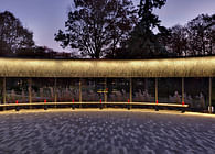
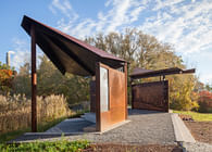
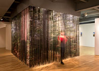
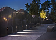
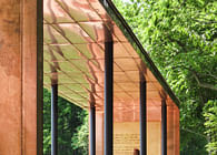
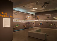
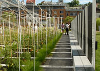
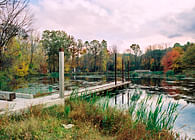
The intersection of Mill Creek and the Grand River is the reason that Galt was founded at this spot in 1816, but this watery intersection, and Mill Creek all the way to Main Street has been buried, moved and forgotten. Where did the creek go? How could such an important piece of natural infrastructure disappear visually and culturally? How long does it take to forget? This installation takes the visitor on a journey to look for the lost creek starting from the point it is buried at Main and Wellington, as it journeys to the Grand. The ten-point walk is paired with a website (www.millcreekgalt.ca) which has archived historic maps and photographs of the creek and its ponds. Walking the phantom Mill Creek dovetails with PLANT’s interior exhibit that is about ‘walking’ as a way of understanding, revealing, and forming site.
THE HISTORY OF MILL CREEK
In 1816, William Dickson and Absalom Shade established the town of Galt at the intersection of Mill Creek and the Grand River.
"They noted that at this site both the Grand River and Mill Creek could be harnessed to provide the power needed for the mills that were the first requirement of any new settlement. Thus it was the river and its tributary that determined the site of Galt" (Jim Quantrell, A Part of Our Past: Essays on Cambridge's History).
Mill Creek quickly became the backbone of the town’s local economy, becoming rerouted, channelled, split, and reshaped for industrial development. Mills, distilleries, and factories all drew power from the creek and its swollen ponds, including the Galt Knitting Company that provided the arched outlet that fed the creek into the Grand River. When the railway was introduced in the late 1850s, it was built alongside Mill Creek, providing Galt with a new means of distribution, reinforcing the strength of the creek’s vital presence, and helping dub the town “Manchester of Canada”.
By 1910, the great ponds to the north and south of Main Street had been channelled; and by the 1960s, Mill Creek had become half-buried after the introduction of municipal power systems and road transport. In the 1990s, the entire creek south of Main Street had disappeared and its arched outlet was blocked off.
With water no longer visible south of Main Street, this once mighty creek remains Channelled, Buried, Moved, and Lost; and yet, present-day maps continue to indicate a visible creek along the central line of the site’s old route. Where did Mill Creek go?
CHANNELLED BURIED MOVED LOST: WHERE DID MILL CREEK GO? | 3ByLAND
Common Ground
7 July—30 September 2012 | Design at Riverside, Cambridge Galleries
Status: Built
Location: Cambridge, ON, CA
Additional Credits: PLANT Team: Lisa Rapoport, Chris Pommer, Mary Tremain, Vanessa Eickhoff, Peter Osborne, Angelica Demetriou | Special Thanks: Matthew Hartney; Volunteers; Midtown Reproductions; Arrow Graphics; Cambridge Galleries; Peter Ross | Law Photography Archives; Steven Evans | Photography; The City of Cambridge Archives; The University of Waterloo Map Library.


