
Follow this tag to curate your own personalized Activity Stream and email alerts.
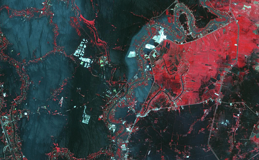
In this image, vegetation is displayed in red, and flooded areas are black and dark blue. Brighter blue shows sediment-laden water, and gray areas are houses, buildings and roads. The image covers an area of 35.2 by 66.3 miles (56.7 by 106.9 kilometers) and is located at 14.5 degrees north latitude, 100.5 degrees east longitude. — http://www.jpl.nasa.gov
Detached from the content depicted, the full-resolution image itself is too amazing to not circulate... View full entry