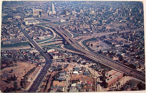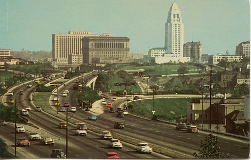

Can you imagine a version of Los Angeles with even more highway veins pursed throughout its (formerly) Bohemian coastline, super-industrial downtown core, and crisscrossing network of foothills? The reality of what could easily have been (save for the opposition of several big-name celebrities and politicians) is being explored by the LA Times’ new editorial series called ‘‘Explaining L.A. With Patt Morrison.’
In last week’s edition, the writer took to the freeway for a delve into its post-war sources of federal funding (90% of the system here was underwritten through the Eisenhower administration’s nationwide interstate expansion effort), and potential alternatives that included multiple Parkway designs that caught on much easier in Northeast states like New Jersey, Maine, and Connecticut during the same period.
Figures like Randolph Collier and George Gordon Whitnall come into the fore to foil more practical schemes (for example a rapid-transit connector from the San Fernando Valley to LAX) in favor of the diffuse system of eight-lane roadways and great curving concrete interchanges best depicted in Rayner Banham’s now-antiquated Los Angeles: An Architecture in Four Ecologies.
One scenario included a multitudes larger version of the Pacific Coast Highway that would have run all the way from the edge of Orange County to north of Malibu, potentially in segments over water, on a stilted roadway that was “killed off piecemeal” like many of the other aborted projects Morrison calls “stubs” in the early-1970’s.
“You find a lot of these also-rans on freeways that were built in the 1950s or early ’60s when they envisioned future freeways branching off of them," explains Freewaytopia author Paul Haddad. "It was more financially expedient to simply ‘bake in’ future junctions while they were constructing. Imagine how much more costly it would be in the ’70s if they had to reconfigure the Hollywood Freeway after getting a green light to build the Beverly Hills Freeway.”

Morrison's sprawling examination of a pivotal period in the development of America's second-largest city that Christopher Hawthorne called ‘Second Los Angeles’ also offers a useful perspective on the breakneck speed of new construction of a more recent vintage. Multiple plans to reshape areas of Downtown are about to emerge through the delivery of seminal projects like the new Sixth Street Viaduct, Angels Landing megadevelopment, and a series of vehicle-less transportation improvements anticipated to redefine life for the county's 10 million residents.
4 Comments
Patt-in-the-hat should go further back into history.
A 1912 map of the many different trollies and interurban rail lines shows that far-flung decentralization across the region was 'baked in' decades before the first stretch of highway was even dreamt of. Early sprawl was the result of transit, not freeways in this case.
No question that freeways and auto transportation massively shaped planning, development, and life here. But the freeway was the second suburban road system, not the first.
To be fair, much of Patt's narrative is not inaccurate... just incomplete, maybe. My post is to remind that freeways did not cause a conventional urban area to spread out, just replace the linkages that had started the process a generation earlier.
There's a qualitative difference between sprawl that uses trains to connect pedestrian oriented centers and car centric sprawl that isolates humans and degrades the environment.
Qualitative and quantitative, to be sure. But the notion that the freeway was the first 'baker' is incorrect. Freeways continued 'sprawl' begun by an impressive transit system.
(Also: Banham's Four Ecologies book is anything but antiquated, I'd argue.)
Block this user
Are you sure you want to block this user and hide all related comments throughout the site?
Archinect
This is your first comment on Archinect. Your comment will be visible once approved.