(more images
here.)
So, a little bit about this quarter’s studio project…
Our instructor is Jose Oubrerie, notable for his
Miller House (Lexington, KY), and for overseeing completion of
Le Corbusier’s Eglise Sant Pierre (Firminy). He has encouraged us to shy away from “the computer” for this project, and to rely on models and hand-drawings. This is somewhat of a relief, although I’ve taken it to mean “no Rhino,” not “no Photoshop” – and so I’m planning on proceeding with models, collages, montage, etc, rather than 3D models….
The program is defined loosely as a “research center” (12,500 sf for research, 12,500 sf for lodging, hotel, restaurant, and ??? sf for public amenities to be determined) – and each student must choose the type of research to be done at the Center.
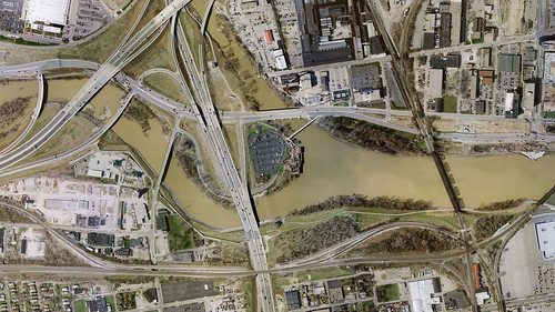
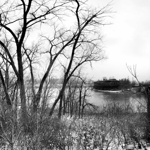
Inspired by the proximity to the highway, bike path, and (potentially navigable) rivers, I’ve decided to make my research center focus on transportation.

Ideally, I’d like to create an architecture that embraces the infrastructure rather than hiding it or keeping it separate…
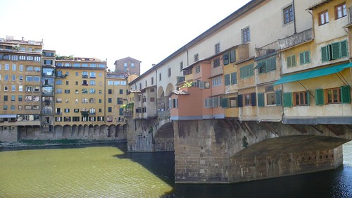
Could this be Columbus’ Ponte Vecchio?

Or a rethinking of La Citta Nuova?
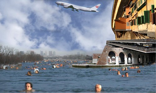
Anyway, as a starting point, there was this collage:
It’s moved a bit away from this by now, but I think the spirit is still (or should be) there…
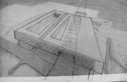
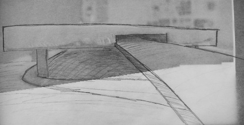
For tomorrow, Jose has asked us to prepare a short text explaining the project. So here it is, interspersed with images of my latest study models/sketches:
------------------------------
OVERVIEW
The Confluence Park Transit Research Center is devoted to the study of vehicular transit and how it impacts the shapes of our cities, the functioning of our economy, and the psychology of our populace.
Like many American cities, Columbus, Ohio is defined by transportation routes. The early frontier outpost only grew into a city once connected by rail to Baltimore and Chicago. It expanded along its primary axes (High street to the north and south and Broad St to the east and west) as streetcars allowed workers to reside outside the city center, and the explosive growth following the Second World War was made possible by widespread automobile ownership and the completion of the outerbelt.
Now, as the world faces exploding population, resource scarcity, and environmental degradation, the means and methods of human conveyance must be fundamentally rethought. Columbus, lacking reliable public transportation, seems poised to embrace new technologies that can redefine its local and regional transportation networks, but only if public awareness is raised, and appropriate technologies are found. The Confluence Park Transit Research Center will be engaged in these two tasks: increasing public awareness, and research & development of new transportation technologies.
SITE
Confluence park is appropriately named: in addition to the converging rivers, the site is by the interchange between Route 315 and Interstate 670, marks a connection point between two branches of the Olentangy bicycle trail, and is not too far from freight rail lines. For future transit networks to succeed in Columbus, they must interface with the existing infrastructure, either by using it explicitly, or connecting to it at strategic transfer points. The site is well-positioned for either of these possibilities.

FORM
The form of the building will derive from site forces, primarily the connection to be made to existing infrastructure, and the necessity of placing the main volume of the building above the 100-year flood line. As such, the current proposal envelops the adjacent highway, but is raised from the ground, cantilevering above the river.


---------------------
So, that’s it so far. Still very very early. This scheme was about an hour of work this morning and definitely needs to be tightened up…. Also it’s gigantic. I think it could start to be a kind of mat building, pierced by the highway and offramp, raised above the ground like Corbusier’s Venice Hospital, connected by ramps…. And I’m thinking the plan footprint can be more clearly defined by the roads…
Still a long way to go….


1 Comment
Very interesting!!! I've been out of Knowlton for about 5 years now and I was always impressed with Jose's teaching approach. One time he told me to put one of my study models onto my refrigurator so every time I wake up I can see it so it reminds me not to do it again. Of course all that with a little bit of french accent makes it hillarious. Good luck with this project.
Block this user
Are you sure you want to block this user and hide all related comments throughout the site?
Archinect
This is your first comment on Archinect. Your comment will be visible once approved.