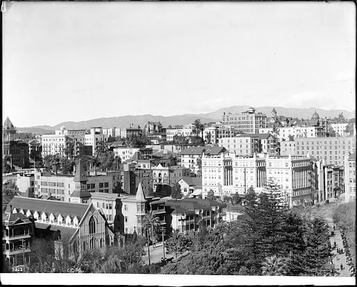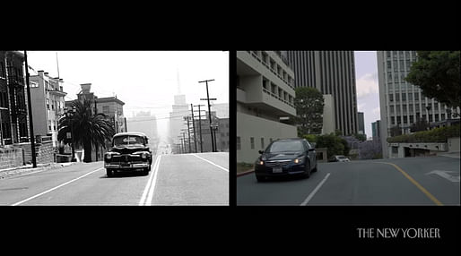

Seven decades after it was razed to do away with what the federal government deemed “urban blight,” the University of Southern California’s Ahmanson Lab, working with the Bunker Hill Refrain Collaboratory, has created an interactive 3D reconstruction of Downtown Los Angeles’ Bunker Hill neighborhood. The initiative gives users a sense of what was lost when the area was turned over to developers and slowly remade into what is today an unrecognizable warren of commercial and luxury residential projects consistently fought over by some of the city’s most powerful names.
The 3D tour captures the area as it appeared between the late 1930s and the beginning of the government-led “slum clearance” initiatives that began in the last two years of the 1940s.
Mayor Fletcher Bowron was the domineering political figure at that time, overseeing an unprecedented second wave of urban expansion in Los Angeles that included the beginnings of the freeway system and LAX, in addition to the post-war suburban housing boom that added to the city even as its beguiling central working-class district was being taken away.
Experience LA's long-lost Bunker Hill neighborhood in 3-D—recreated from historical photographs, architectural drawings, and other archival materials: https://t.co/q9o9rFBxW0 pic.twitter.com/1Xz3NP4Ouv
— USC Libraries (@USCLibraries) July 5, 2022
Ahmanson staffers worked with the city’s archives and other local sources to produce a 12-block map dotted with recreations of historic buildings and topographic features that defined the area in its pre-war heyday. Users can select from one of seven interactive tour options that incorporate select census and other historical data to give them a better sense and feel of how things worked in the neighborhood once defined by the defunct Angels Flight funicular railway and now populated by multimillion-dollar showcase projects such as the famed Walt Disney Concert Hall, Broad Museum, Wilshire Grand, and the new massive The Grand development.

The tours can be accessed on Macs and PCs via Modelo or Enscape. Users can also toggle on and off between the model and present-day images of the area for further comparison. A 360-degree panoramic view of the model is available as well. More information, including a download option of the tour itself, can be found by following the link to the Ahmanson Lab webpage here.
No Comments
Block this user
Are you sure you want to block this user and hide all related comments throughout the site?
Archinect
This is your first comment on Archinect. Your comment will be visible once approved.