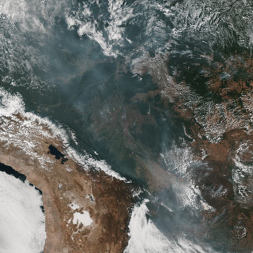

For the past few weeks, the media has slowly increased its coverage of the devastating fires being intentionally set in the Amazon rainforest. Besides the politically charged issues and highly questionable leadership in Brazil, matters like this can quickly become headline news that leaves people 'social media-aware' but not necessarily informed.
For starters, forest fires in the Amazon are not uncommon and often related to seasonal temperature and weather fluctuations. However, these particular fires are due to intentional land-clearing methods employed by loggers and farmers rallied by the Brazilian president President Jair Bolsonaro and his pro-business agenda. His blatant aggression against indigenous rights, environmental conservation, and concern for sustainable practices has put Brazil and the rest of the world in a difficult position.
Increased deforestation efforts by the Bolsonaro administration have been propelled by a desire for promoting development and agriculture through aggressively clearing land in the Amazon. Smithsonian Magazine explains, "although the Amazon currently accounts for roughly a quarter of the 2.4 billion metric tons of carbon absorbed by all global forests, changing weather patterns, deforestation, tree mortality and other factors are hampering its ability to serve as an essential carbon sink."
The Amazon is an integral part of our global ecosystem, affecting not only plants and animals that live in the area but also people. This complex ecosystem is responsible for producing 28 percent of the world's oxygen, according to estimates. Although that widely cited statistic has recently come under questioning. The Amazon is also one of the planet's largest naturally occurring weapons for fighting climate change. With the intentionally set fires increasingly incinerating large sections of forest at an alarming rate, can understanding the scale of the destruction compel the public to mobilize?
The team from amazondeforestation.io thinks so and has created an interactive data visualization platform to help inform others about the impact these fires are having on the Amazon. According to their project, "this is a data visualization project based on the latest announced deforestation rate on the Brazilian Amazon Forest. The intention is to bring that rate closer to us by comparing it to our own cities and neighborhoods." Through mapping and data viz techniques, the team behind the site hopes to help others understand these fires from a relatable context by imbuing the damage with a sense of spatial awareness that shows the growing scale of the fires relative to wherever you might be.
Several organizations and initiatives are rallying to help increase awareness and raise funds towards fighting the destruction of the Amazon. It's crucial to implement spatial design tools like data visualization, in addition to understanding the harmful effects of deforestation, to help the public comprehend issues beyond a trending hashtag.
1 Comment
NASA just came out and debunked some of these misconceptions. Amazon produces 6% O2 not 20%. Also.....
https://www.google.com/amp/s/www.nytimes.com/2019/08/23/world/americas/amazon-rainforest-fire-photos.amp.html
Block this user
Are you sure you want to block this user and hide all related comments throughout the site?
Archinect
This is your first comment on Archinect. Your comment will be visible once approved.