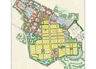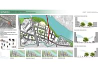
Hutto State of the Community Poster on paper stock 3'x6'. InDesign, ArcGIS, Envision Tomorrow. Created for Sustainable Land Use Planning class. Spring 2014.
The purpose of this exercise was to familiarize myself with the existing conditions and planning issues for the scenarios. The main task was to accurately describe the existing conditions, major planning issues (SWOTSs), and community values that will inform the planning scenarios for the Sustainable Hutto Activity Center Scenario/Future Land Use map.
Conditions, issues and trends addressed the following: (1) History (2) The People (Demographic/employment data and projected changes), (3) Infrastructure and Community Services (parks, roads, sewer and schools etc.,), (4) Environmental and Cultural Resources (historic resources, wetlands, soils, ESA, floodplains etc), (5) Economic Development (major employers/diversification of employment base), (6) Existing Land Use, (7) Housing, and (8) Community Character. Maps were generated to spatially analyze the issues noted above (demographics/employment, infrastructure systems, environmental natural systems, housing, land use and community character).
Status: School Project
Location: Hutto, TX, US
My Role: Concentrated on Existing Land Use and map generation
Additional Credits: Angela Bagnasco, Benjamin Ettelman, Ashley Greenstein, Hao Pang, Alvan-Bidal Sanchez
