
Well a lot of things are changing as we seem to be having a fair amount of problems with the government organization that we're partnering with on this project. Apparently they have an interest in hosting a large scale architecture design competition for a few aspects of their 106 km canal project. Thus they have denied our request for detailed GIS-like information on the project as it would give an unbalanced advantage to us if we were to enter said competition, given that this alleged competition is nowhere near actually happening. So this leaves our studio kind of in the middle of nowhere with kind of a cap on how detailed/advanced we can get with our studio projects, but I believe we will proceed as we were before and just intend on doing our best with what little information we can collect. So to have to speak so incredibly vaguely about this.
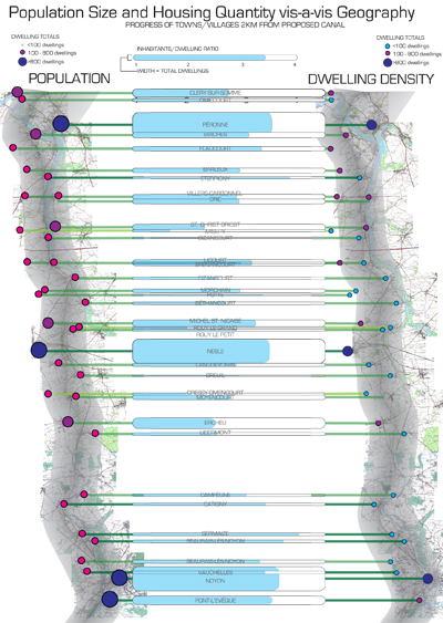
Any we had some kind of mid-ish pin-up. Basically we were divided into groups based on categories of research on the enormous area; my partner and I were responsible for "Urbanisation". I tended to focus on demographic and population change issues. I, initially was very interested in time of demographic change, now I seem to be a bit more interested in density of population and land use, we'll see how this plays out. Some of these I've posted in one form or another.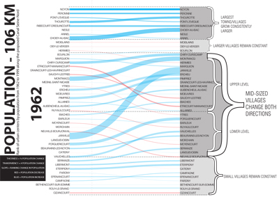
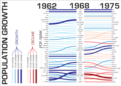
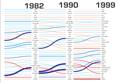
This was kind of a confusing exercise as things kept changing but it was more or less to just get a lot of data on the table to then be able to begin (seems like we're always beginning to do things, never actually doing them) really mess with it and get some results.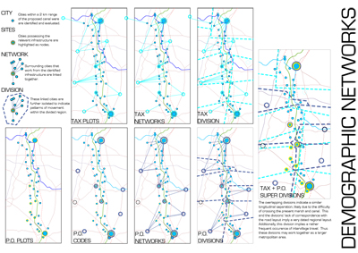

Many of these diagrams just set up vocabulary for me to use later once reinterpolating data back into design, I think.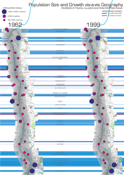

Especially I plan on building out this catalogue of "type".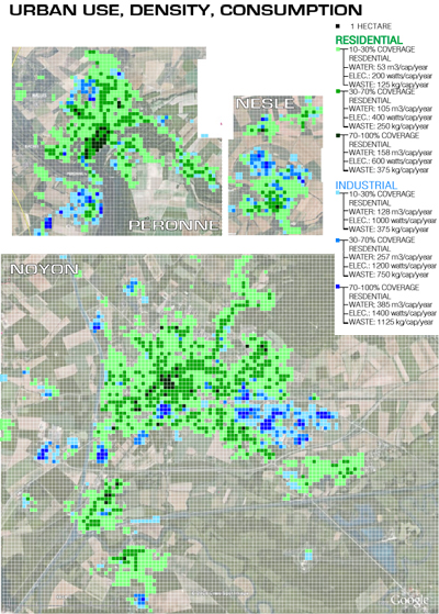
However, I am putting aside issues of seasonal swell and domicile density to work more on this last diagram of land density of uses. I am currently putting it into a more malleable form and plan to overlay it with topographical and infrastructural data to find linkages between. I think I've found a rather great way of doing it, though it be tedious and confusing as hell right now. Check back next week and we'll see if it actually worked out.
No Comments
Block this user
Are you sure you want to block this user and hide all related comments throughout the site?
Archinect
This is your first comment on Archinect. Your comment will be visible once approved.