Public parks do much more than provide places to play, relax or exercise – they can also preserve portions of the natural landscapes, and remind us of our city’s history. In Los Angeles’ urban core, where public parks are few and much of the landscape has already been paved in concrete, combining peace and preservation becomes more difficult. But embracing infrastructure can lead to novel and engaging park systems, as seen in projects like the High Line, and now, in Los Angeles' State Historic Park (LASHP).
Situated in a former rail-switching yard in LA's Chinatown, LASHP sits at the base of Elysian Park’s hills, stretching between an active light-rail line and the Los Angeles River. While still under construction, the park is already the focal point of an urban trail project, LASHP Trails, initially drafted by local high school students and developed by UCLA’s Center for Research in Engineering, Media and Performance (REMAP). Originating in and around the park, the trails lead walkers through neighboring communities, linking Downtown, Chinatown, and Northeast LA with the River and rail infrastructure. While no official trails actually appear on the ground, REMAP’s Interpretive Media Laboratory adapted the trails into a mobile website, where users could view historical information specific to their current location along the trails. This goes way beyond time lapse on Google Street View, including photos and info from throughout the city’s history.

LASHP Trails empathizes with much of what cities are currently wringing their hands over, trying to weigh priorities of development, historical preservation, public space, public health and place-making, all while playing catch-up with technological adaptations. The history of an urban space can feel obscured when overrun by development, but with a bit of prompting, the surrounding landscape can divulge a lot. At last Thursday’s launch celebration of LASHP Trails, Fabian Wagmister, director of REMAP, explained the significance of the Park’s location: “It’s the one place where the San Fernando Valley and the Los Angeles Basin meet, without having to go up and down hills. That's why so many important things, from trade to the freeways, went through here.” He referenced Gaspar de Portolà, Spanish explorer and governor of “Las Californias”, who passed through the same space when founding California’s missions and pueblos, and Los Angeles’ first train station, established in the same space in 1876, connecting California to the transcontinental railroad and San Francisco.

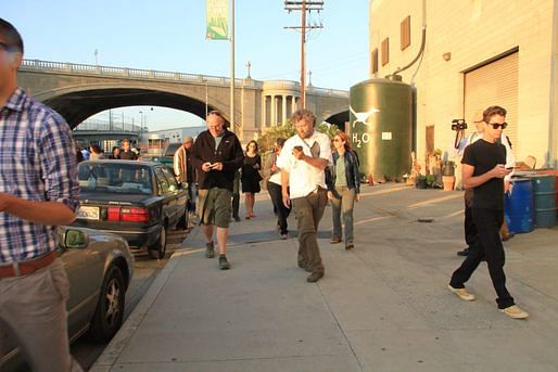
As it stands, anyone with a mobile, internet-connected device can access LASHP Trails, and learn a bit of Los Angeles’ history along their chosen path. Like a guided city museum tour – that you take outside, in the actual city. Eventually, anyone will also be able to make their own trail, built around a theme like restaurants or exercise spots, or simply a random dérive. The paths are rooted by a shared trailhead, an interactive sculpture known as Wellspring, located at the tip of LASHP just underneath the Broadway bridge. From there, visitors can embark on their chosen trail and unlock pockets of city history.
Beyond connecting people more easily with city history, the higher goal of such a service is to put technology towards a collective, public use – like any city park. As Fabian Wagmister explained, on behalf of REMAP and the trails project, “We’re very interested in looking at new ways in engaging with technology as to have people do things together, have people express themselves, and fundamentally, focus on issues that we call 'collective creativity'.”

To try out the app, head to the North Broadway Bridge at 1800 Baker Street in Los Angeles. Further instructions await you.
1 Comment
just make sure to look up and around from time to time...
Block this user
Are you sure you want to block this user and hide all related comments throughout the site?
Archinect
This is your first comment on Archinect. Your comment will be visible once approved.