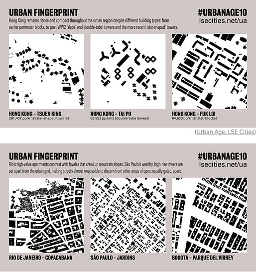
Like humans, cities and neighborhoods have their own unique fingerprints. The maps were created by researchers at the center’s Urban Age program, who have been studying how the layout of rapidly urbanizing cities can affect their livability. — CityLab
New York is a grid, London is an airy whirl, Hong Kong is dense: at least, that's according to the black and white "fingerprint" maps put together by the Urban Age program at the London School of Economics and Political Science. The project helps researches see at a glance the macroscopic characteristics of urban environments, from density to wealth disparity to room for growth. The project has profiled urban centers all around the world, including Rio de Janeiro and Mumbai.

For news about other innovative designs using aerially-compiled urban patterns, do read:
No Comments
Block this user
Are you sure you want to block this user and hide all related comments throughout the site?
Archinect
This is your first comment on Archinect. Your comment will be visible once approved.