
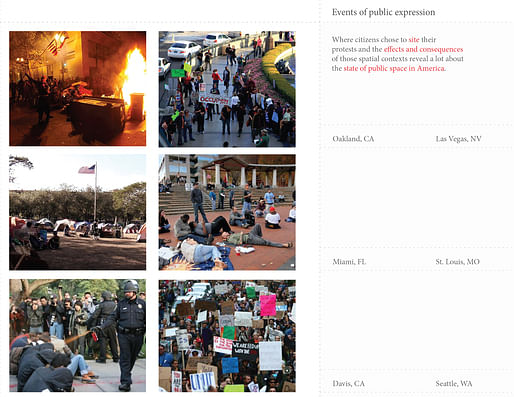
I started to build upon the diagrams and images shown in the previous post. I wanted to look more closely at what the difference was between the Occupy protests in NYC and STL. I only knew that one had much press coverage and many people and the other had little to no press coverage.
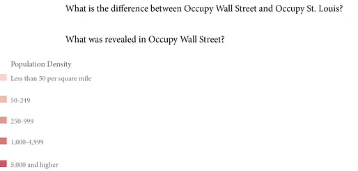
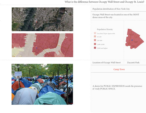
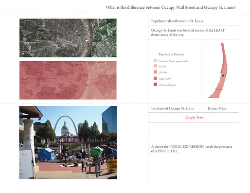
Looking into it more, I found the documentation of the STL protests showed few people and even fewer news articles about the protesters. Comparing that to the population density charts I pulled from NYT, I saw that the difference in density was night and day. While All of Manhattan and many of the surrounding boroughs had very high densities, downtown STL actually had one of the least dense areas in the city. Why people still chose to protest in Kiener Plaza in the downtown area was lost to me, but it became a critical part of my Design Research development and Degree Project later on.
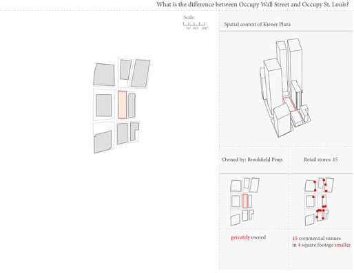
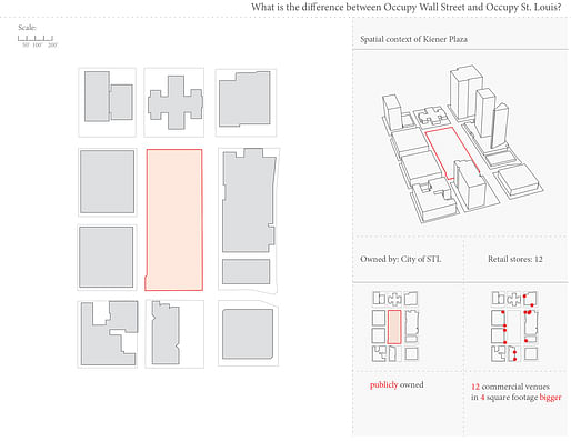
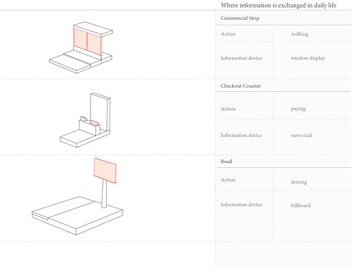
At the time though, I was looking at places where people actually were present and living. From my experience and the "public information exchange" diagram I had made, I imagined the retail environment was actually where people met each other. I then brought that to Zuccotti Park and Kiener Plaza and found that while having a similar number of retail shops along the their respective perimeters, Kiener plaza was four times larger than Zuccotti park.
It was fun drawing their sites and having them at the same scale in the book. Many people were surprised to find how small Zuccotti actually was. I have a feeling that the sense of surprise reflected the size of importance it has in people's minds.
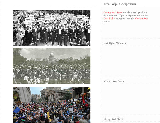
Guided by the flow of progression I also started to reflect on the nature of protests in America in the hopes that the research might also reveal something else I could build off of.
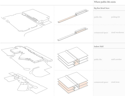
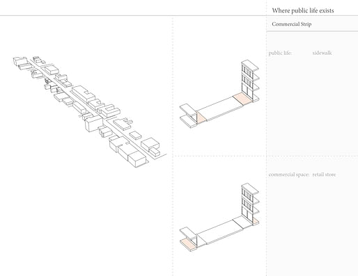
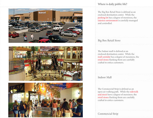
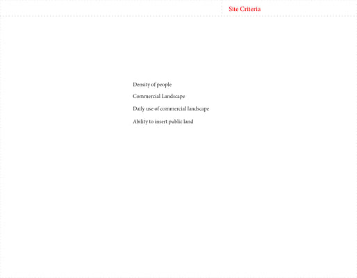
Concurrently, I focused on researching and analyzing the different forms retail comes in. When drawing them, I divided the zones into public life and commercial space. As things developed further on down the road it became clear the distinction was a false dichotomy. So later on I changed it to controlled space and commercial space. The later distinction helped me a lot in forming the spatial proximity of objects in my Degree Project.
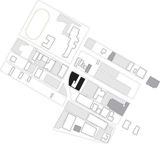
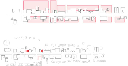
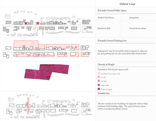
For site analysis, I looked at commercial presence and population density as ways of finding potential locations. I still was looking at the Delmar Loop and exploring different options for intervention. I also included South Grand because I felt that it had a nice cultural development that I could perhaps bring commercial retail into.
~~~~


I will chronicle my design research and degree project, providing commentary on my thought process at the time. From there, I will transform the body of work into a book which seeks to place into dialogue the two (currently) separated semesters of work.

No Comments
Block this user
Are you sure you want to block this user and hide all related comments throughout the site?
Archinect
This is your first comment on Archinect. Your comment will be visible once approved.