
After finishing our journey south through Eastern Europe, Jennifer and I parted ways. While she remained in Barcelona to partake in a summer studio with WUSTL’s Sam Fox School, I ventured on to reunite with my father to cycle the Camino de Santiago across Northwestern Spain from Madrid to Finisterre, the westernmost point of continental Europe and the sacred point once thought to be the end of the world before the discovery of the Americas.
Part I of Camino de Santiago Installment, Madrid to Sahagún
In a nutshell:
The Way to Santiago
The Camino to Santiago de Compostella is one of the most famous and ancient pilgrimages in western civilization. Going by way along various routes of the historic Camino de Santiago, we cycled mostly off road, and the trails varied from wide dirt paths, to winding single track, to steep technical climbs and descents, to ancient Roman roads. They were at times isolated and at many points we shared the trail with hundreds of fellow pilgrims making the trek on foot, bicycle, horse, and donkey. They started from all points in Europe, and had come from every corner of the earth. I hope to capture the beauty, diversity, and hospitality of the Spanish Landscape and Culture. These posts are dedicated to my brother Adam, who unfortunately was not able to join us on the Camino, his absence was missed.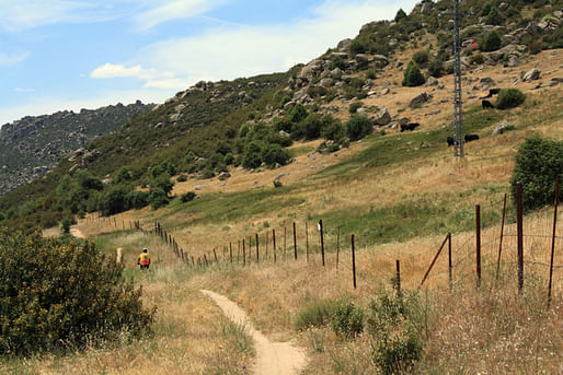
To summarize this journey in its entirety and to go into the history of each place and the Camino itself is far too exhaustive for one or two blog entries. Rather, I have broken down the trip into two distinct parts:
Madrid to Sahagún
The first entry documents the journey along the Camino desde Madrid, the much less known 320km route that runs north over the Guadarrama Mountains and over the Spanish plains and mesas of Castilla, the kingdom of castles and the heartland of the Spanish Reconquest effort.
Sahagún to Santiago to Finisterre
The second entry documents the remainder of the journey from Sahagún, the confluence between the ruta Madrd into the original and most famous route of the pilgrimage, el Camino Francés. 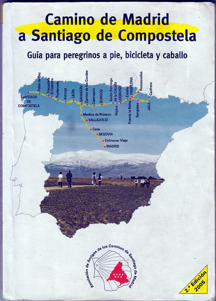
Our invaluable guidebook, showing the ruta Frances and the Ruta de Madrid
Wayfinding
Even more crucial to our guidebook in finding our way was being able to locate the "flechas" - either symbols of the scallop of St James, painted yellow arrows, or more formal granite markers. They exist along the entire route to Santiago and beyond to Finisterre. 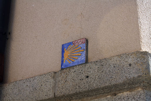 At every intersection or path diverged, we would scan for the markers.
Lodging
Our sleeping arrangements were as diverse as the landscapes and people. With the proper 'credencial,' basically the passport for pilgrims, one can stay in the many refugios set up by the local governments or residents for little to nothing.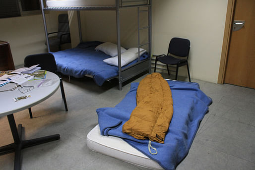 Our first night in the Town of Tres Cantos we slept in the basement of the townhall, free for pilgrims, depending on availability.
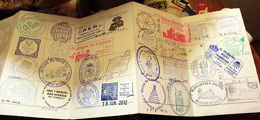
The credential, as you move along the way, you collect stamps from albergues, churches, and countless other places. It is used to verify in Santiago that you have successfully journeyed the Camino. In medieval times, criminals would often be condemned to walk the camino as an alternative to prison. This was their proof of the journey.
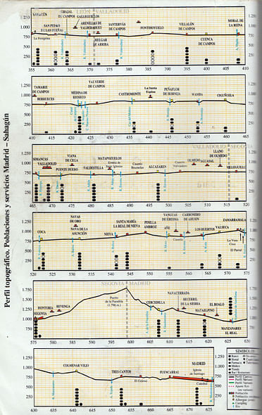
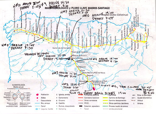
Elevation profiles along the ruta desde Madrid, from bottom to top. After the third day's pass over the Fuenfría Roman road to Segovia, the way was much easier to Sahagún.
Phase 1: Out of Madrid and Into the Mountain Forest
Looking back, we could barely make out the iconic skyscrapers of the city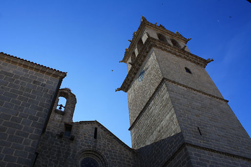 One of the first of hundreds of churches. Every small village and town was anchored by these stone sanctuaries.
 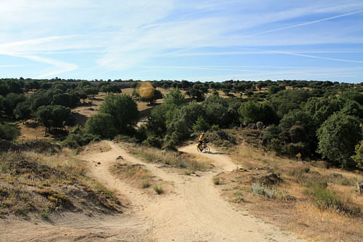 The trail began with pleasant rolling, dirt single track through rolling dusty hills littered with trees. As we continued, the forests became denser, and the ground less arid.
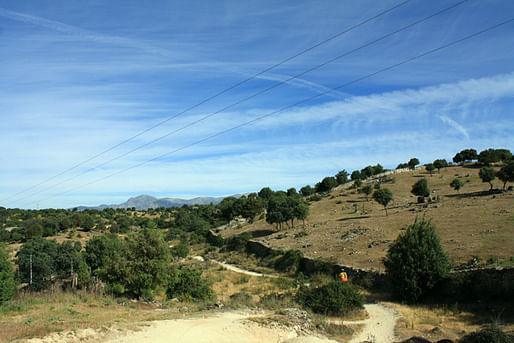
Before the light descent into Manzanares el Real, a scenic town that was historically a key stronghold in the effort to push back the Moors in the reconquest. Because of this 700 year conflict from 711 to 1492, Spain has more castles than any other country. Every piece of land taken back required a new castle to defend it. Thus the name of the Kingdom, CASTILLA 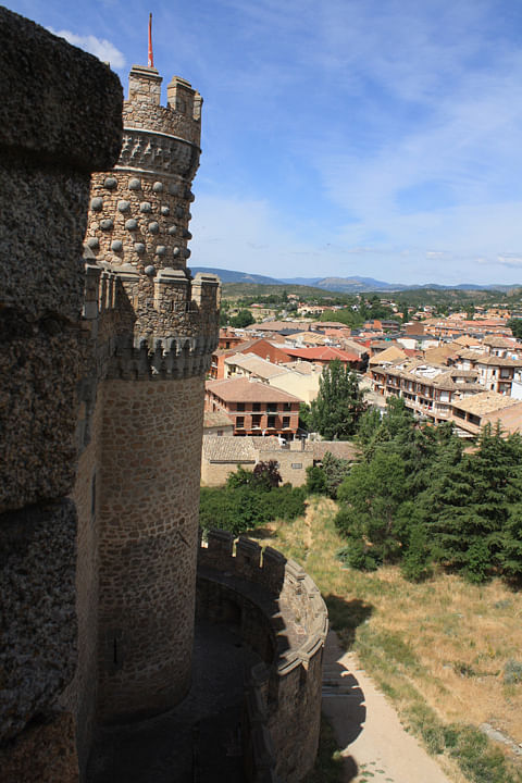
The castle at Manzanares el Real is a key example of High Style Castilian Castle Architecture, at this point in the reconquest, the Spaniards were gaining more and more strength, and as such it reflects in the level of ornament. As we move north past the earlier castles of the Reconquest, the architecture of the fortifications become more and more severe, as the Christian efforts against the Moors were more futile and weak.
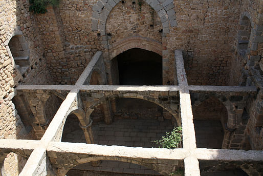
The collapsed ceiling and exposed vaulting of the old chapel.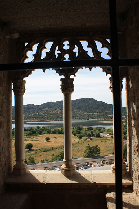 View from the Queen's bedroom
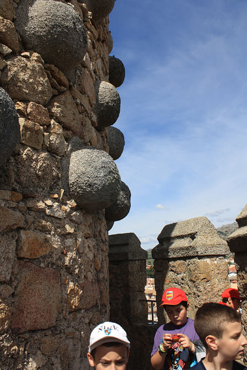
Warts in the walls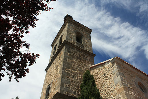 From here on, nearly every church tower had at least one stork nest .
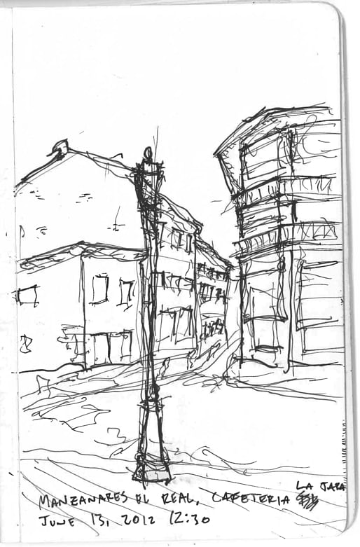
Lunch in Manzanares
...and back to the trail 
Soaking in the gorgeous scenery after a long climb out of the town of Navacerrada. This would be the start of the first first grueling climb of the Camino, and the only real one on Ruta desde Madrid. 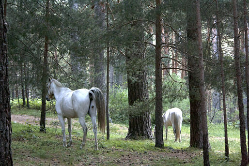
At the start of the excruciating climb up the first mountain pass, we came across free ranged horses that appeared in the mist.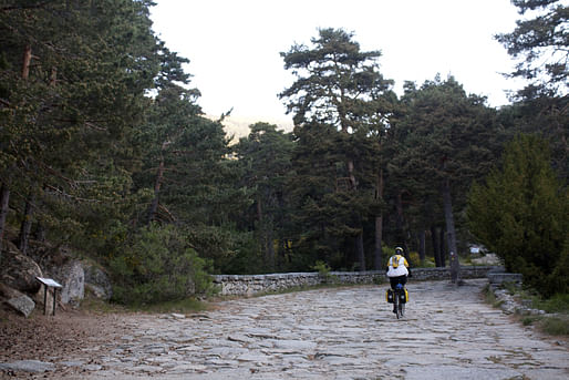
Working our way up the Roman Road. This was a critical passage through the Guadarrama Mountains for the Romans, and until the automobile, this was the way over.
Believe me, it was much steeper than it looks, and taxing on the bikes. Absolutely impressive piece of infrastructure. 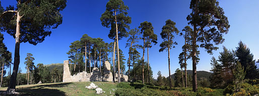 Ruins of a royal resting palace for Spanish Kings and Queens making their way over the mountains.
Phase 2: Out of the Mountains and into the Plains
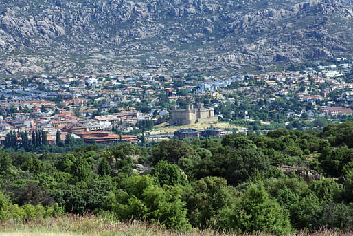
After the exhausting 3,000 ft of climbing, we enjoyed gorgeous and exhilarating 25 km descent into Segovia.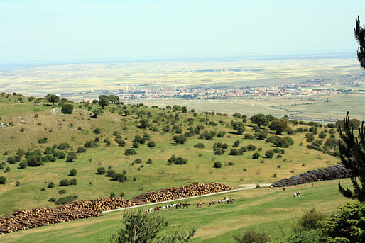 The forest opened up into beautiful ranches owned by the Spanish Government. Below, Spanish cowboys, and in the distance, the lovely city of Segovia.
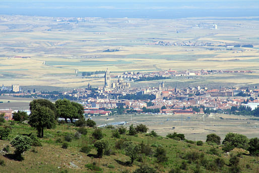 Getting closer to Segovia...
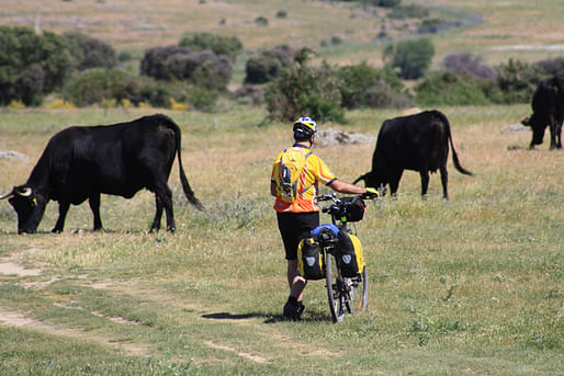
Bulls being raised for food and bullfights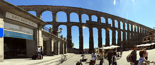
Without question one of the highlights of the trip. This Roman Aqueduct is almost entirely intact and occupies the main plaza of the city. It was still functioning as designed and used by the residents into the 19th century. The scale, dominance and breadth of this structure is something to behold.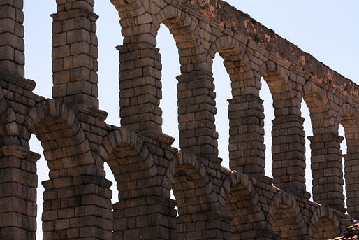
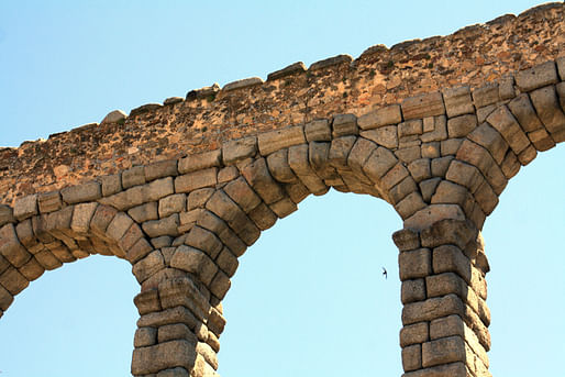
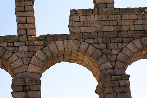
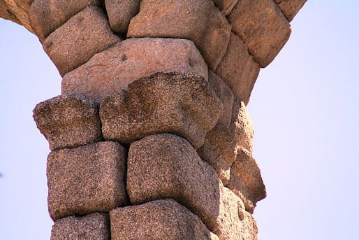 There is no mortar. Entirely dry-laid, perfectly fitted stone.
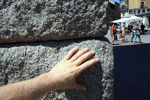
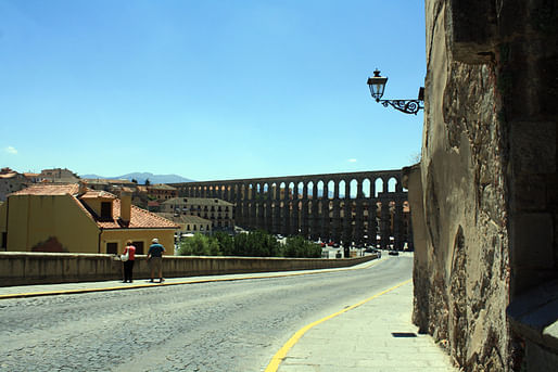
From the opposite side.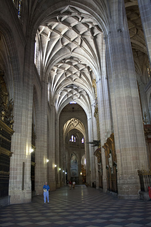
The cathedral in Segovia is considered the last true Gothic Cathedral ever built. Constructed in the 16th Century, Italy and other European countries were well into the Renaissance and had returned to Classicism. Spain is different. 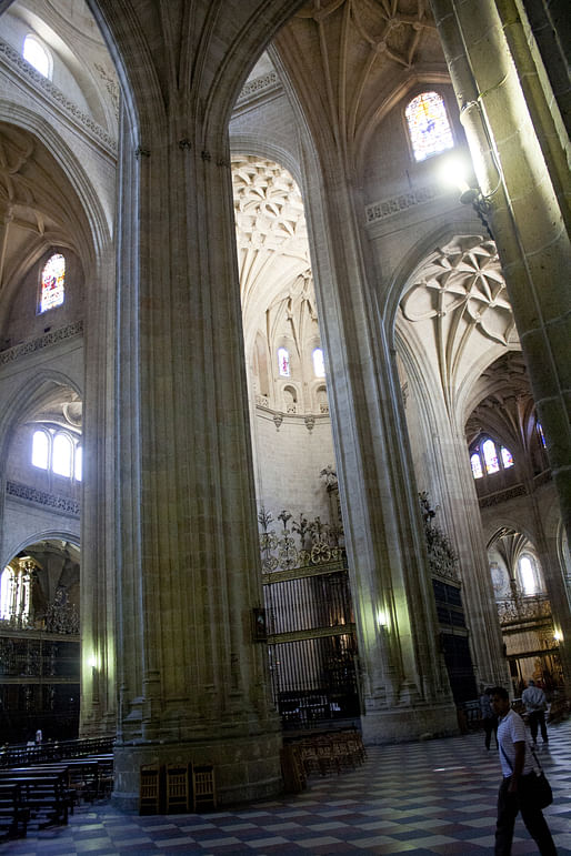
Highly ornamented unlike its Gothic neighbors we would encounter further north, it is the highest of high gothic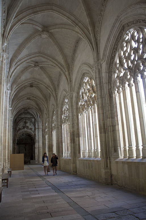
Cloister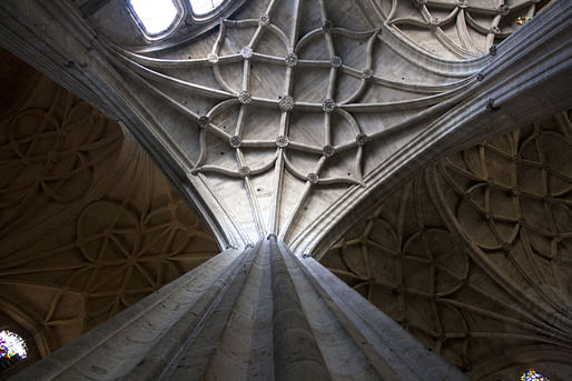
High Gothic Star Vaulting in the Cloister Galleries
Textured wall treatments are a signature of Segovian architecture
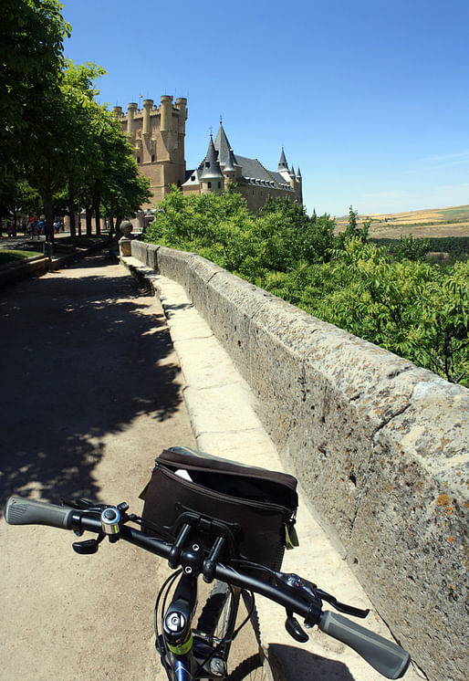
The fairytale-like royal Alcazar Castle. This is a reconstruction.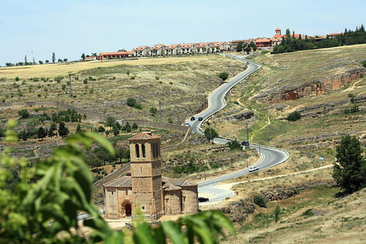 Looking out of Segovia and into the Spanish plains of Castilla. The church below belonged to the Knights Templar
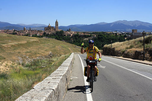 My dad happy to be over the hill. Segovia in the back, as well as the Mountains we had descended earlier in the day.
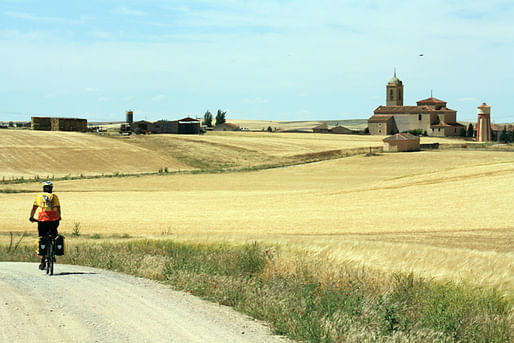
The dusty Spanish plains of Castilla... rolling fields punctuated by small towns with their churches and castles.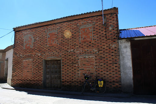
I was fascinated with this storing house and its use of brick
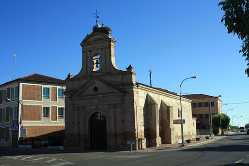
Piecemeal architecture: A Mudejar Aspe, a Romanesque Nave, and a Spanish Renaissance Facade. All complete with Stork Nest.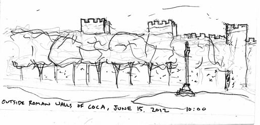 Breakfast outside the medieval walls of Coca.
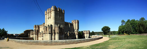
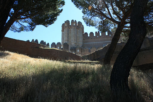
The beautiful castle of Coca. One of the most quintessential examples of Castilian Military Architecture. 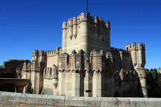
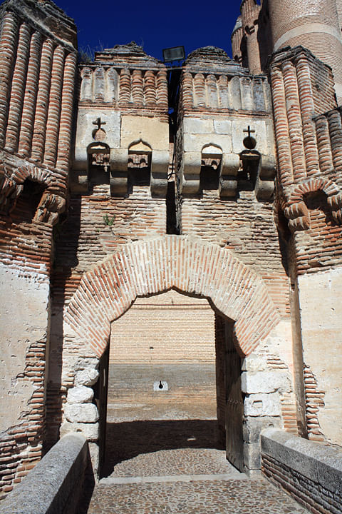
Bizarre arch at the entry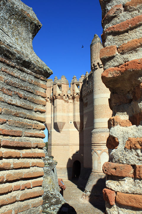

Beautiful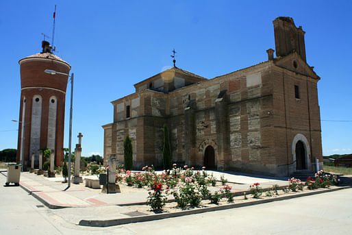
Idiosyncratic church with separate Mudejar Tower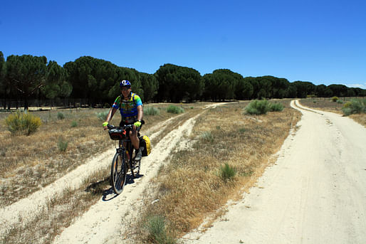 The plains gave way into sandy pine forests. The going was slow.
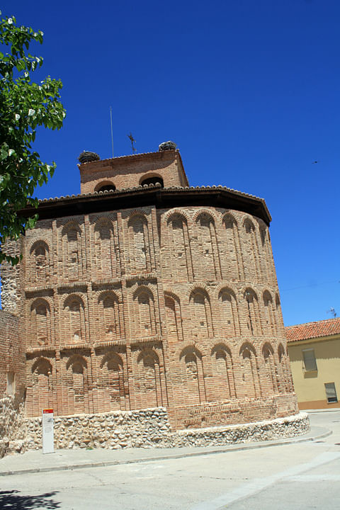 Town of Alcazaren. Mudejar Aspe
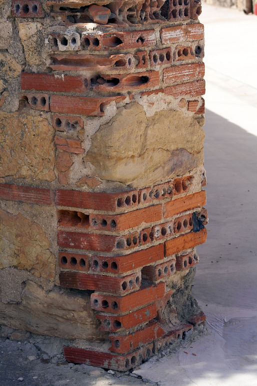
Beautiful decay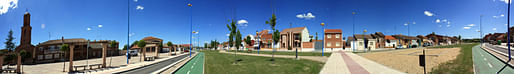
Out of Place: This portion of the town Puente Duero had a very Scandinavian town layout. Absolutely bizarre. 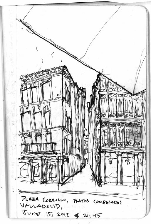
Dinner in Valladolid, the 4th largest city in Spain. Birthplace of Christopher Columbus, and former capital of the Spanish Kingdom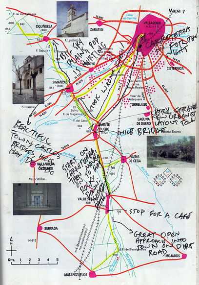
Detailed pages and travel notes in the guide book.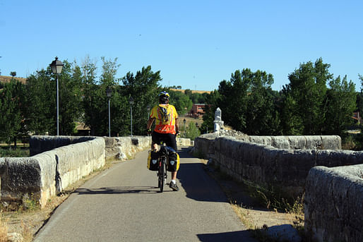
Crossing one of the many picturesque medieval bridges. This one entering the town of Simancas.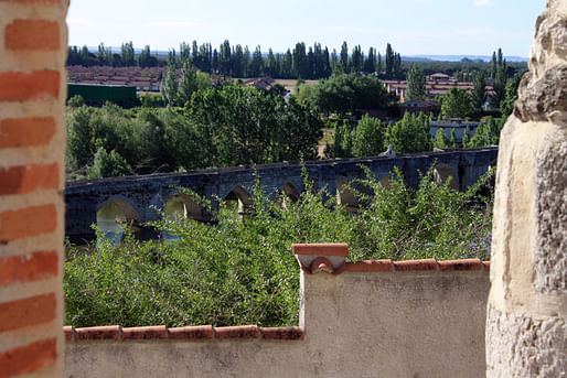
Looking back on the bridge from Simancas. A wonderful town.
Phase 3: Out of the Plains and Into the Mesas
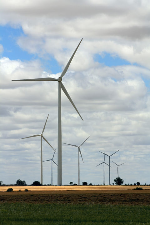
After SImancas, we crossed into a distinctly different landscape of towns located down in deep river valley separated by vast, windy mesas and open flat fields. 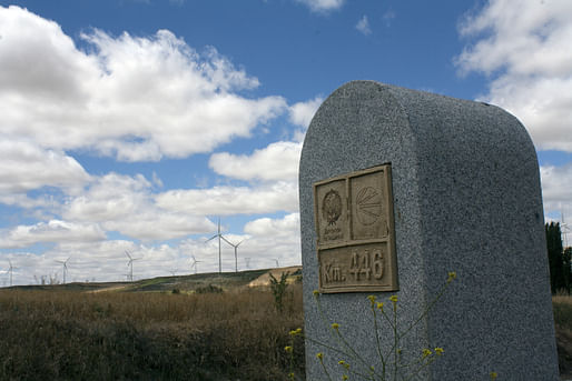 Former marker... windmills in the background
 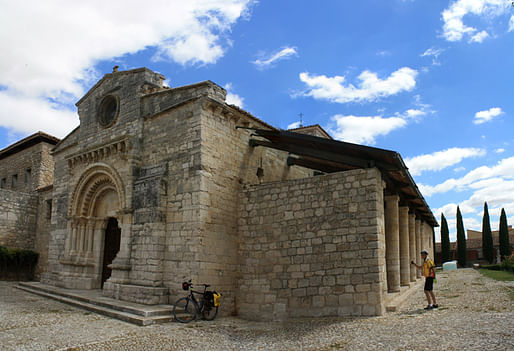 Definitely one of my favorite churches I have ever seen. This secret gem in the town of Wamba is one of the oldest in Spain. It was originally a Roman temple, and has been used and converted over the ages by the Visigoths, the Moores, and now the Christians. There are pieces of everything.
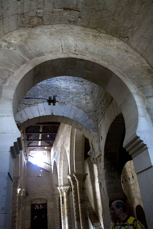
And abridged history of church architecture can be found in this one little structure. Above, Islamic, horseshoe arches.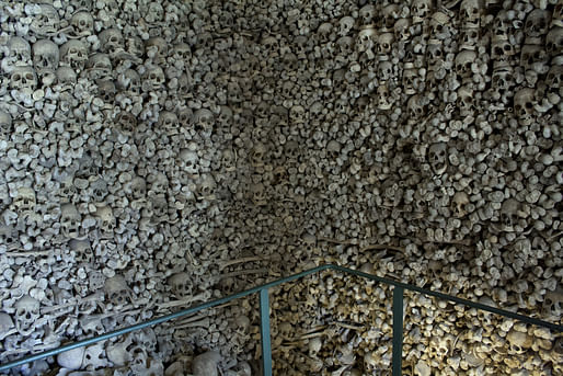
The crypt. The photos do not do it justice. We were surrounded on 3 sides with bones above our heads. 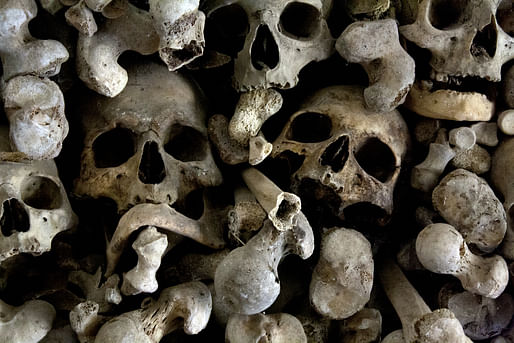
 Modern day giants of Cervantes
Chance Encounters of Hospitality
We happened to pass through this small village of Valverde de Campos during their annual Summer festival. Insisting we join them for lunch, I was about to experience the single greatest act of hospitality in my life. We had no idea what we were in store for. 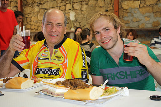 Happy to take a break and a pile of delicious food.
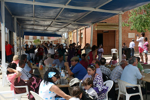
It soon became apparent we were going to stay beyond lunch.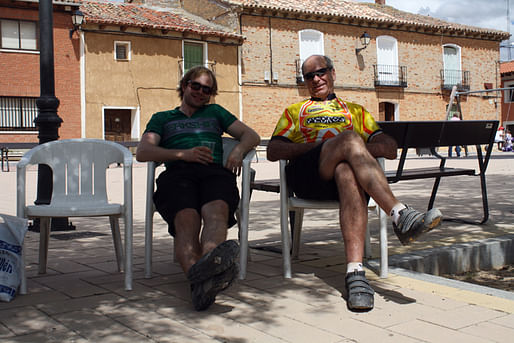 The residents let us into their homes, allowed us to shower and change, and we spent an unbelievable day soaking in the culture of the town. It was one of the best moments of the trip, hands down.
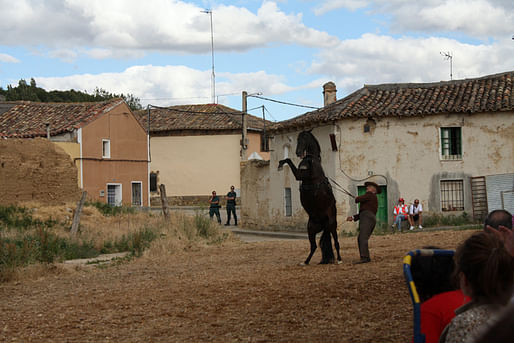
 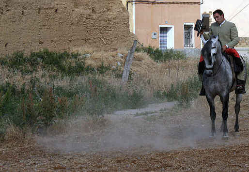 Local horsemanship showing
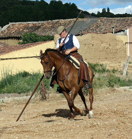
 This man controlled his horse the entire time while walking directly behind it.
 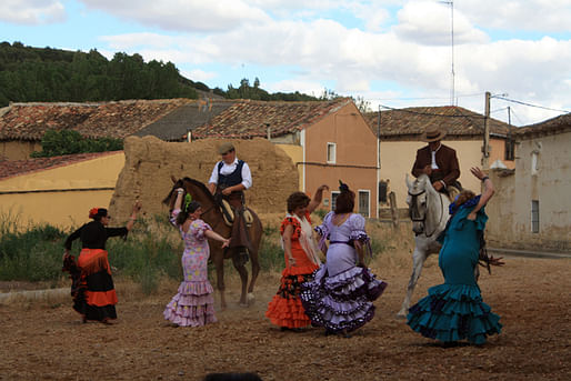 Dancing with the horses. We ended up sleeping on the floor of the mayor's office, and the festival lasted late into the evening. Thank you, Valverde de Campos!
The gorgeous town of Medina de Rioseco. Even with a hangover from the night before, this was easy to appreciate. The majority of the streets were lined with diverse arcades and colonnades of wood and stone. 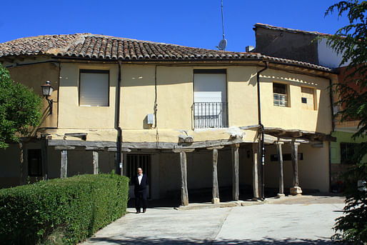
The Colonnade was a predominant feature in many of the towns of this region north of Valladolid. Here, a typical Señor outside in the quiet plaza of the town, Cuenca de Campos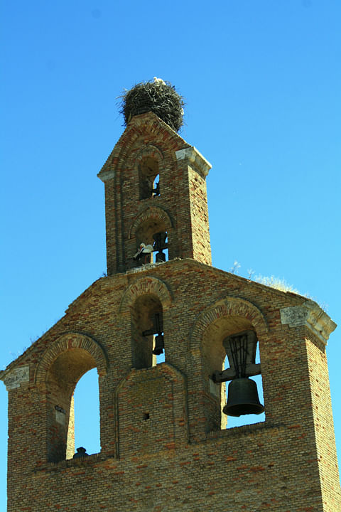
Another stork in the belfry 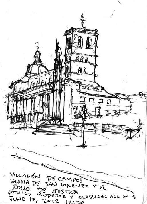
Cappuccino with a Croissant in Vallalón de Campos. The gothic spire sculpture in the middle was designed by the same architect of the Burgos Cathedral. 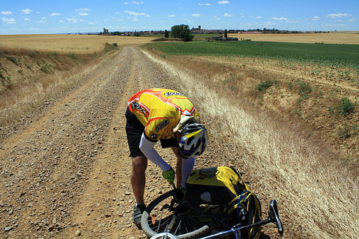 First flat tire of the trip.
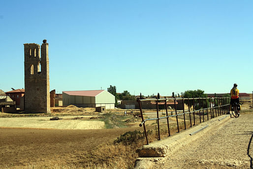 Soaking in the ruined belfry of Tamirez de Campos
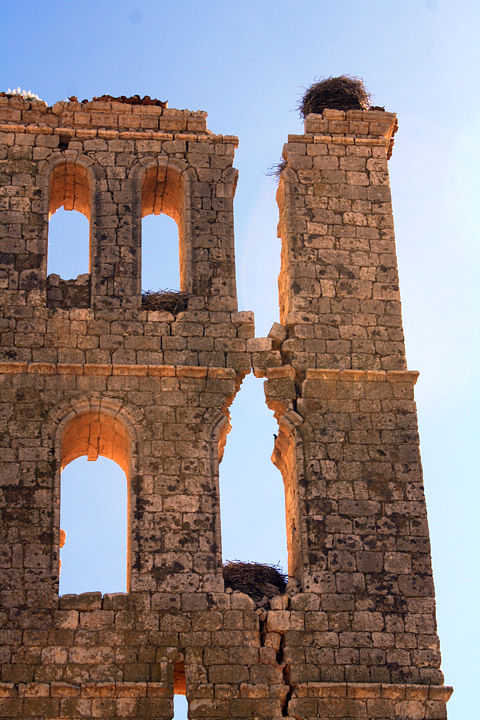
Beautiful crack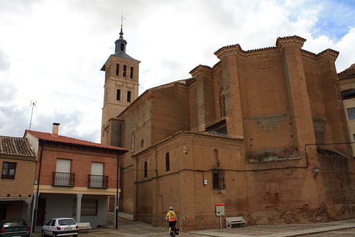
Bizarre aspe in the church of Grajal de Campos 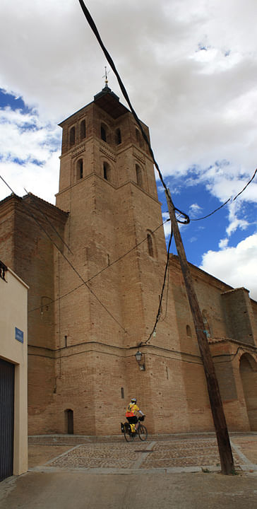
Bizarre tower in the church of Grajal de Campos 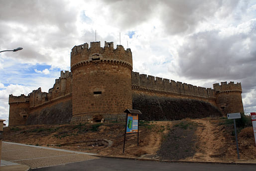
More austere castle of the early Reconquest. Grajal de Campos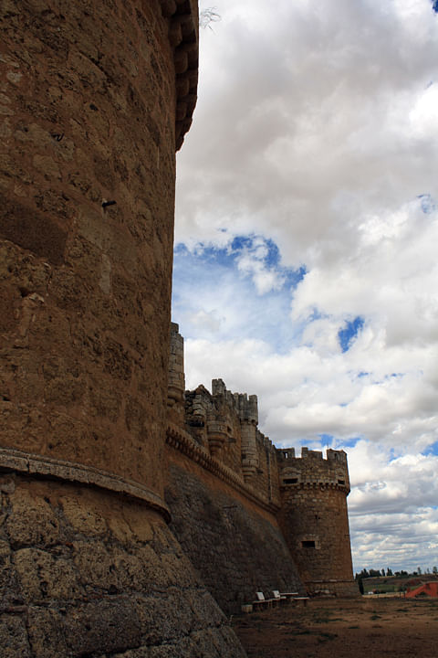
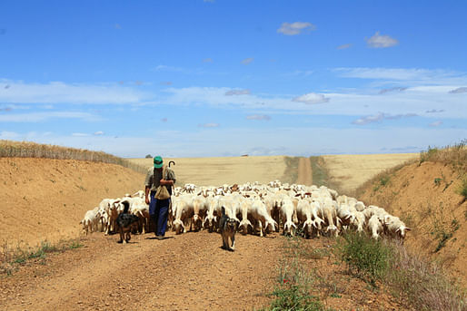
Even 1000 years ago, this scene would look exactly the same.
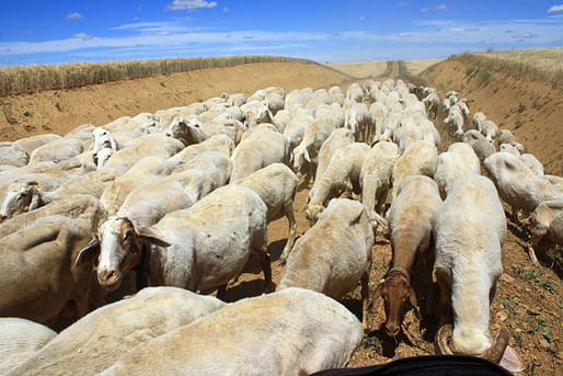
Traffic on the camino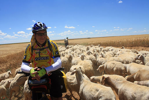
Every moment one of solitude, thought, and delight.![]() At last! We reach Sahagún, and the isolated camino de Madrid has come to an end. Next, I will post the journey to Santiago along the much different Camino Frances. Thanks for reading!
At last! We reach Sahagún, and the isolated camino de Madrid has come to an end. Next, I will post the journey to Santiago along the much different Camino Frances. Thanks for reading!
“The master in the art of living makes little distinction between his work and his play, his labor and his leisure, his mind and his body, his information and his recreation, his love and his religion. He hardly knows which is which. He simply pursues his vision of excellence at whatever he does, leaving others to decide whether he is working or playing. To him he's always doing both.”
James Michener
This work by A.D.Morley is licensed under a Creative Commons Attribution-NonCommercial-NoDerivs 3.0 Unported License.


A new adventure begins as we finish one chapter; we hope to share our story with you. We are graduates of Washington University in St. Louis, Sam Fox School of Design & Visual Arts.

")
6 Comments
Thanks for sharing, these where beautiful photos.
amazing!
very jealous
i'm jealous too! Great photos!
Amazing trip, photos and sketches. It's a trip I hope to make some day. However I need to rectify Spain's continuous overshadowing of Portugal...
Cape Finisterre is sometimes said to be the westernmost point of the Iberian Peninsula. However, this is not true, since Cabo da Roca, in Portugal is about 16.5 km further west and thus the westernmost point of continental Europe.
Hi!
Excellent photos, thank you.
We met on the camino June 16th somewhere between Cigunuela and Penaflor. Good to know that your camino was a success. So was ours.
Block this user
Are you sure you want to block this user and hide all related comments throughout the site?
Archinect
This is your first comment on Archinect. Your comment will be visible once approved.