Located in Nanbu, Sichuan, Yujidao Park uses forest landscape design techniques and the linkage of urban landscape and cultural resources to build a harmonious living environment that integrates culture and city, industry and city, and scenery and city. After completion, the park has not only become a good place for citizens to relax and exercise, but also play a positive role in enhancing the comprehensive carrying capacity and competitiveness of Nanbu County, as well as promoting the fast development of the county economy.
Design Overview
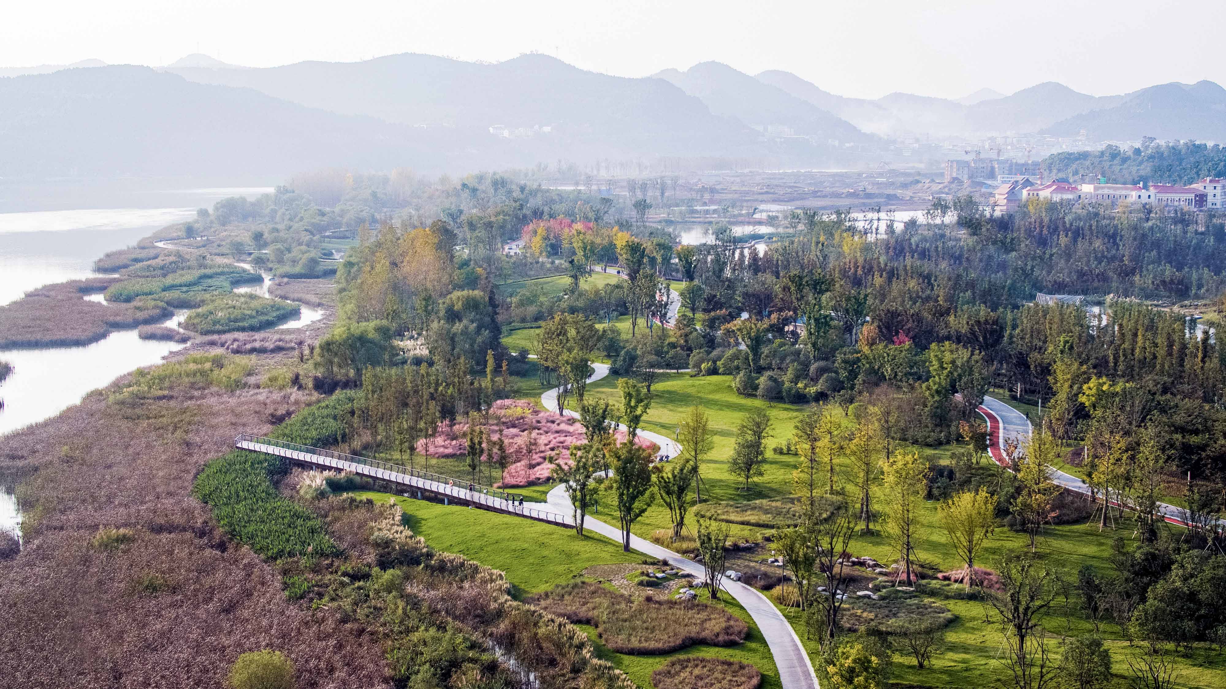
New Ecological Axis-Jialing Pearl Riverside
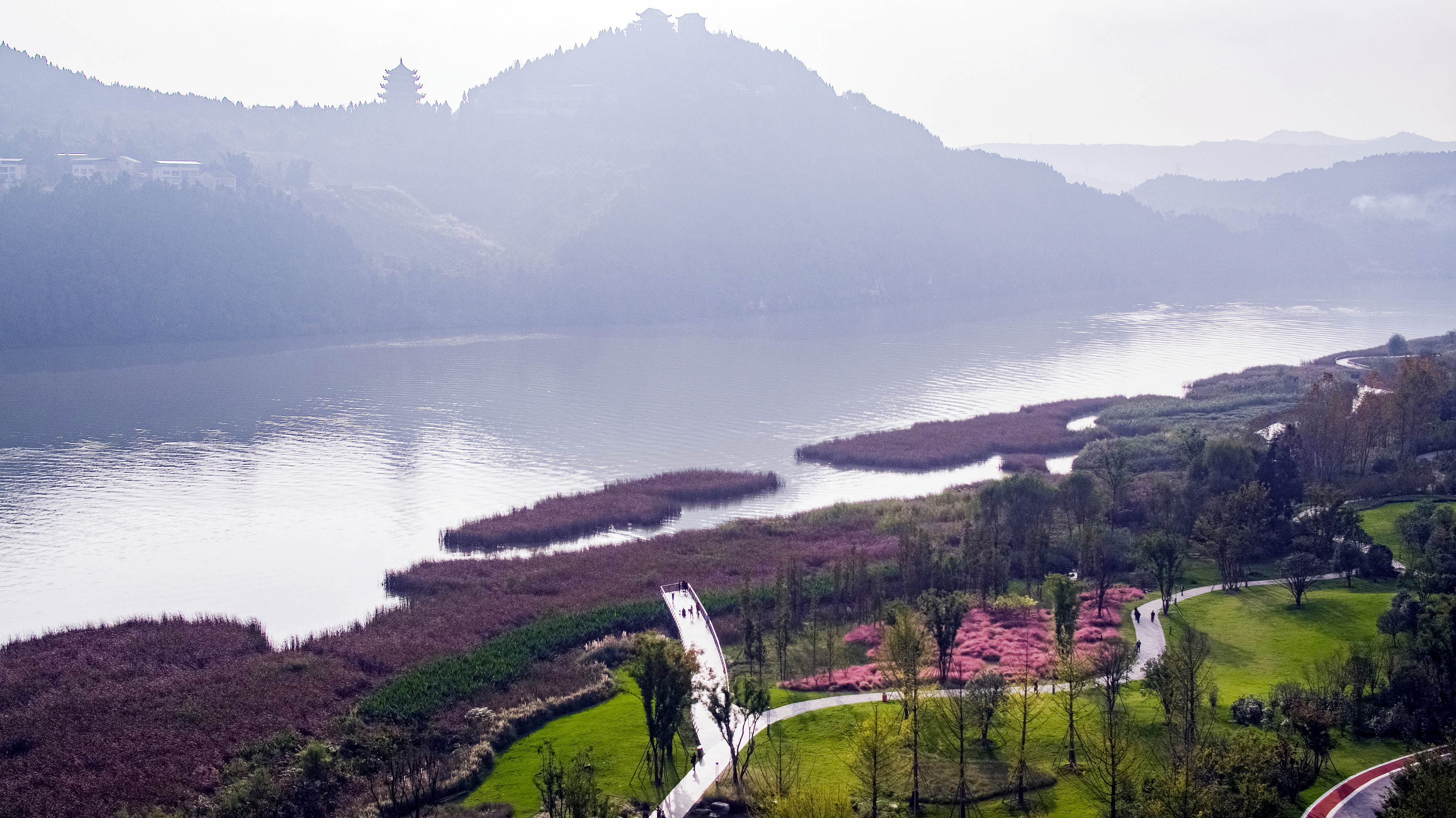
Nanbu County, Nanchong is known as the "Second City of Chengdu-Chongqing Circle" in Sichuan."A history of the south, the love of water through the ages", for thousands of years, the water of the Jialing River has been rushing here, nourishing everything, and the people of northern Sichuan have thrived here and compose a glorious chapter. In the principle of respecting nature and advancing into the future, the design puts forward the concept of "Jialing Pearl, Brilliant Riverside". It introduces the Jialing River water into the site to create Nanbu Shuicheng where the city is on the water and the water is in the city, creating a closer and intuitive experience for people's water activities.
New Cultural Landscape-the Highest Goodness Is Like Water
According to legend, in ancient times, floods were inundated and people were unable to live. Dayu was ordered to eradicate floods when he was in danger. He dredged the river and widened the gorge, eventually allowing the water to flow smoothly and the people live and work in peace. In the process of traveling all over the land to control water, Dayu also left precious relics in Nanbu County.In order to inherit history and culture and pay tribute to the spirit of Dayu’s scientific water management, at the premise of large-scale parks and characteristic visual landscape belts, the design incorporates the Dayu culture in the entire site, showing the life of Dayu through line construction and formal symbolism, creating a cultural business card for the integration of the Nanbu Shuicheng.
The New City Portal-the Magnificent Scroll of the Prosperous Age
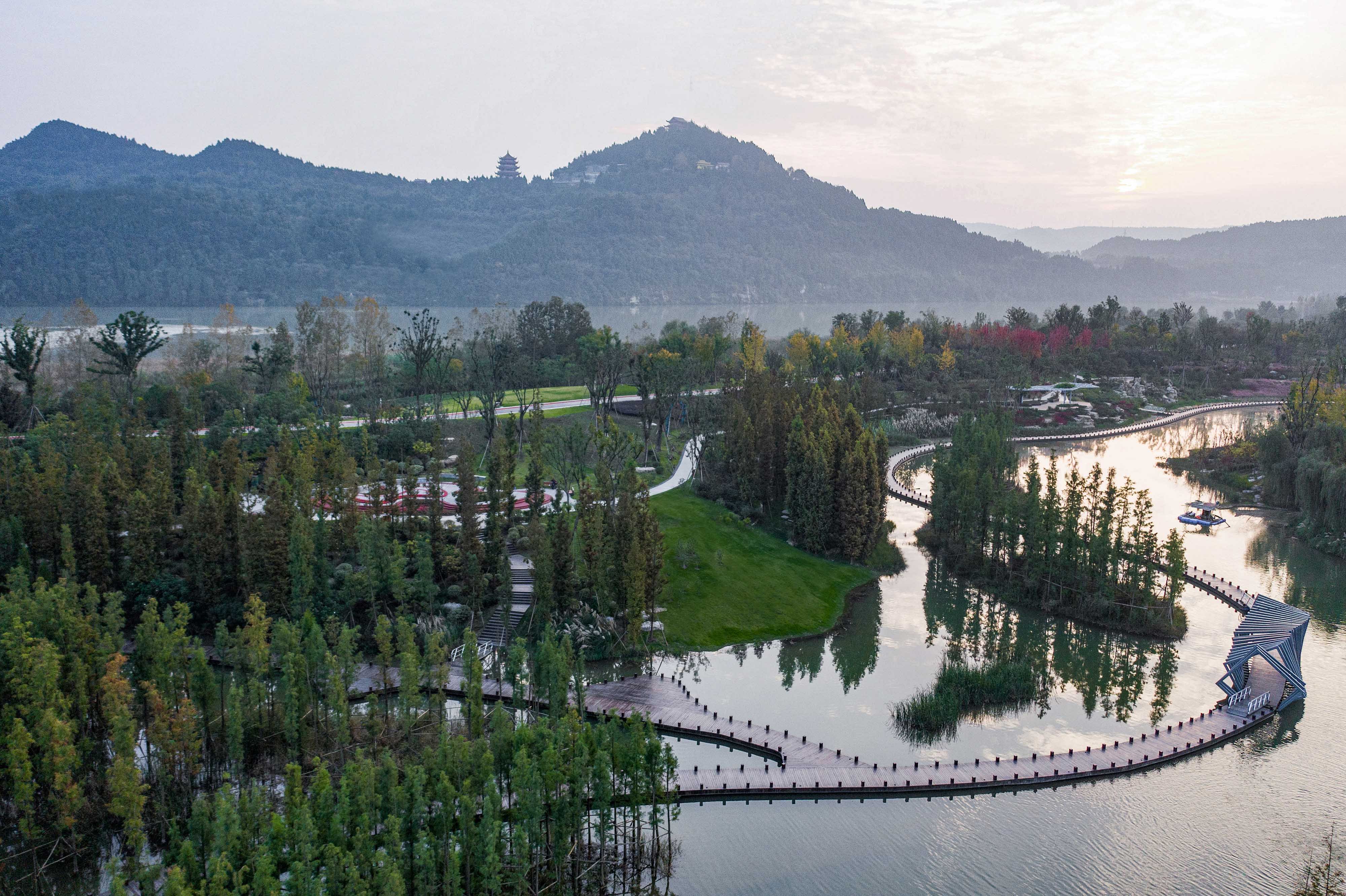
As the visual link between the old and the new city, the construction of the river system in the area fully integrates the water resources with the interior of the site, which has realized the urban development goal of connecting the city with curved water, interweaving blue and green, and coexisting organically. Through combing the terrain of the landscape and planting vegetation, it strengthens the natural context, and strives to form a glorious picture scroll of Nanbu in a trance. The construction of modern landscape venues effectively improves the quality of the city, and finally creates a special space for people's leisure, image display, and festival celebrations in Nanbu.
Forestry Landscape Design Strategy
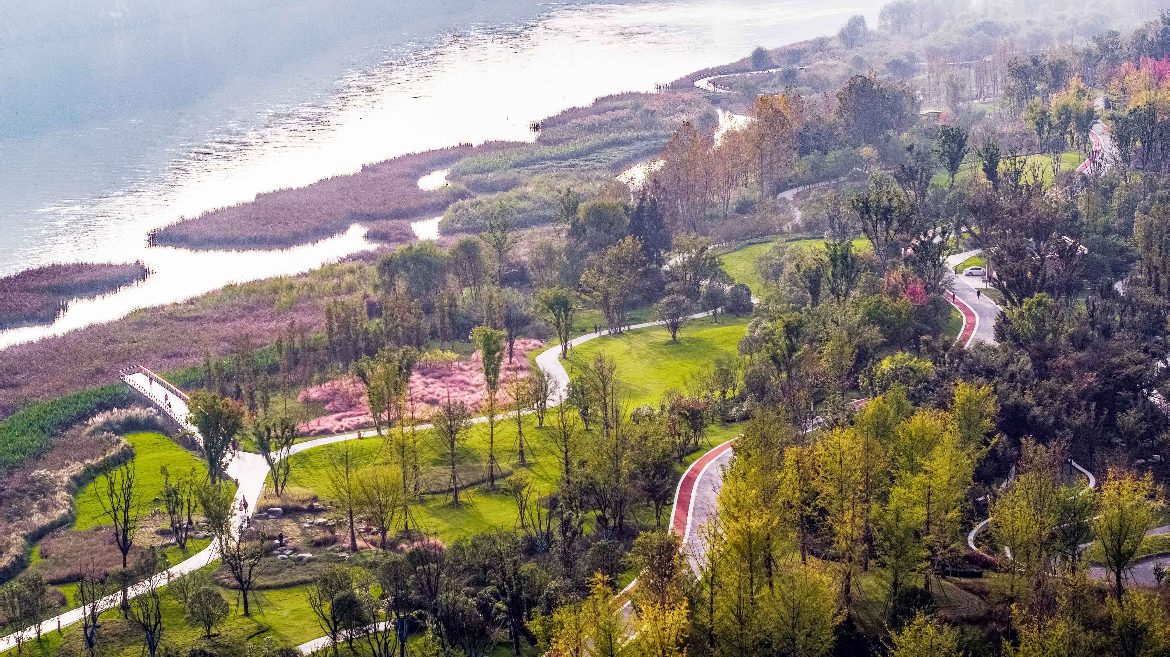
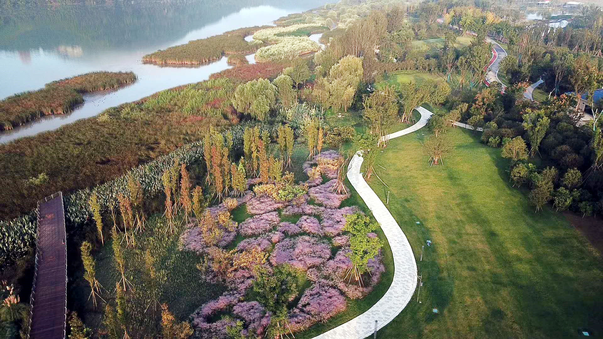
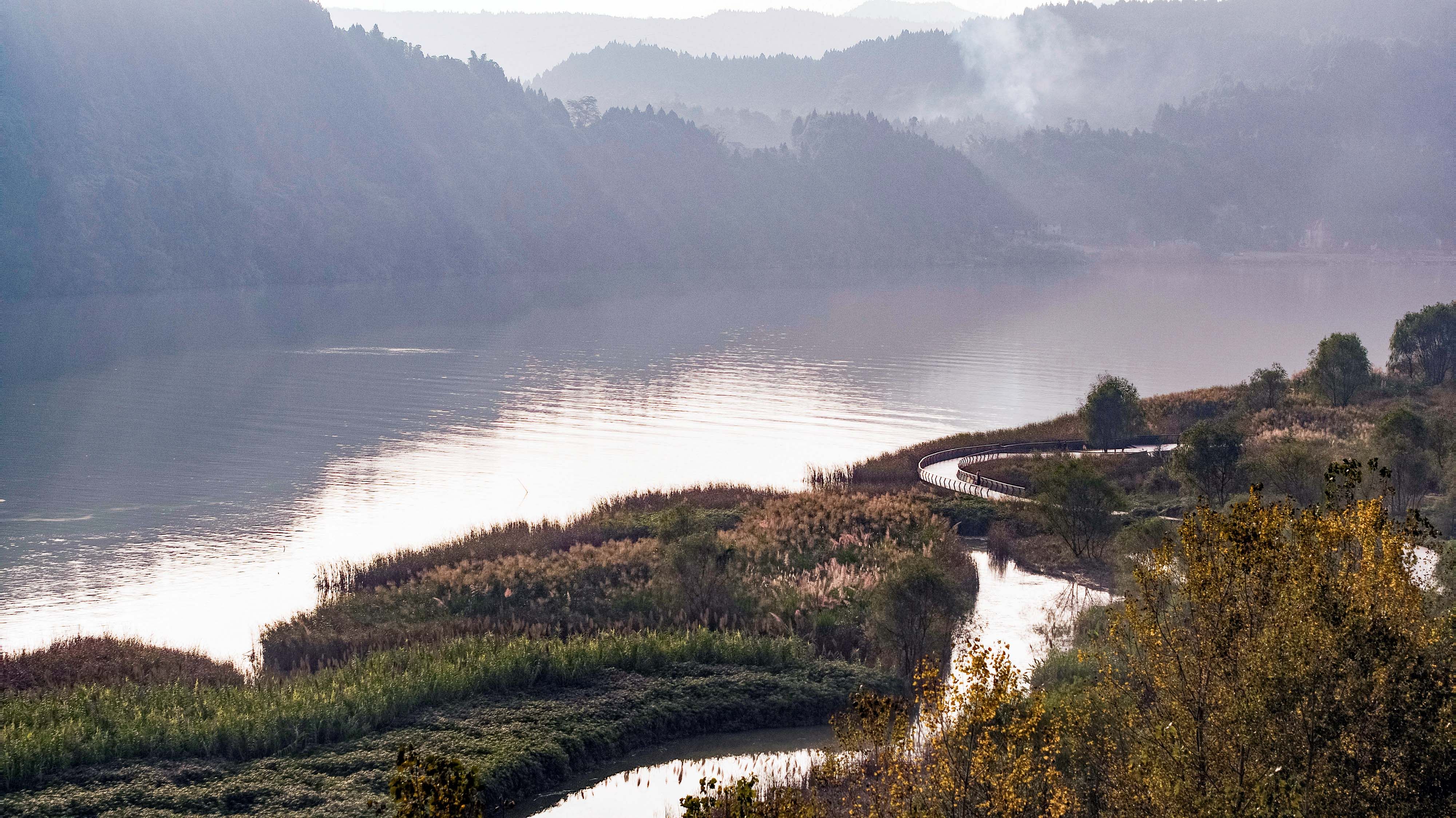
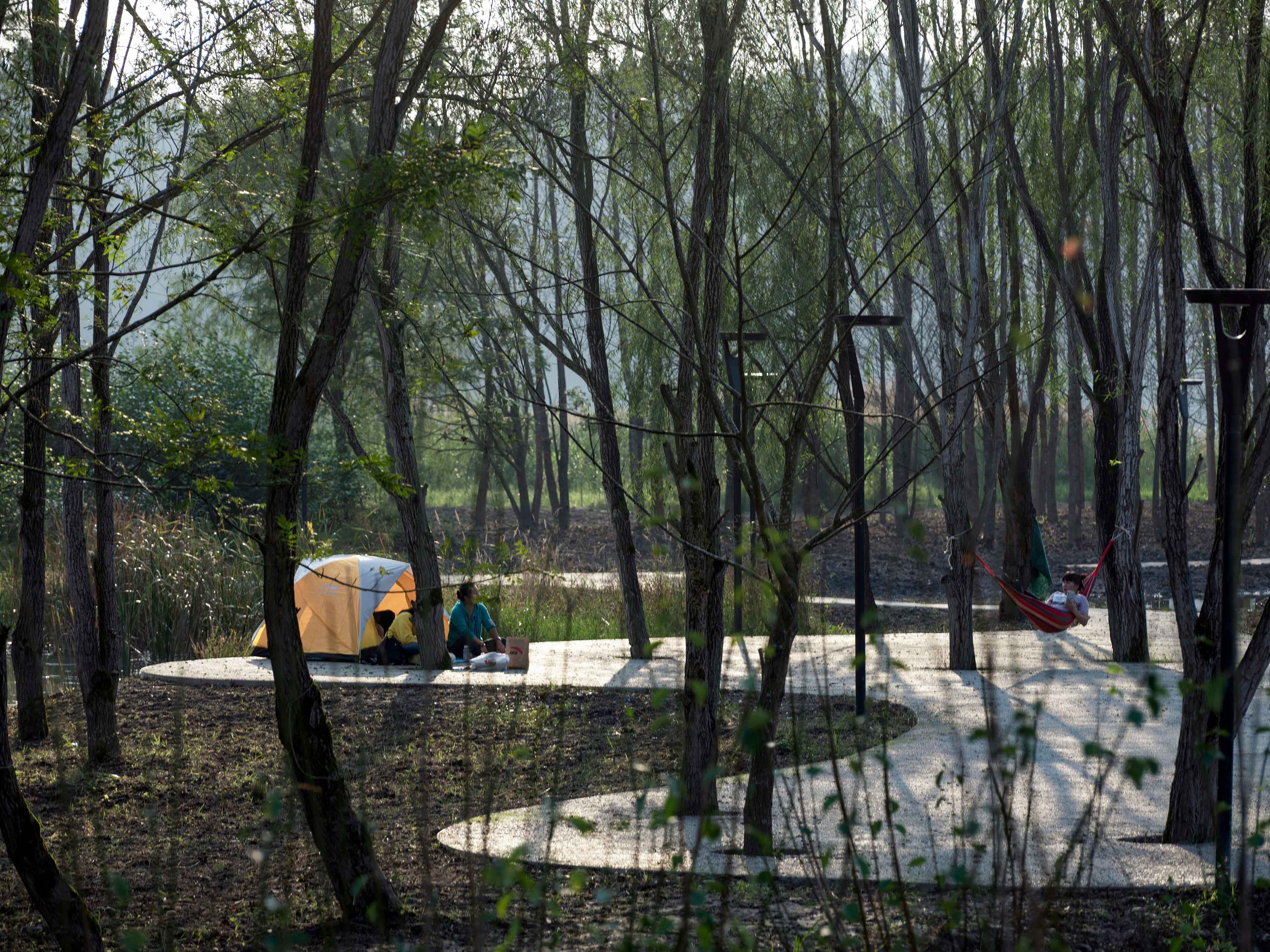
In view of the current waterfront scenery belts that focus on wetland construction, the lack of transition from inland to riverside vegetation has led to the emergence of strong traces of design belts along the river and lack of focus on landscape ecology, the Yujidao Park project ingeniously completed the transition zone design with primary forests, replanting forests, artificial plantations and characteristic landscape forests, perfectly realizing the conversion from native to artificial landscape.
1. The Original Ecology-the In-depth Creation of Landscaping
The traditional waterfront area emphasizes the ecological construction of the wetland system, and the liquid bubble ecology and self-purification system of the waterfront wetland are achieved to the extreme. However, in the process of gradual transformation from wetland ecology to forest ecology, it was blocked by urban roads and riverside dikes.
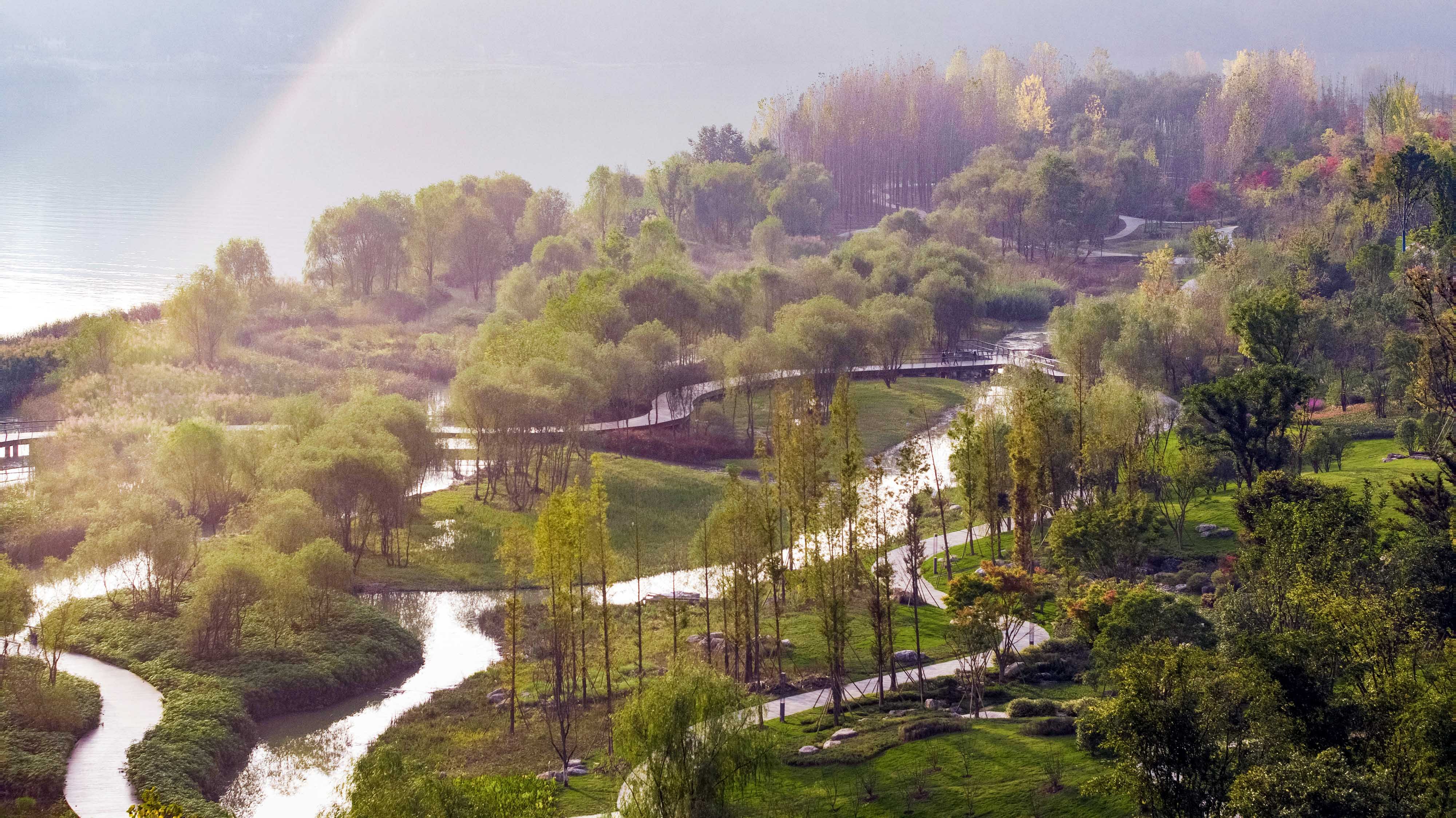
In order to create a more complete ecosystem, at the beginning of the planning, the design breaks the barriers of solid boundaries and fully considers the combination of the riverside belt and the urban waterfront park. It builds a deep forest line from the inside to the outside of the riverside tidal flat-wetland system-primary forest-artificial garden area-urban boundary, allowing nature to more perfectly integrate with the city.
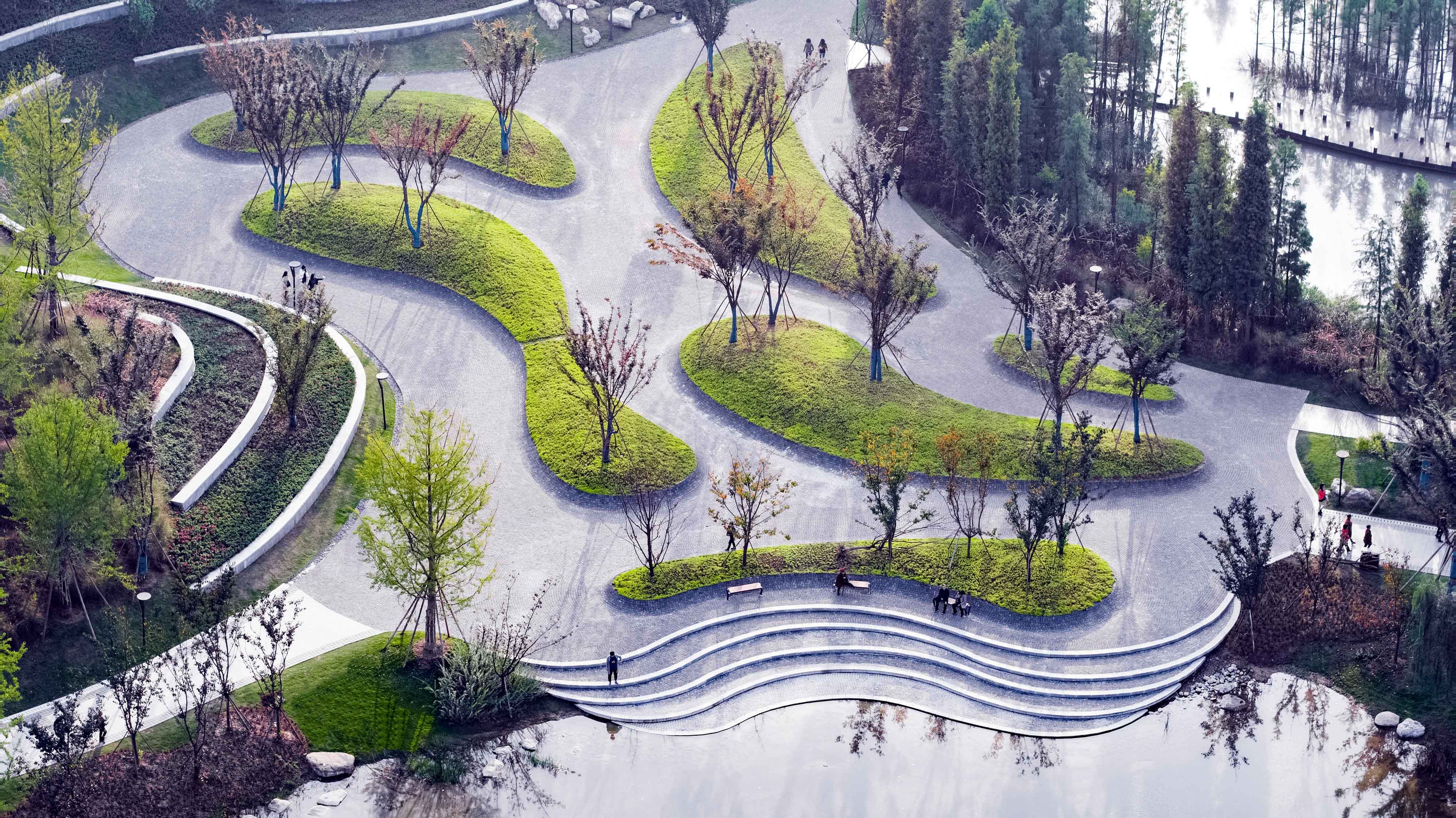
2. Design Transition from Solid to Fluid
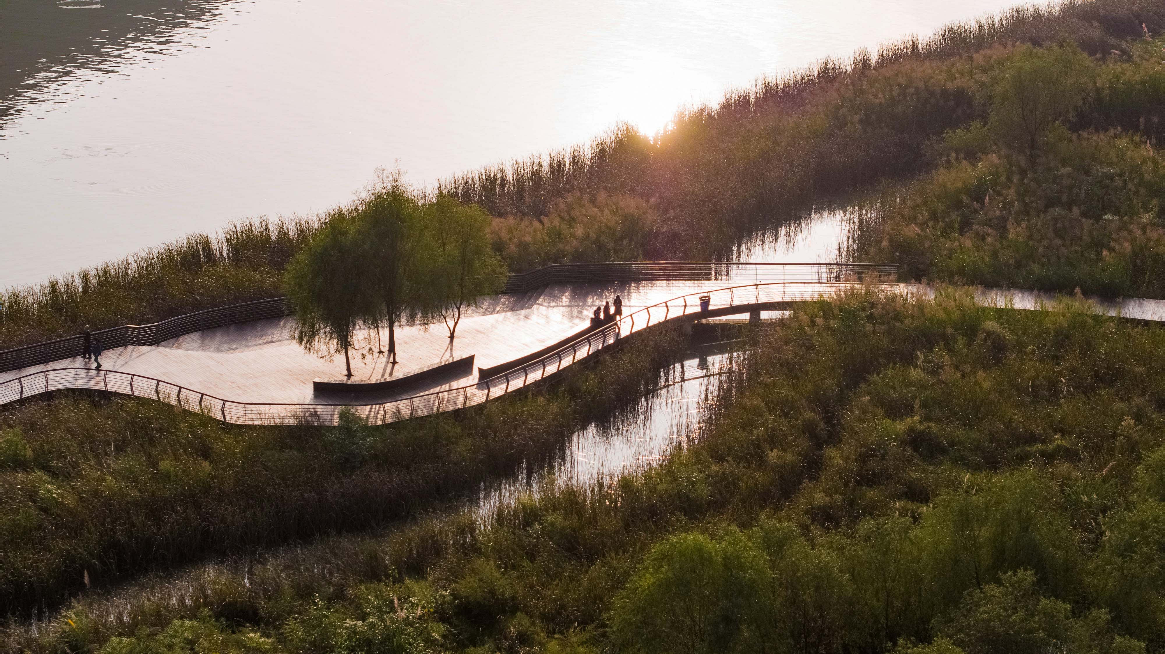
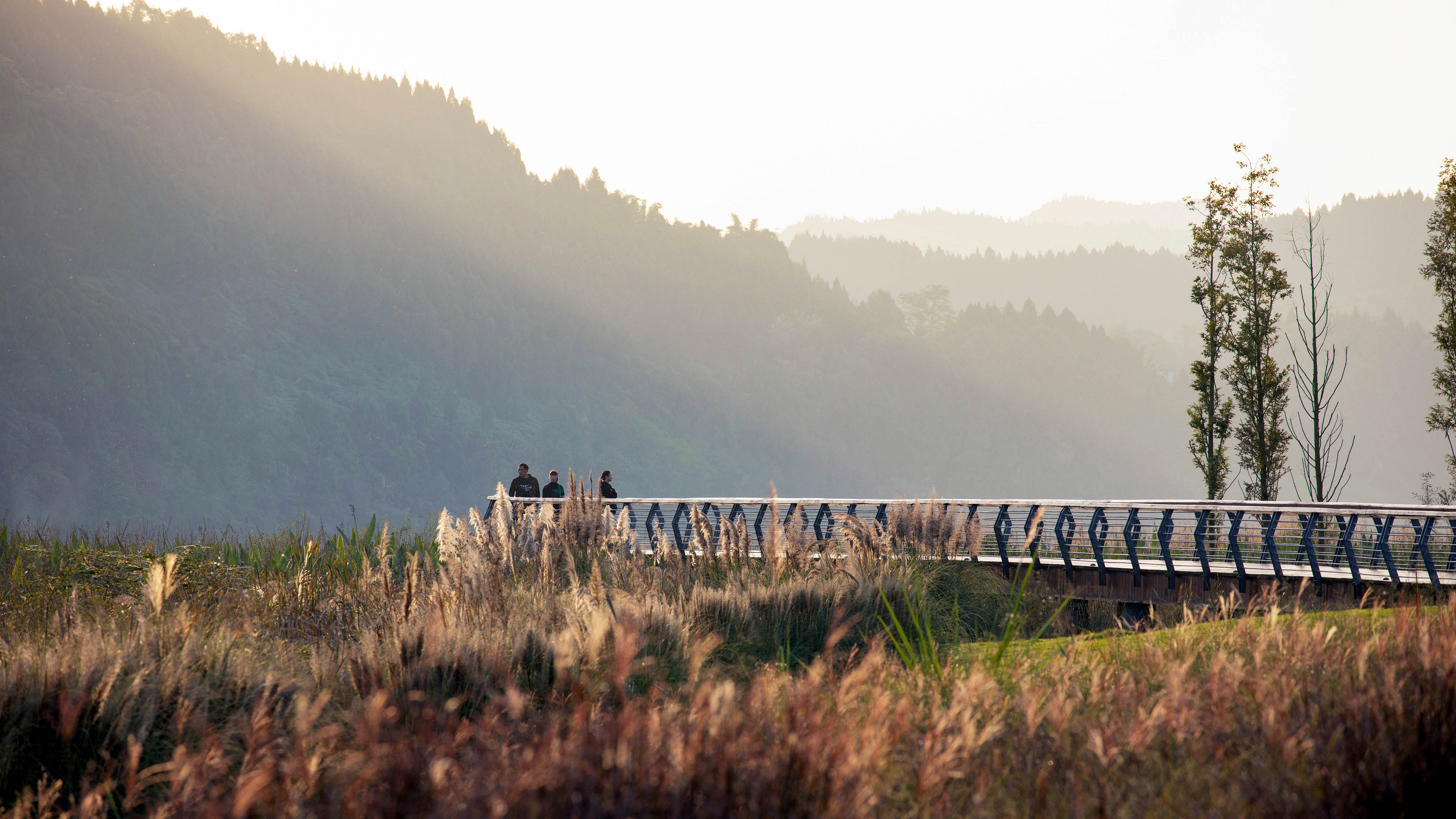
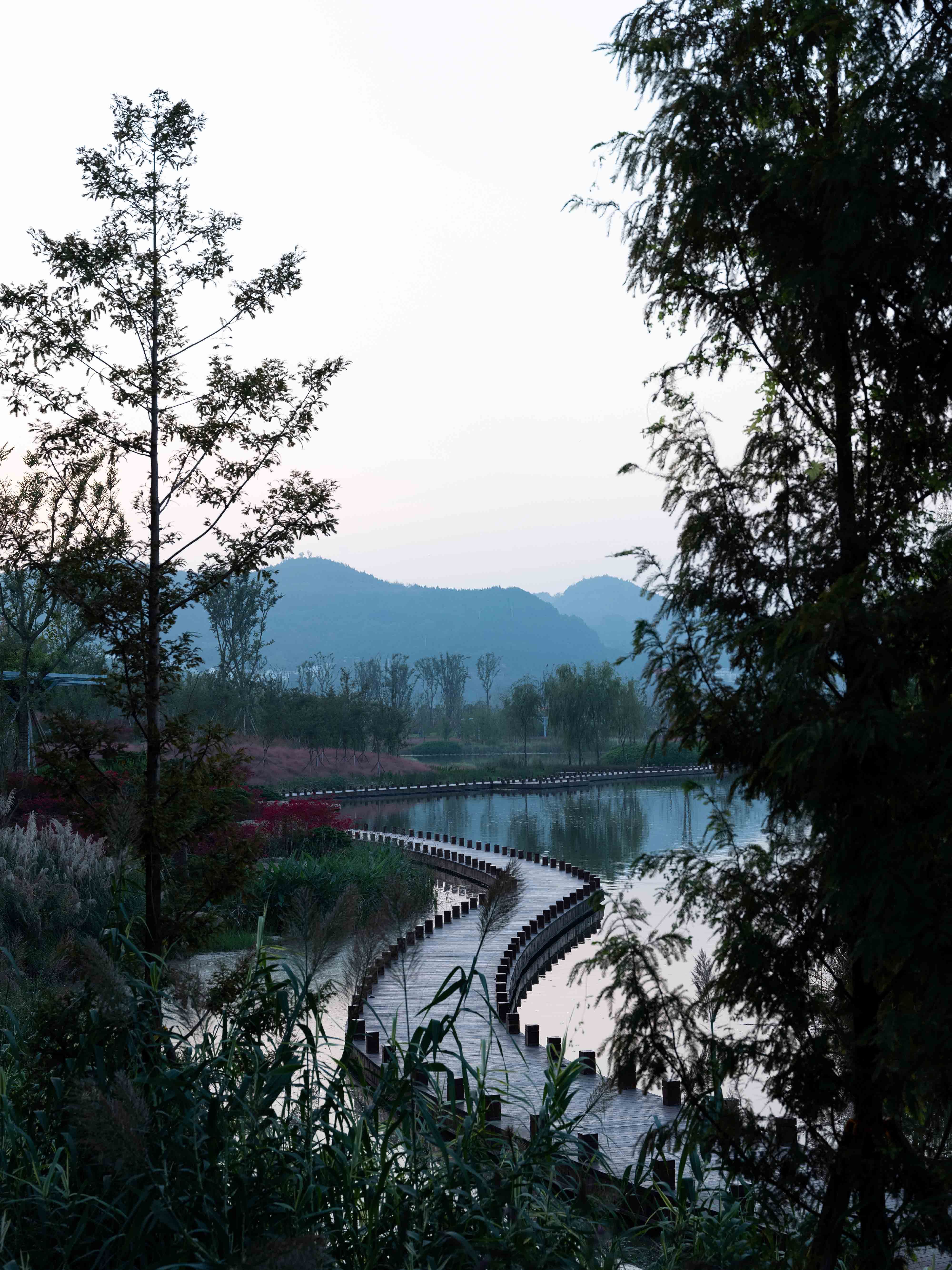
Facing the solid flood control measures that usually traverse between the waterfront space and the city boundary, the traditional design method is to treat it as a space parallel to the river. The design is also performed centered by this, and finally formed a second linear space parallel to the waterfront: a solid model that is connected in series by large and small nodes and a trail system, surrounding the flood control road.
In order to avoid the linear control of flood prevention measures on the entire riverside zone, the design draws on the landscaping techniques of Chinese gardens and constructs a number of different "layout" forms. Through multiple enclosed spaces, the continuous multiple vanishing point scenes in Chinese landscape paintings are created to form a flowing picture scroll.
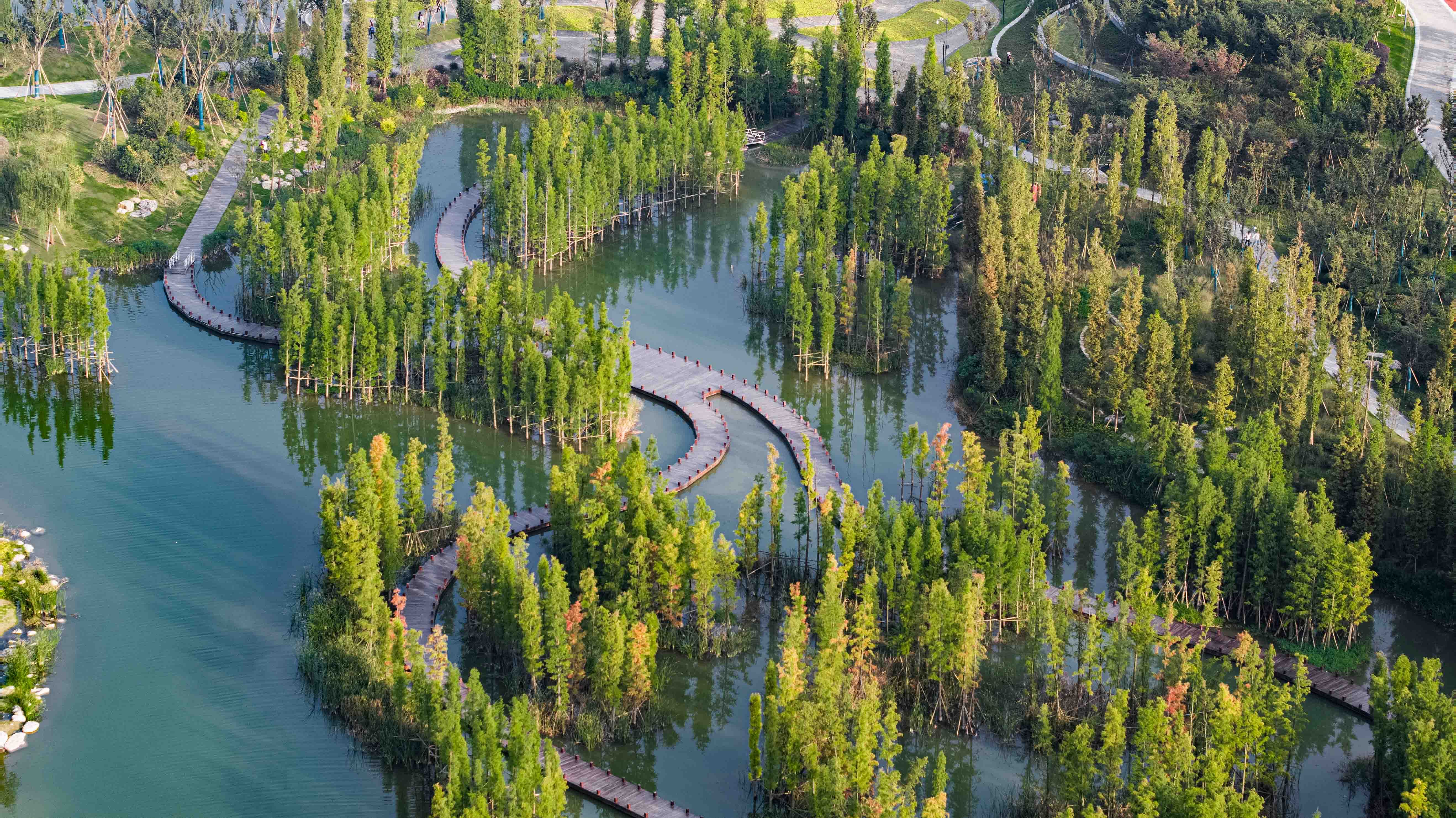
3. Organic Integration of Waterfront Landscape
In the traditional design, the method of separating the three areas of tidal flat virgin forest, bank replanting forest, and blue-green plantation forest is of little help to the water ecology. Due to the characteristics of the developed root system of plants, certain powerful tree species will erode to other spaces that were originally intended to be separated on a large scale, and the final result is an environment that cannot withstand time to wash.
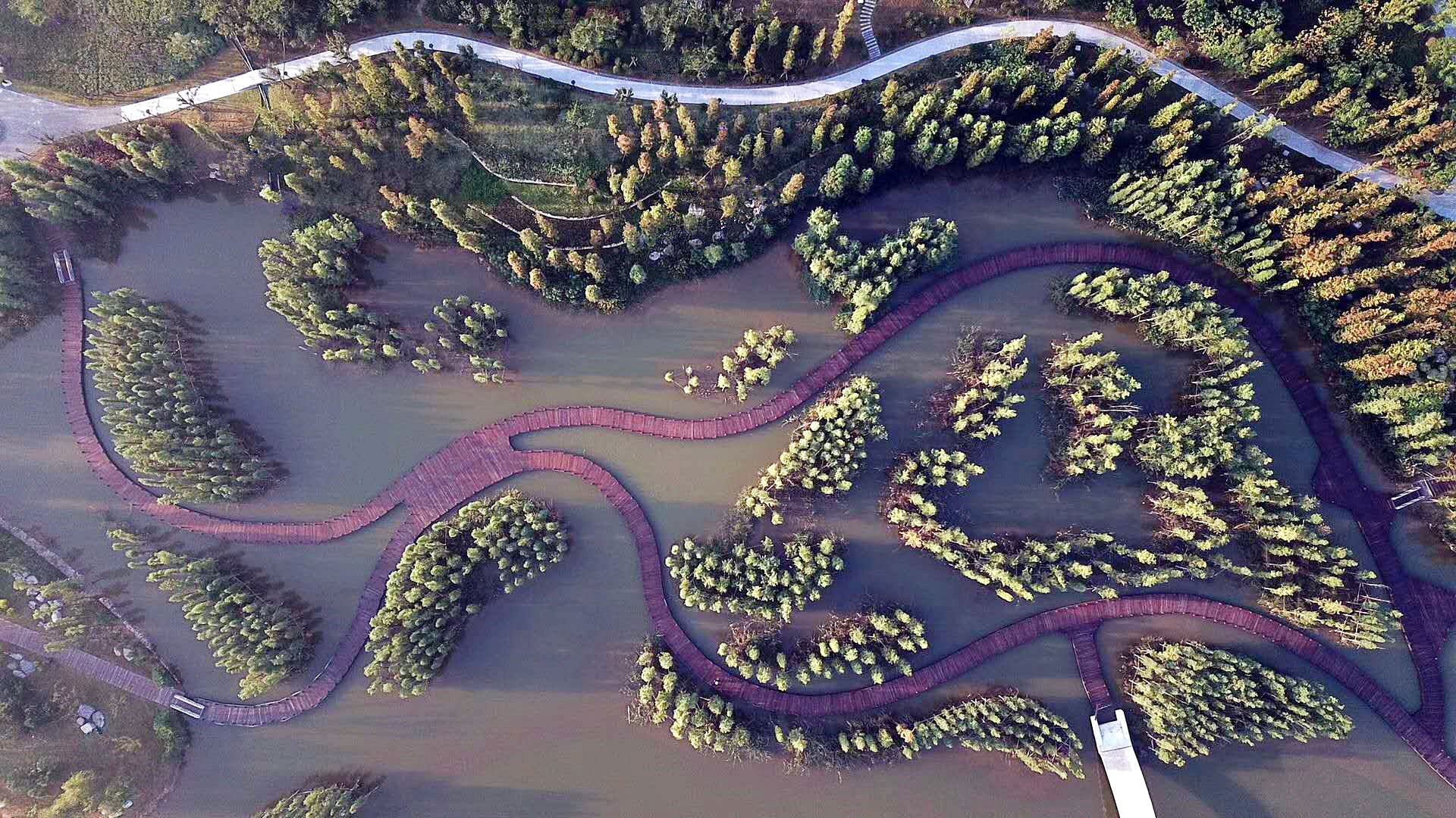
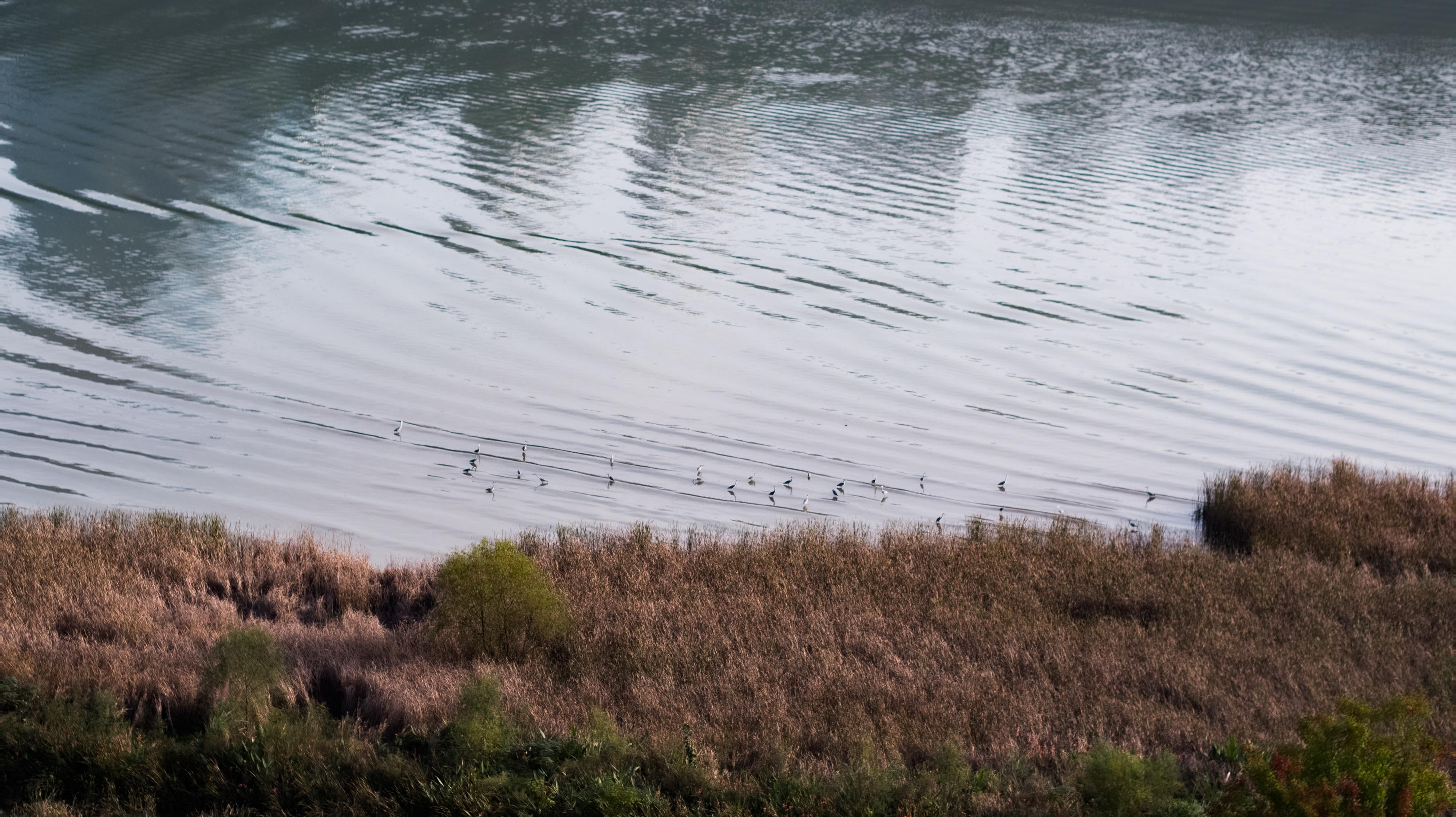
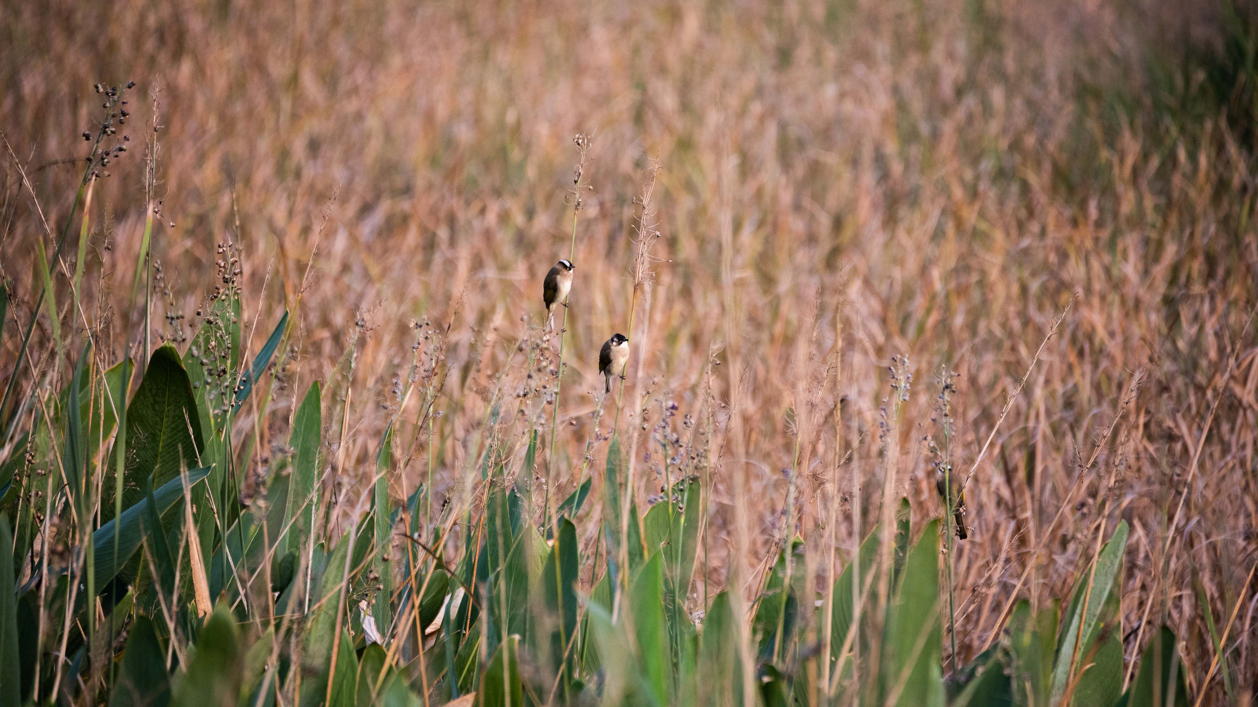
Therefore, in this project, the design has systematically considered the above-ground and underground spaces. As for the ground and water banks, they are appropriately grouped and combed through the creation of visual corridors, without destroying the boundaries of the original forest. For example, properly clean up trees with a diameter at breast height less than 10 cm, so as to create an artistic effect of landscape gardens. As for the groundwater bank, artificial methods are used to block the unrestricted extension of the root systems of plants such as calamus, parmesan, and reeds. It makes the waterway to enter the tidal flat land, thereby turning the tidal flat into a wet island, improving the foraging space of birds and the habitat of large birds.
One Island, One World, One Water, One Universe
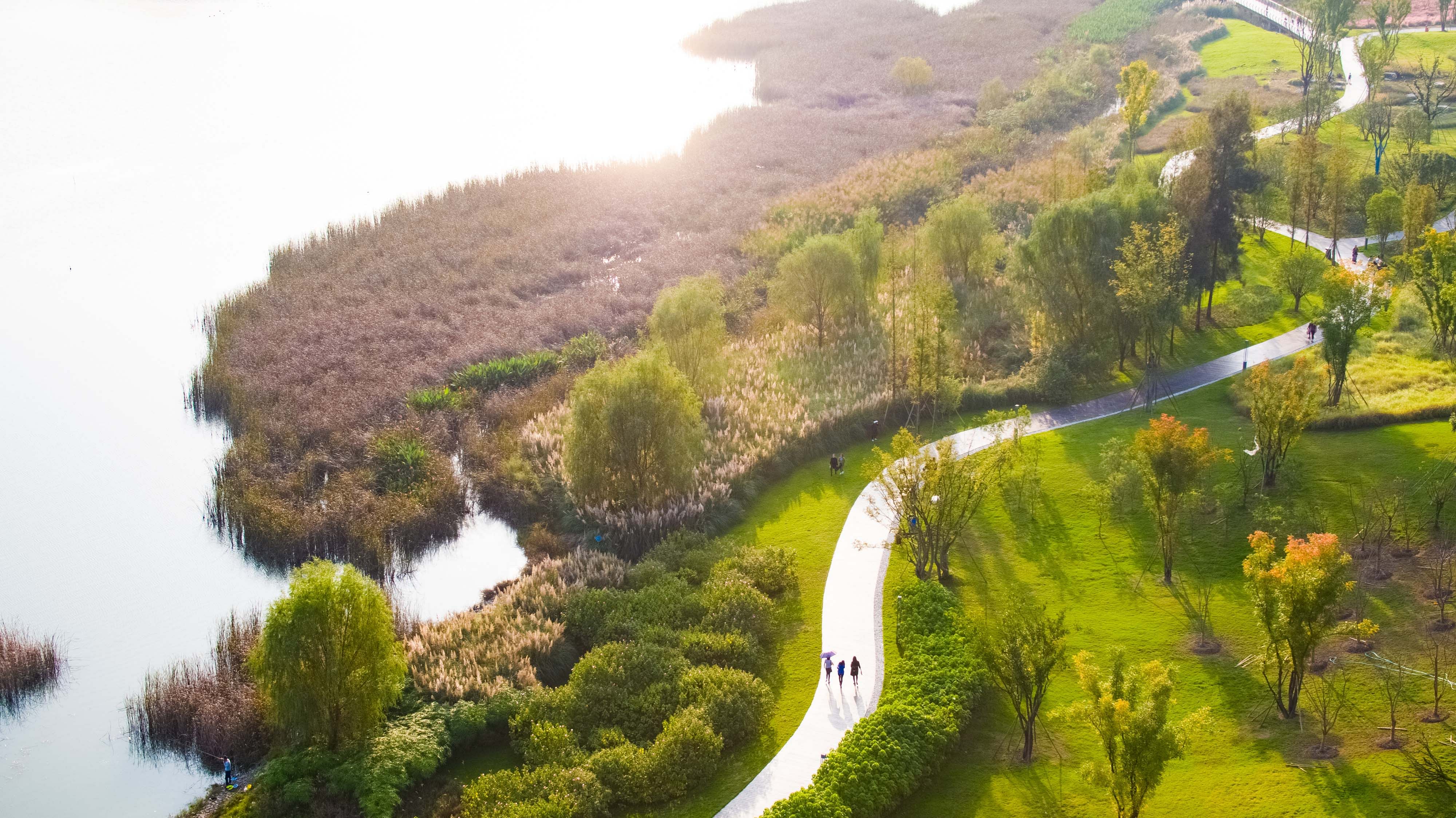
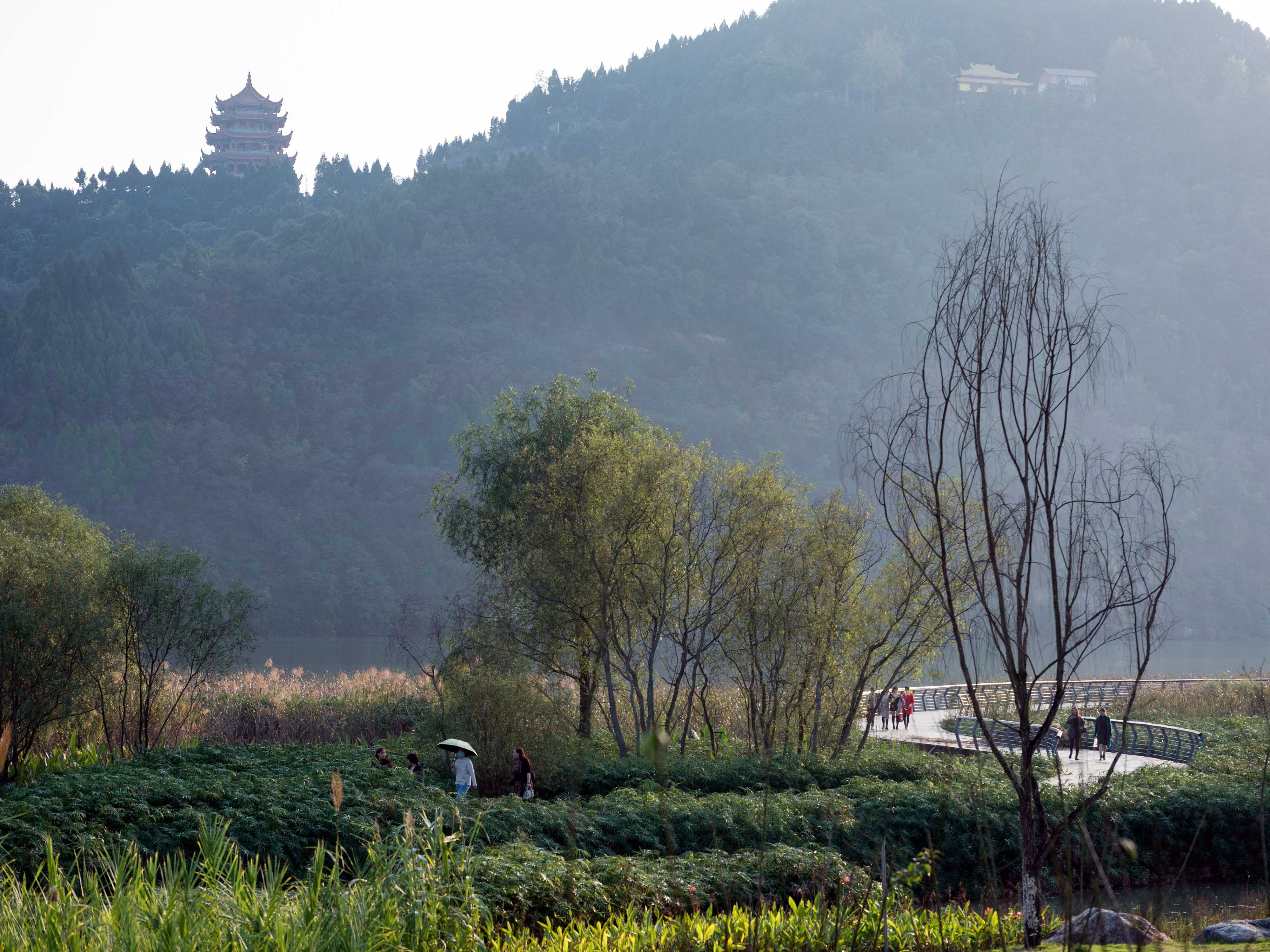
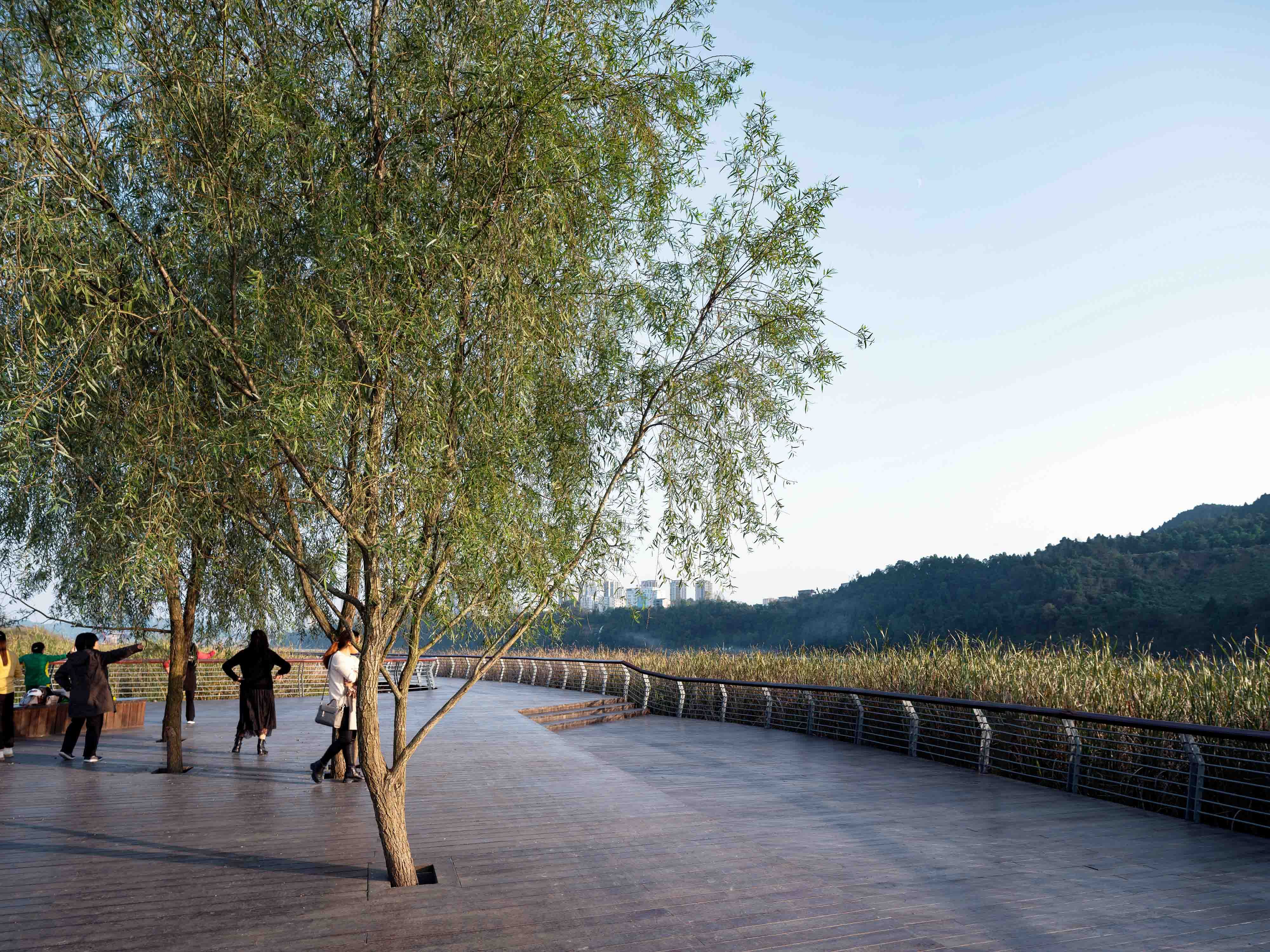
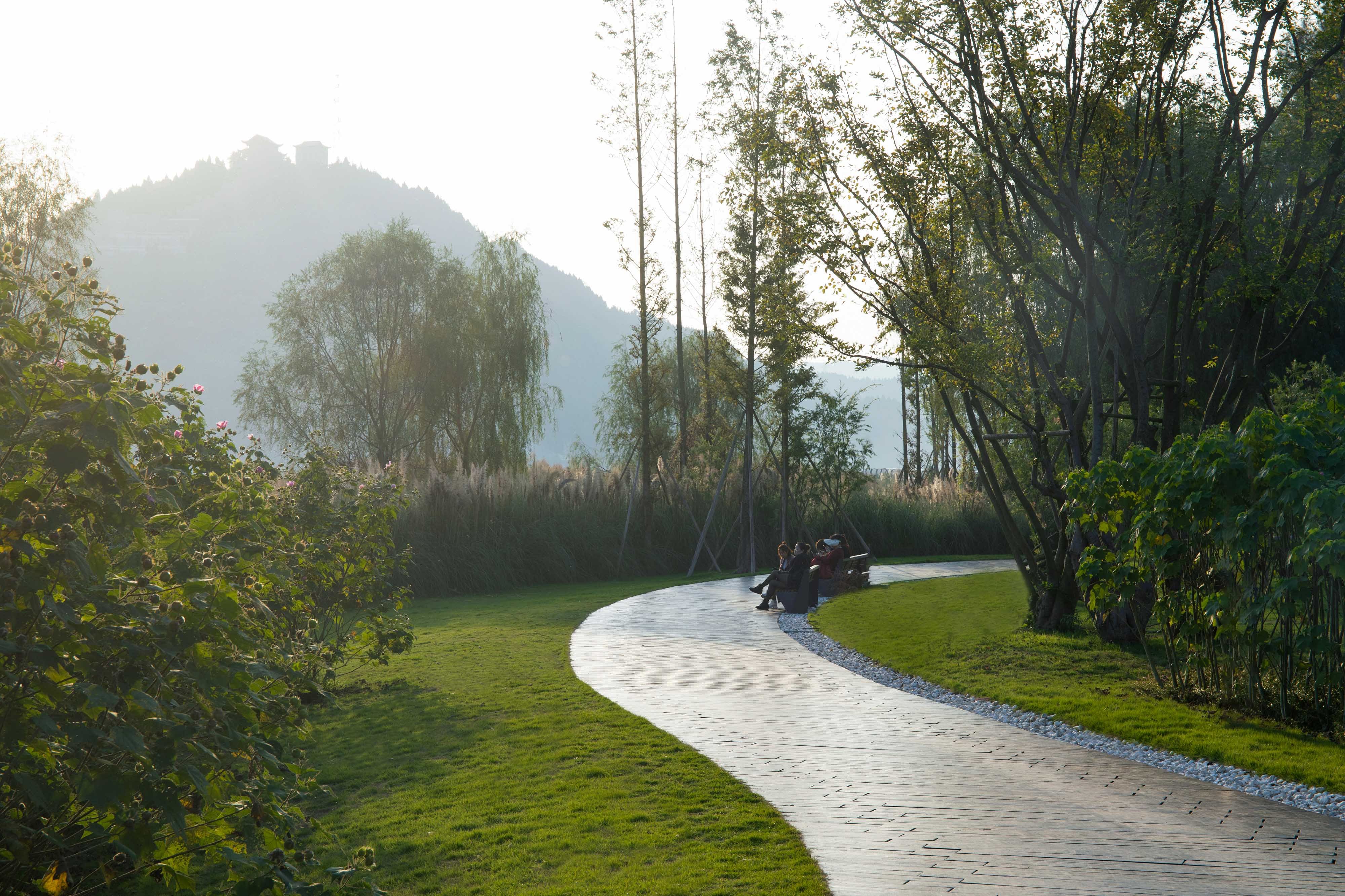
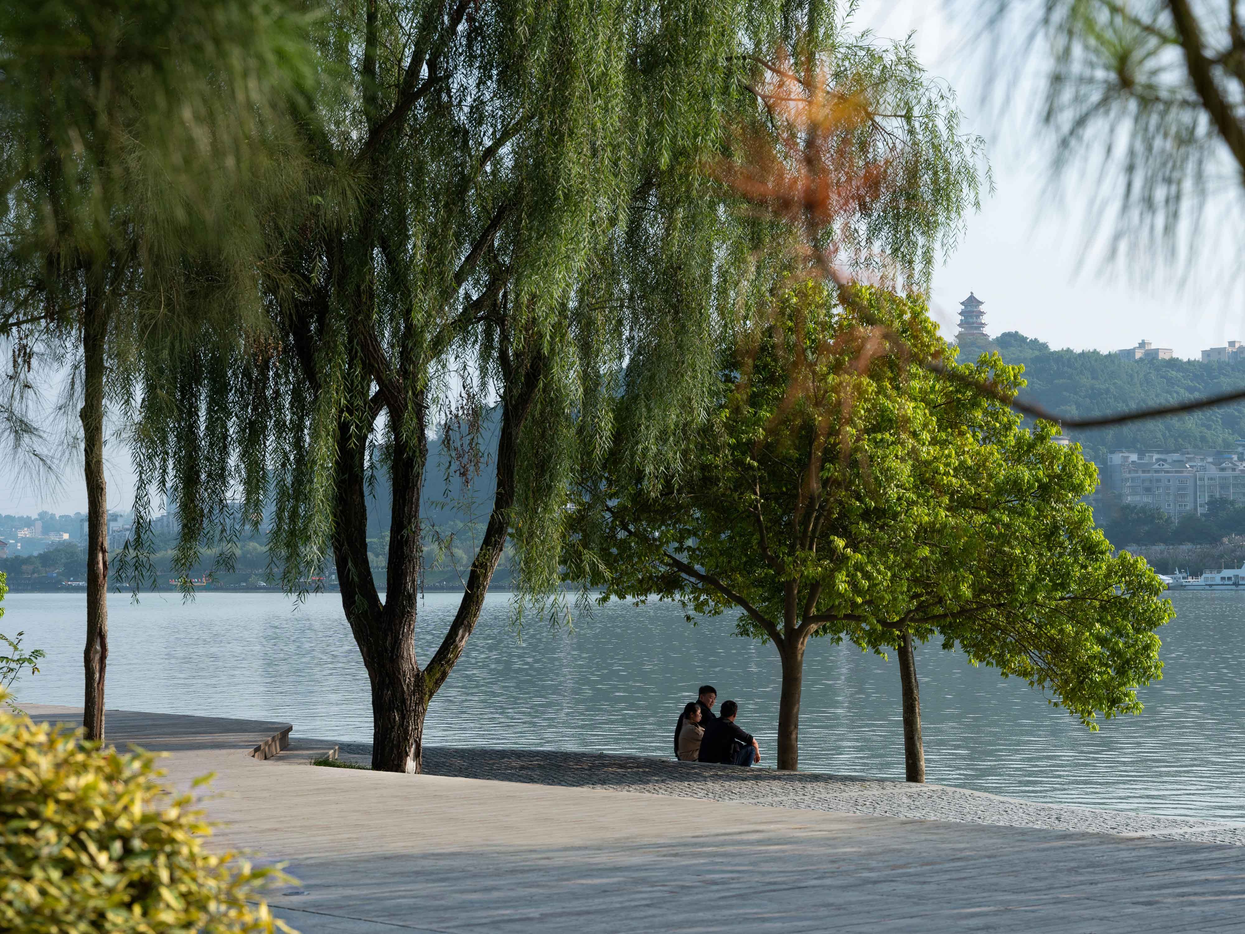
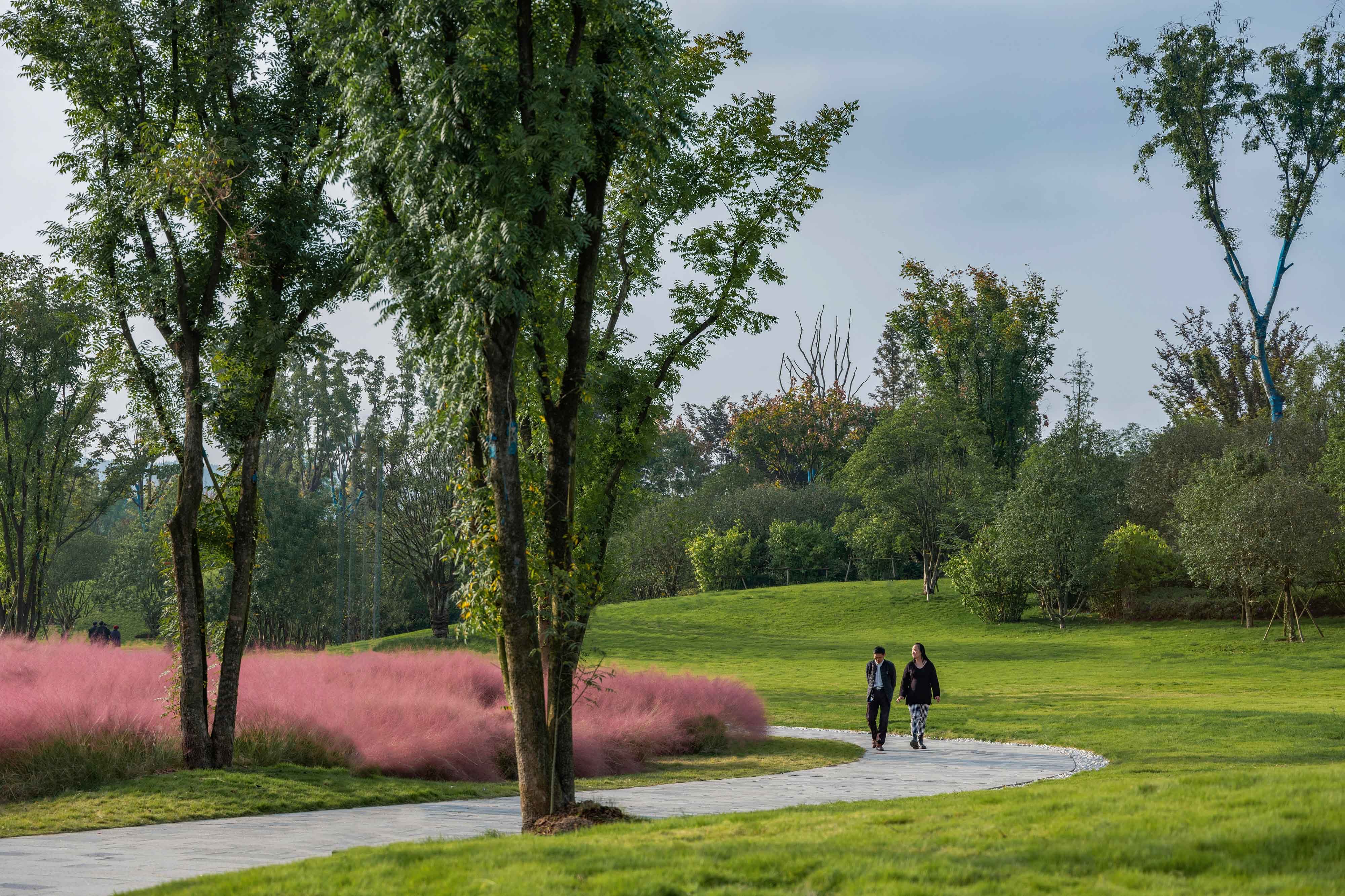
As for the large and long coastal area, the design provides a rich and diverse visual sensory experience through the shaping of the terrain, the adjustment of the relationship between the vegetation, the enclosing of the dense planting group and the road, the construction of the parking site, and the construction of the characteristic dry stream. During the tour, visitors can not only feel the magnificence of the mountains and rivers, but also enjoy the aftertaste of the details of the park.
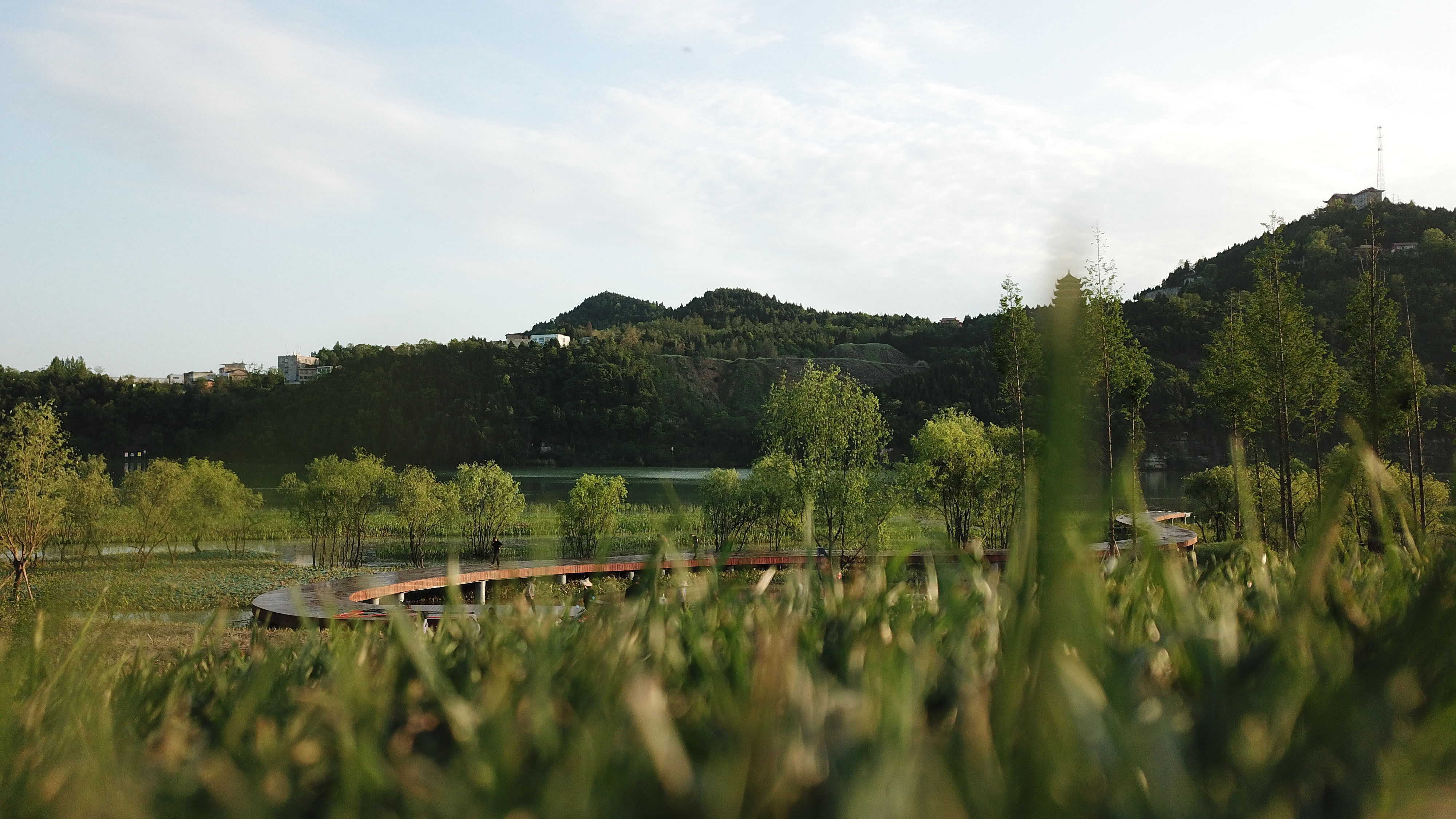
As a municipal park, the project needs to consider the sense of experience and participation of visitors, but it must not be at the expense of native forest. Therefore, the designer adopts methods such as reduced migration or complete preservation to maximize the ecological value of the primary forest. At the same time, the plank road design is also adjusted in accordance with the space under the forest: the wide area naturally forms a small park, and the narrow area extends into the forest by a winding path. When visitors strolling in it, everything is natural and they can enjoy the natural movement to the heart's content.
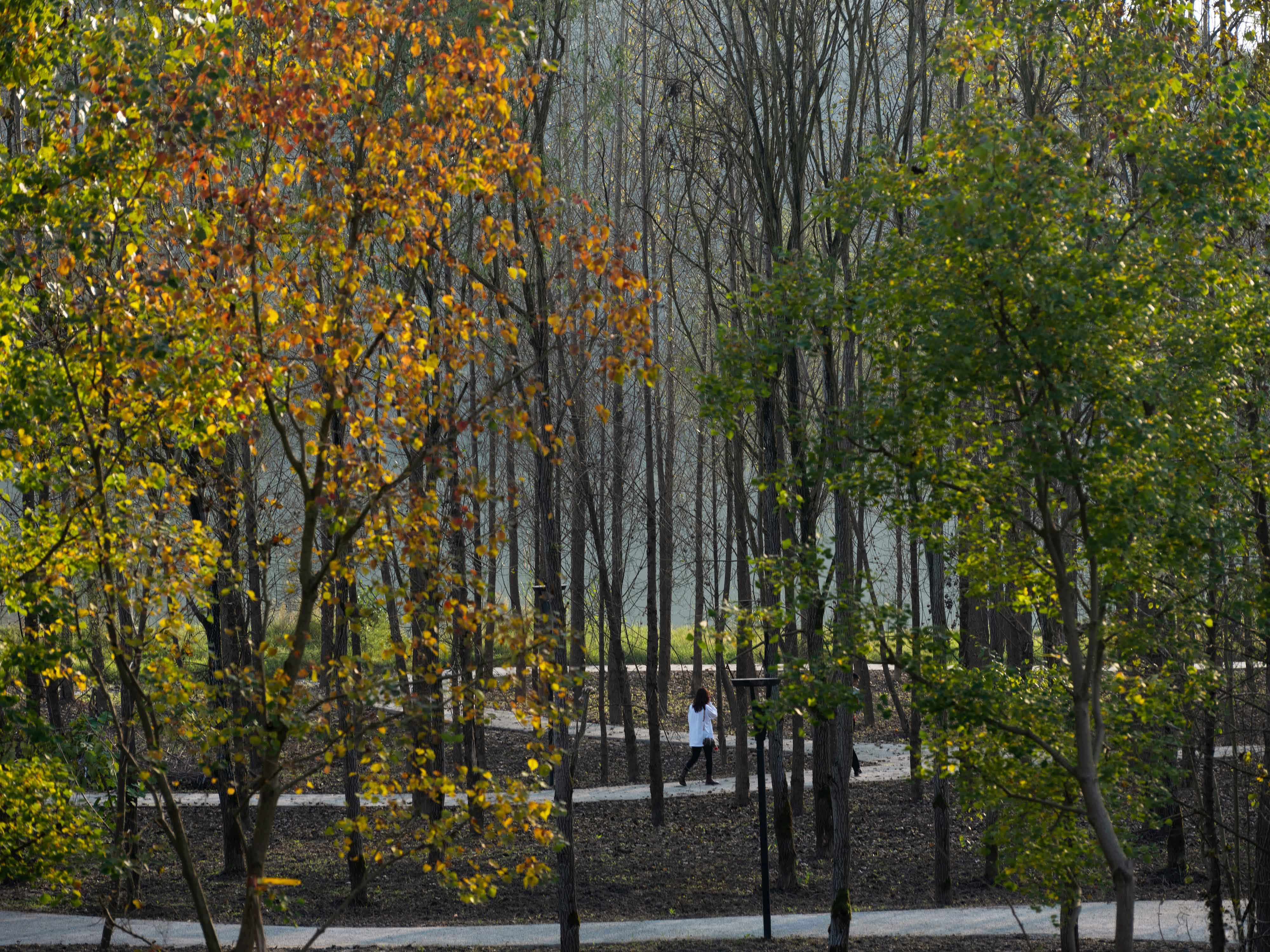
The carefully selected plants have constructed an ecologically-based civic activity space with a complete natural pattern, rationally arranged functions and spatial layout, and rich landscape and plant systems. The design integrates and considers various factors such as the original site, design style, seedling resources, etc., and embeds the change and invariability in the design thinking, and finds the most suitable location for growth and viewing for each piece of vegetation. For tourists, the moment they arrive is the most beautiful time.
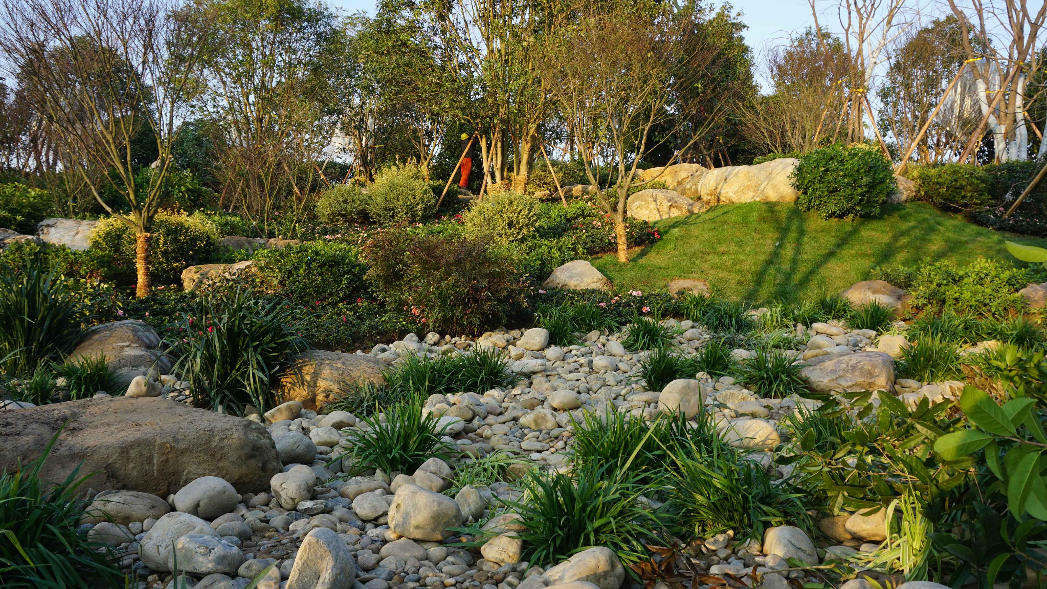
The mountain design is based on the theme of "cold plum blossom and strong pine", which plays a finishing touch in the picture scroll depicting the Manfuba in Nanbu.78 black pine trees selected from all over the country are mutually complementary with scenery stones arranged by professional landscape stone masters according to plant type, height, direction, posture, etc, jointly outlining an ink painting with a profound artistic conception. The addition of fine plants such as red plum and tea plum adds an elegant atmosphere to this landscape ink painting.
"People say that I live in the city, and I suspect that I am in the mountains."The Yujidao Park in Nanbu Shuicheng balances the contradiction between river channel development and ecological nature with the de-stylized method of returning to nature and integrating into nature, creating a new and ever-lasting waterfront landscape space. Spring blooms, summer flourishes, autumn falls and winter hides. In Yujidao Park, people and water are reconnected in a most cordial form, breathing with the city, continuing to write a new memory chapter in the water loving Nanbu.
Project: Yujidao Park, Sichuan
Area:100,0000 ㎡
Completion time: 2021
Design company: BLVD International
Chief designer: Yun Du
Landscape designer: Chulin Hu, Weiyi Li, Lemsic Arnel Manga, Gang Huang, Li Zhang, Jin Li, Weishui Lin, Yingru Hou, Songhong Cai
Architecture Designer: Deliang Liu, Yinghong Tan, Dela Liu, Zhe Tao
Client: Nanbu County Landscape Bureau
Construction company: Beijing Orient Landscape & Environment Co., Ltd.
Photograph: Shining Laboratory
Status: Built
Location: Nanchong, CN