In the summer of 2009, a landscape architecture seminar was to examine the forces and physical manifestations at the US border with Mexico. The project began with intensive study and research of the border and included readings from experts beyond the design disciplines. This information was turned into information graphics, which would accompany "Snagged," an art installation at the University of Texas at El Paso. (UTEP) UTEP’s Rubin Center for the Visual Arts commissions works, which specifically address issues of the US-Mexico border.
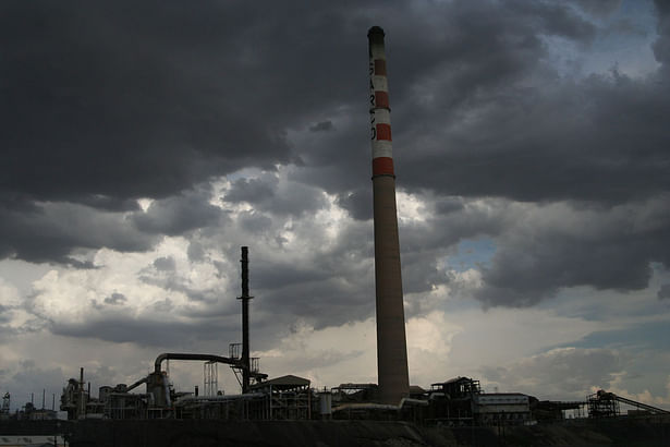
The research phase included a brief trip to the border. Photographs, sketches, and mappings documented the experience, which included visits to an abandoned Asarco smelting plant, a split nature preserve, and views of peripheral slum areas of Ciudad Juarez, Mexico. I was responsible for documenting the infrastructure that has and was being installed due to recent legislation that responded to concerns since 9/11, illegal immigration, and drug trafficking.
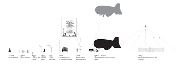
The timeline below illustrates the increase of fortification at the international boundary, with the most
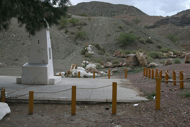
significant increase of spending happening since 9/11. There was a wide range of technological sophistication and expense across the found pieces of infrastructure. Originally concrete obelisks were placed within site of one another to mark an open border. San Diego and El Paso originally constructed fences made of surplus steel landing mats from the Gulf War with Iraq. In the 1980s and still in use today is the Tethered Aerostat Radar System (TARS). TARS is a system of blimps which are physically connected to a station at the ground in order to send radar waves out over the border. They were initially initiated to combat the planes which smuggled drugs from as far as Columbia into the US.
More recently, the Secure Borders Initiative Network (SBI Net) spent millions of dollars to place cameras on towers 20 miles inside the US border. These cameras could be controlled remotely and zoom in over miles of distance to capture illegal movements across the line. Human rights groups have installed their own border infrastructure as well.
Humane Borders, a humanitarian group, installs and maintains stations outfitted with water barrels and emergency response beacons throughout the Arizona desert. Hundreds of migrants were dying each year in their three-day expedition to cross the border through the less barricaded landscape. They have gained support from local governments due to the comparison of costs between handling dead bodies and maintaining the water stations. Sections drawn through the various types of infrastructure, built to control and cross the border, were included on the presentation boards at the installation.
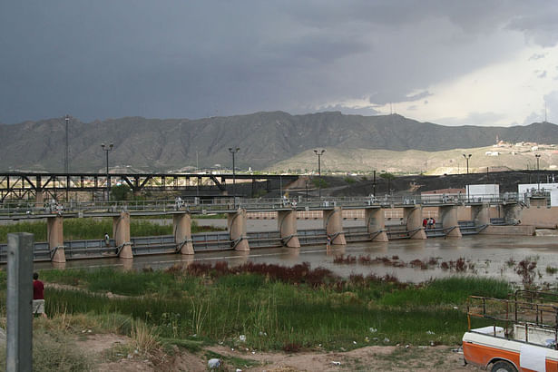
The ‘Controlling Infrastructure’ section depicts the typical bridges and obstacles that paradoxically connect and separate the two countries. Water is an important resource in the hot climate. The US diverts all water from the physical trenched border with Mexico and instead channels it down the Franklin Canal, which remains on the US side. The second section illustrates the extents to which artists will comment on the border condition and drug traffickers will evade checkpoints and obstacles. “One Flew Over the Void,” commissioned by Javier Tellez, had Dave ‘the Cannonball’ Smith shot out of his cannon over the border into the US with his Passport ready to present to customs officials.
Border agents continually find new tunnels that have been built to by-pass controlled checkpoints. The most advanced was found to be a half mile long, 80 feet underground. It was formed by a 12 x 6 foot concrete shaft that connected a warehouse in Tijuana to an office building near San Diego.
These photographs and illustrations of border conditions were displayed not only at UTEP. The installation was later moved to the gallery at the Center for Land Use Interpretation in Los Angeles.
Status: School Project
Location: Rubin Center for the Visual Arts, UTEP & Center for Land Use Interpretation, Los Angeles


