:New York Bight, USA:
This project is about access and assets. As sea level rises, millions of homes and business along the barrier of the New York Bight are increasingly susceptible to climate change and sea level rise. In response to this immediate and gradual crisis, my teammate Diana Gruberg and I propose a massive relocation strategy that strengthens public access to the shore and allows neighborhoods and individuals to consolidate community and financial assets.
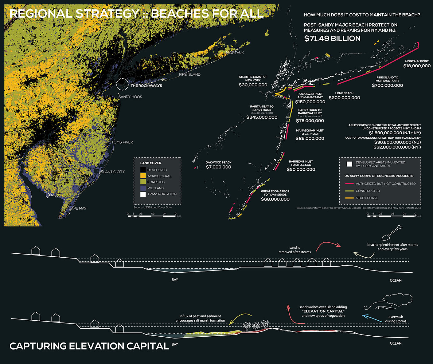
Post-Sandy beach protection measures and repairs for New York and New Jersey reached over $71B. This figure does not include housing, businesses, or buildings of any kind. While this public expense goes in part toward future flood prevention, 90% of the effectiveness of wave action mitigation measures goes toward the first row of housing off the beach. In essence, this massive public expense is supporting private occupation of the shore. We propose to alternatively use public money for public access.
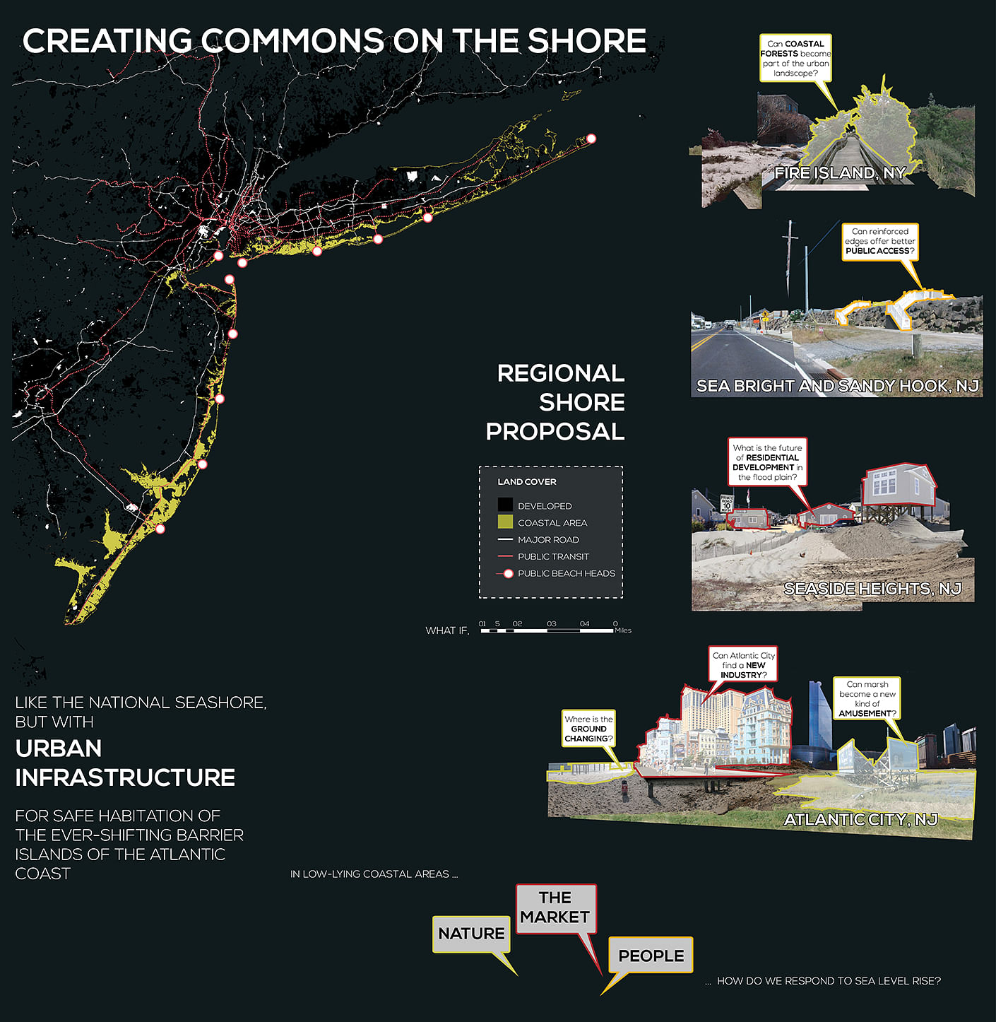
Our regional strategy imagines a new future for barrier islands, a future of temporary occupation, public access, and new economies and experiences that seem almost foreign to the Atlantic Coast. This future stems from addressing and acknowledging what see as core project concepts: barrier island are dynamic systems, public money should fund public projects, and vulnerable populations are less able to adapt to a capricious environment and volatile markets.
Given these conditions, we need a new and dynamic shore, something akin to the National Shoreline but with urban infrastructure. We need to find the commons in pliant ground. This environment would have all the richness and complexity of any great shore, from thicket and forest to sand and water, yet it would be capable of accommodating the demands of the Northeast Corridor.
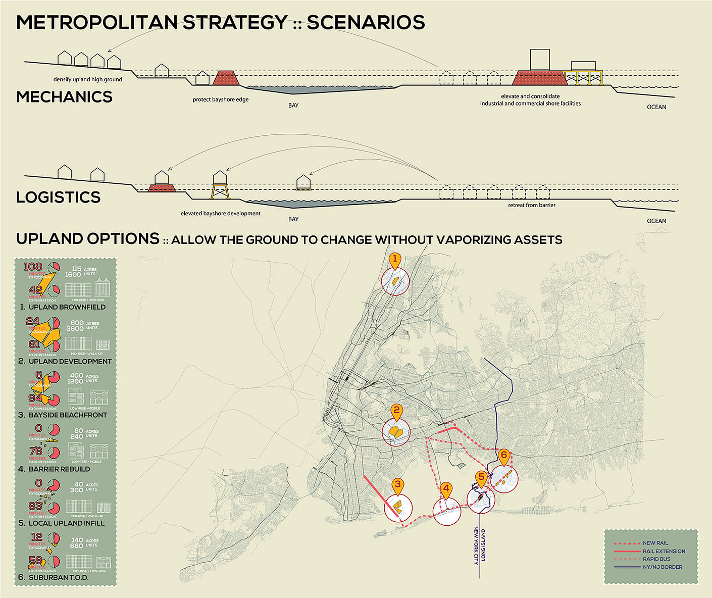
Illustrated rated below is our regional site analysis, as well as our basic sectional strategy for capturing “elevation capital” and our basic relocation strategy. Because barrier island are dynamic systems, they move naturally with changes in sea level. Tidal changes and storm events push sand on to the shore, raising the level the barrier. Simultaneously, peat and sediment are pushed into the bay, encouraging marsh formation and essentially moving the island toward the mainland. This shift can only take place with drastically less housing on the barrier. Those buildings that remain need to be elevated so as to decrease the need for beach replenishment, and allow natural systems to act.
Our strategy depends on a few key characteristics of the landscape and population. Chief among these are existing access routes, or good opportunities for new access routes. Next are areas where ground is changing. Because we are harnessing the natural dynamism of barriers, areas where ground is actively changing are better suited to this strategy. Lastly, we needed to identify the most vulnerable populations.
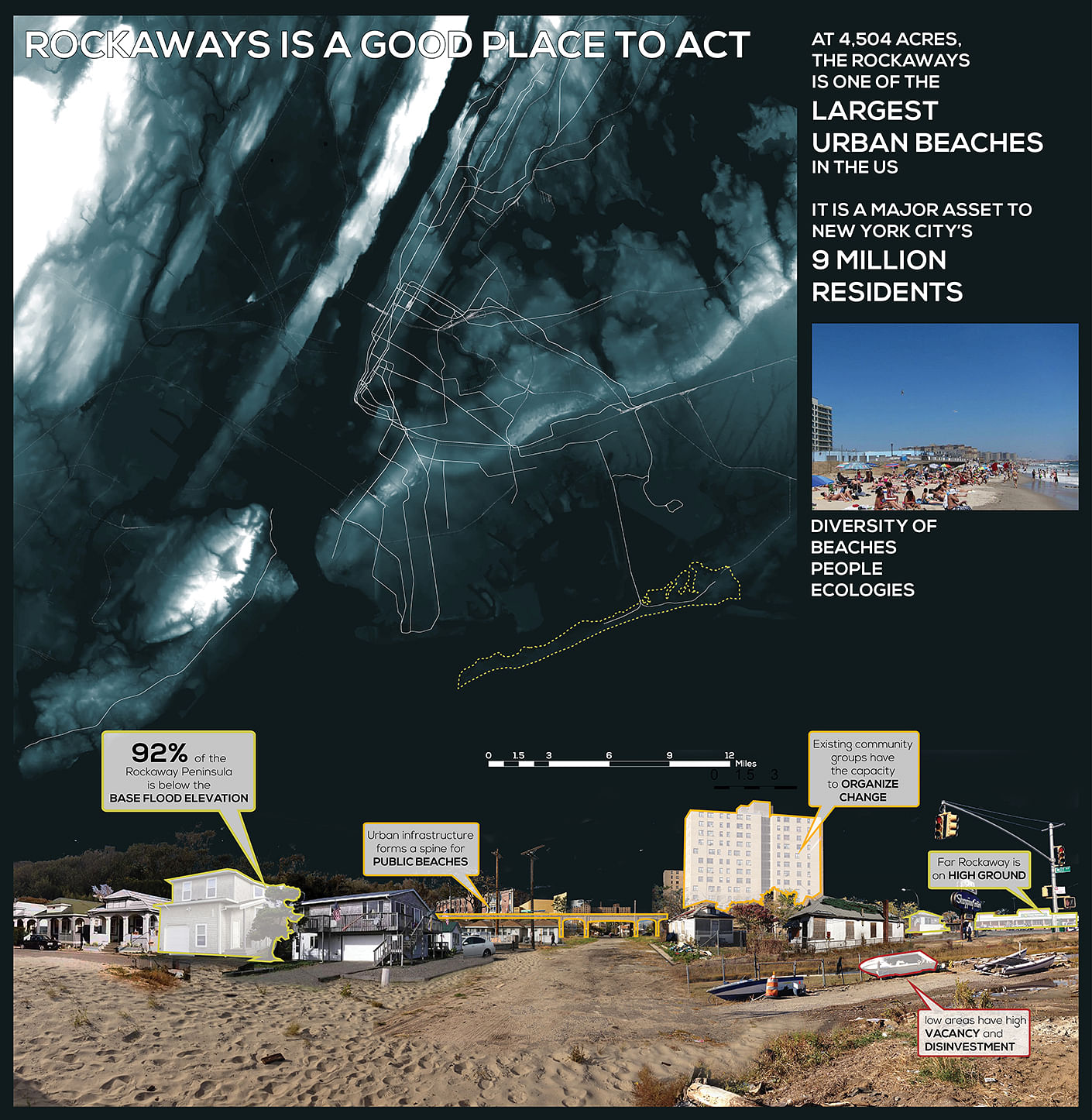
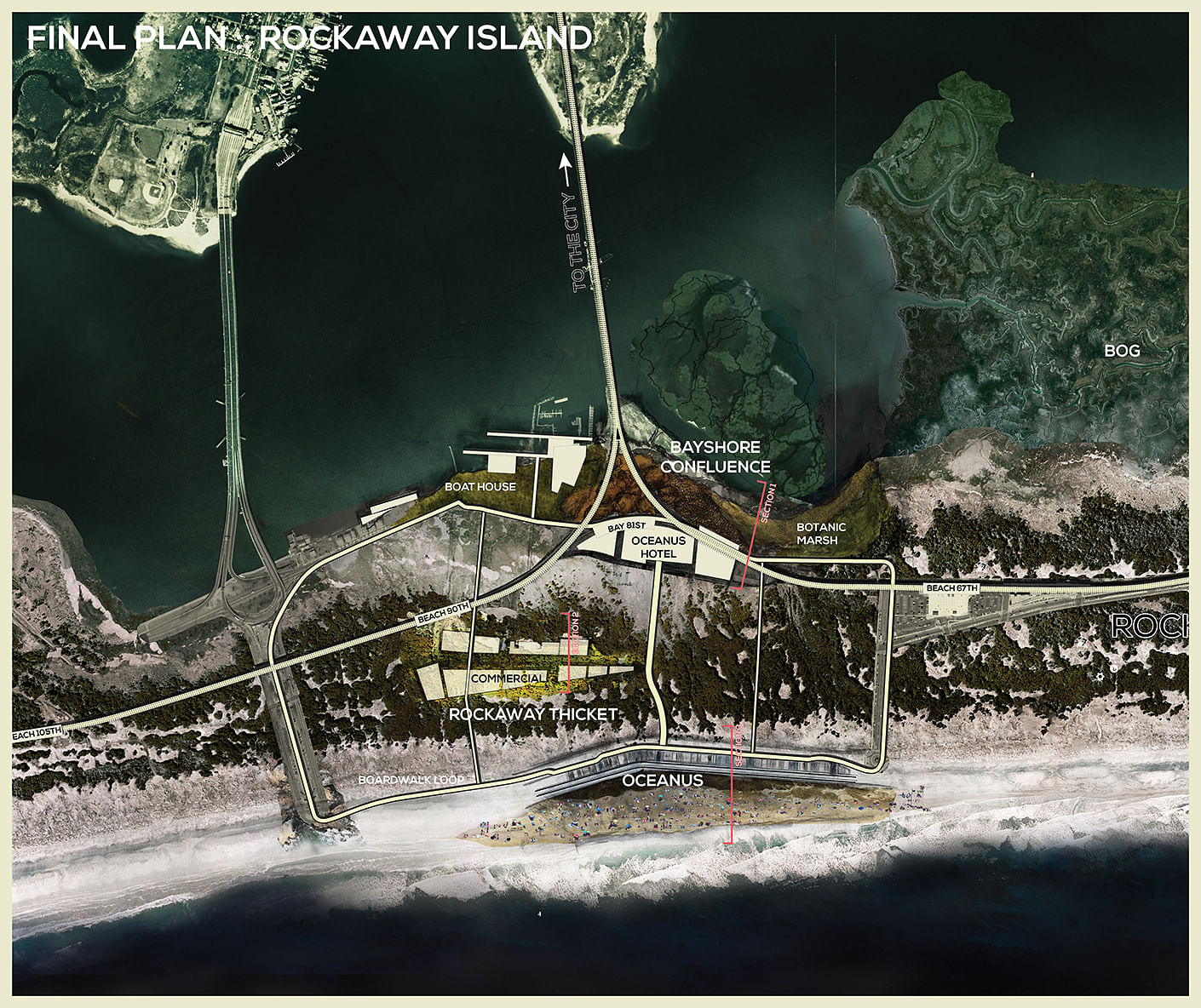
The Rockaway Peninsula, in Queens, NY, perfectly embodies these characteristics: subway access to the beach, massive income inequality, high vacancy, and strong community capital. We identified two areas in Rockaway where the market and nature aligned. These areas would become the epicenter of our design.
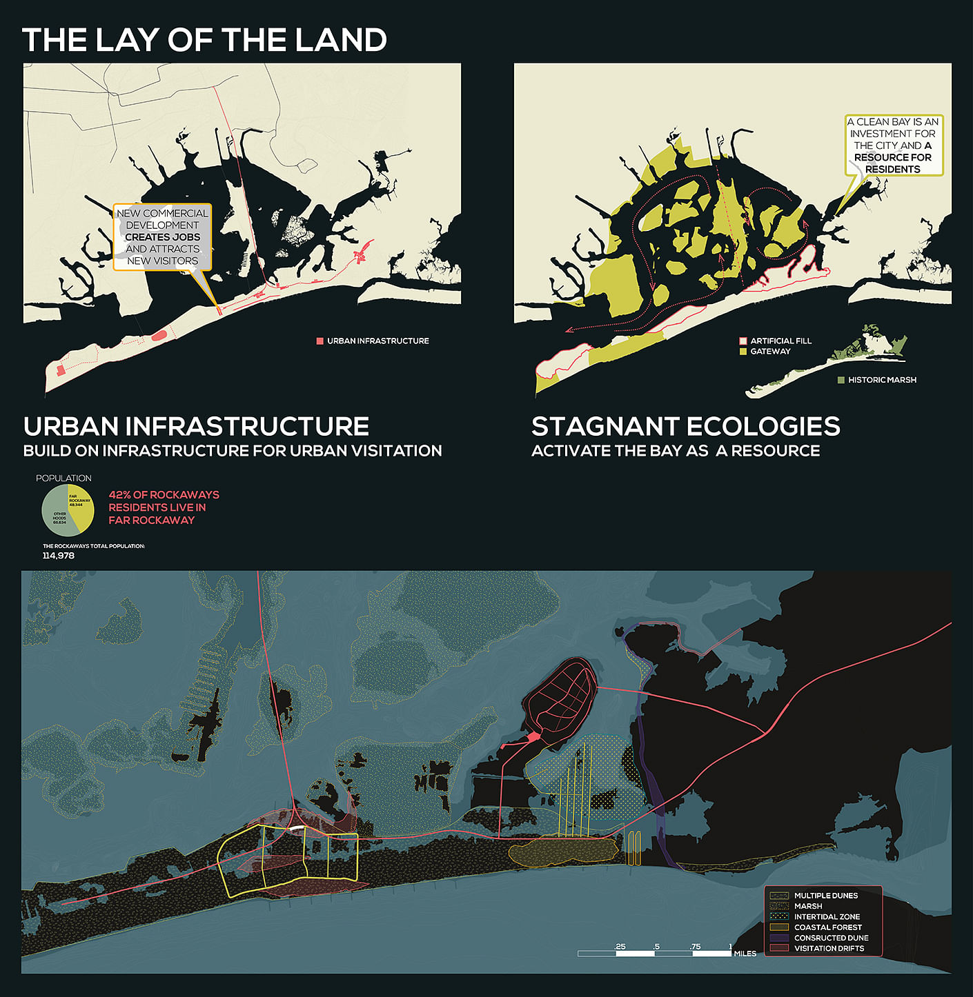
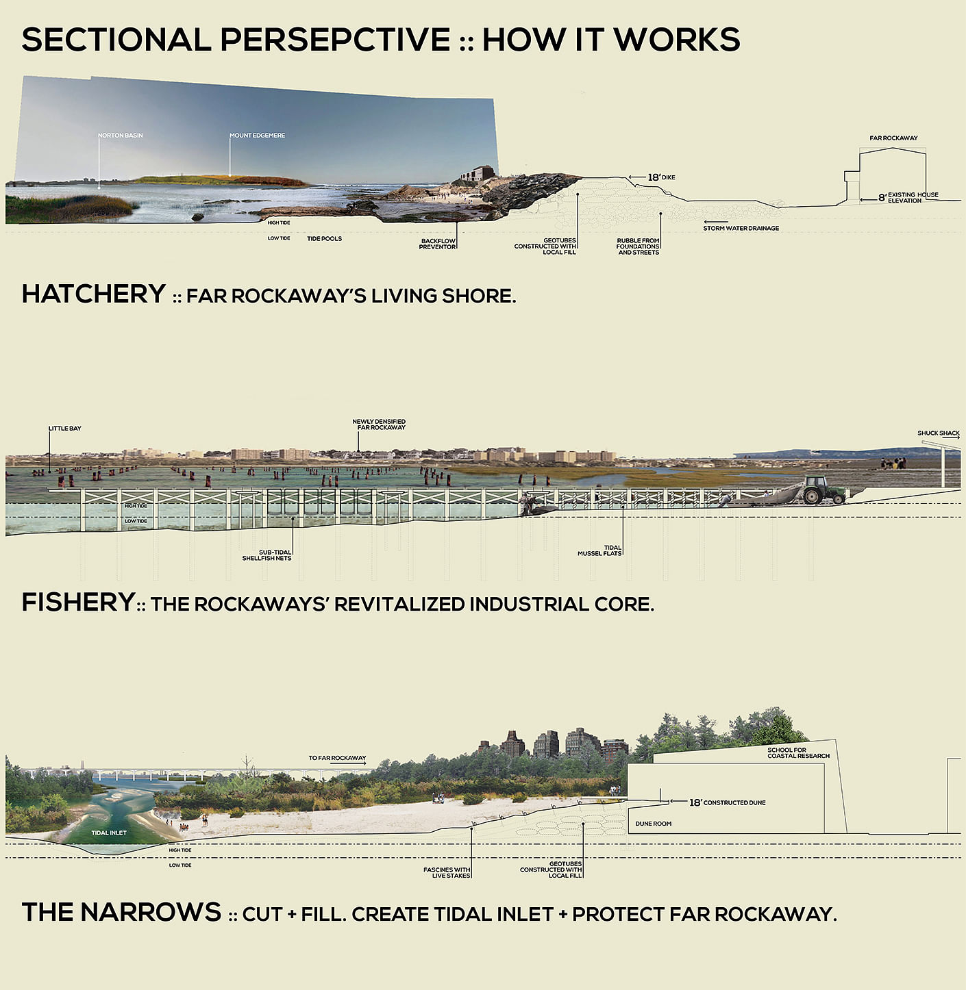
Illustrated below is our urban design strategy, in addition to our landscape strategy. Our urban design strategy, phased in three parts, combines a buyout strategy, selective new development, elevated infrastructure, and integrated flood protection along the western edge of Far Rockaway, which is naturally elevated. In addition, we’re proposing to develop Edgemere Landfill into housing, an long-term extension of the mainland development elevated even above Far Rockaway.
Our landscape plan envisions large sweeps of different environments. Some will occur more naturally, such as the bayshore salt marsh and coastal forest. Others, such as the constructed dune along the Far Rockaway dyke, will require some maintenance. The small divisions and pockets of development currently on Rockaway will succumb to the gigantic landscapes of the National Shore.
Our proposal projects gigantic landscapes, massive expanses of land, water, and everything in between. These landscapes are incredible experiential, and offer the endless depth of any natural setting.
However, it’s important to keep in mind that they are not designed solely for experience. Their integration with flood protection and burgeoning industries is paramount to the consolidation of community and economic assets. Our strategy must work technically, and logistically, as much than it must work experientially. Those living on the barrier, and those with the power to help them move, need a strategy for relocation, and a vision of something better. As the barrier is depopulated, these landscapes must protect those facilities still on shore. This mean that edges became central to the design’s success.
With gigantic sweeping landscape dominating the Rockaways, only the edges could be defined with any detail. Our edge designs create jobs through construction and maintenance, and enable new industries to lay their foundations. It’s not about eating oyster with boxing gloves, naked, but eating oysters freshly shucked walking through forest to the subway.
Welcome to Rockaway Island.
--
This project was done in full collaboration with Diana Gruberg.
Status: School Project
Location: The Rockaways, New York, NY
My Role: Design & Research
Additional Credits: Diana Gruberg