SIGNAL SPACE, part of our CITY SENSING project, is an ongoing independent research initiative of the office's, examining the historical relationship between antennas and the city. The iconic form of the Manhattan skyline is a reflection of this relationship, as evidenced by the Empire State building's ongoing prominence on the skyline which is due in part to its status as the primary broadcast infrastructure of the New York metropolitan region. The project was featured in the United States Pavilion in the 2013 Venice Biennale of Architecture.
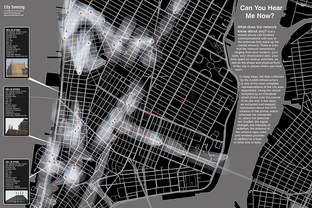
The broadcast model, with one important and stationary antenna sending information to many individual stationary antennas is giving way to an entirely new set of relationships. Mobile will soon overtake broadcast as the primary environment where we get our information. Like the Empire State, the infrastructure of mobile is private, though the airwaves are owned by all of us. But unlike earlier relationships between antennas and the city, the mobile phone infrastructure is also largely secret, It's hidden in plain site, but its extent, its spatial relationships, and its locations are not known. And given the concerns over this infrastructure - from its visual characteristics, to concern over RF radiation - we wanted to understand the shape and extent of the mobile infrastructure in order to explore how, like every other infrastructural system of the city from water to transport, to social and cultural ties, this important network is shaping the city of the future.
We've developed three informational banners with some of our visualizations of publicly available data on the mobile phone infrastructure. This data comes from the Federal Communications Commission, The Federal Aviation Administration, and a variety of New York City sources, including building permit databases.
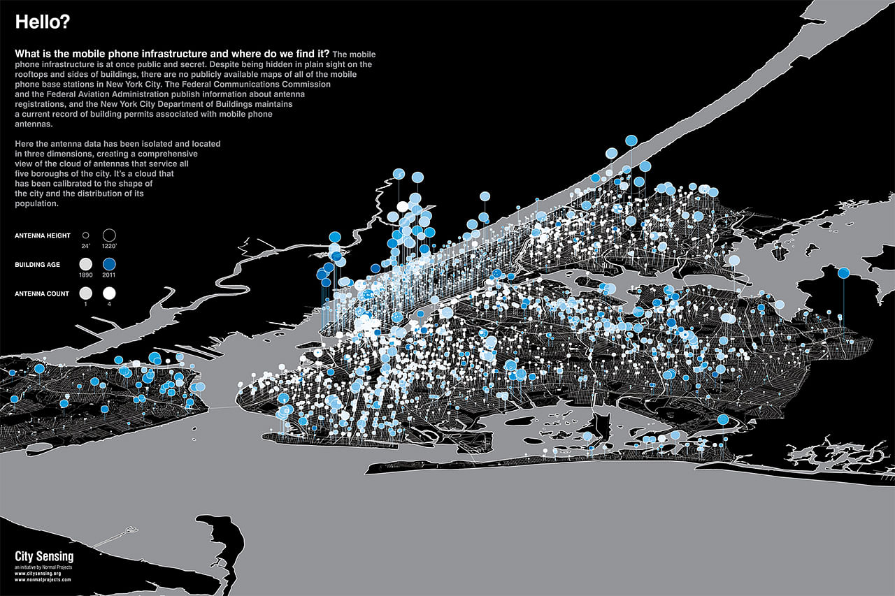
Using this data, cross referenced with New York City planning data, we've created the first comprehensive views of all of the 14,000-plus mobile phone base stations in New York City. It's the shape of the city itself - its obstruction environment - as well as the volume of users and demand within a particular zone of the city that drives the placement of antennas. These maps call to mind Jorge Luis Borges's fable about a great empire that creates a map of its territory so exact that it approaches the size of the territory. If we pause for a moment and consider all of the information stored on this infrastructure - from calls, to phone numbers, to GPS locations and identities of every user, to the physical shape of the city - the mobile infrastructure may very well be the greatest and most comprehensive representation of the city ever created.
Status: Built
Location: New York, NY, US
Firm Role: Designer