Archinect
LineSync Architecture

LineSync Architecture

Wilmington, VT

anchor
SEAMSCAPE proposes a counterpoint to unchecked development that is both preventative of future sprawl and amenable to co-existence with existing urban densities. The proposal relies, formally, on a series of landscape deformations around a dense, interconnected residential core.
8 more images  ↓

SeamScape

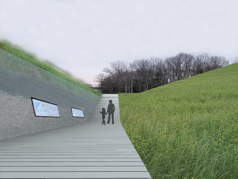
SEAMSCAPE emerged out of a competition to develop a plot of ecologically significant farmland bordering an intensive strip of commercial sprawl in Western Massachusetts.  The challenge was to develop a large site, which varied economically, environmentally, functionally, and aesthetically, in a cohesive way which was sensitive to multiple overlapping functions. To accommodate this, we took the seam between two seemingly unrelated contexts as the departure point for a proposal which emphasizes mediation and reconciliation.  While satisfying the programmatic requirements of development and growth, the project acknowledges and celebrates the disparate surrounding conditions - that of the shopping mall, housing, wetlands, farmland, and forest.

 
Read more

Status: Competition Entry
Location: Hadley, MA

 
To maximize farmland, natural beauty, and critical environmental areas, residential and commercial units, in standard shapes and sizes, are stacked into series of interconnected, mixed-use developments straddling the border, providing views and access to both sides. By stacking and partially burying some of the structures, vertical density is achieved without much added height
The strips of land formed by this grid help delineate different programs and occupations, enveloping or supporting buildings, pastures and walkways. These, in turn, provide the infrastructure for people, animals, crops, and forests. In the proposal, physical space is generated on the site, producing more pastured farmland and inhabitable space than existed there before.
At the center of the development, the land deflects to divide and guide the circulation between a series of ten linked pastures for rotational animal grazing. With calculations based on the model of PolyPhase Farm -- which relies on neighboring forested land to supplement the natural conditions of pasture (birds, shade, etc.) -- we aim to replenish and improve the soil through careful animal farming. We count these animals as integral and infrastructural, similar to housing and parking.
In keeping with a sensitive approach to the ecology of the site, automobile travel is permitted only at the edges, servicing residential developments without dividing the farmland. A staggered unpaved street is loosely defined by the spaces between buildings. The permeable streetscape is meant as a shared space that slows cars and accommodates people, bicycles, and farm carts. Small lots adjacent to the street can be utilized as gardens, yards, or parking spots.
By treating each of the existing conditions on the site as inextricably linked, it was possible to generate an additive system in which each component is greater than its program: living near farmland improves living conditions, wetlands improve farm water supply, and retail infrastructure improves the sustainability of small-scale agricultural production.