
GIS Analysis for locating potential landfill sites in Massachusetts. ArcGIS. Completed for GIS class. Fall 2004.
Given the area under study, I chose Orthophoto 3-meter 1:5,000 Elevation Contours as the basemap. For brevity, the report text has been excluded in the images.
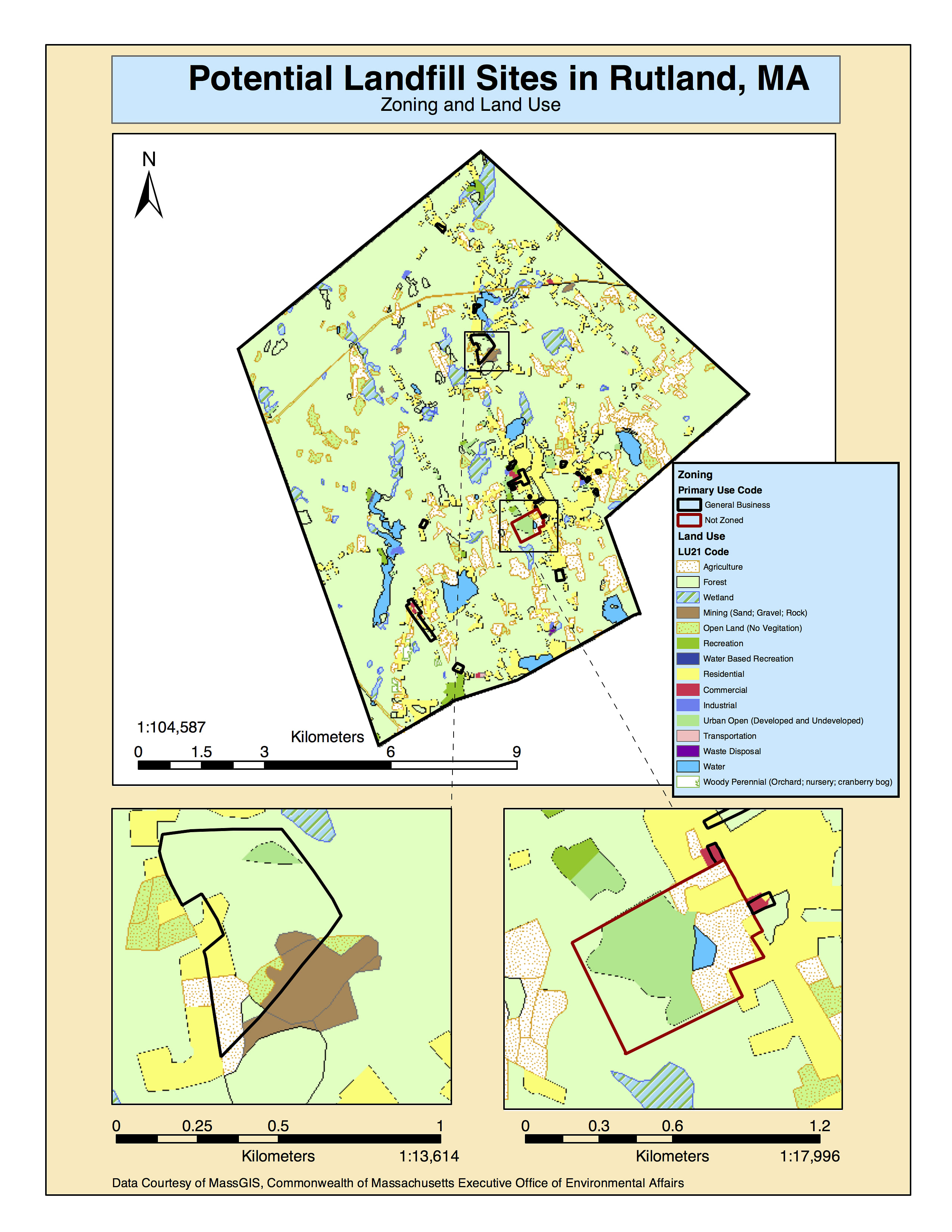
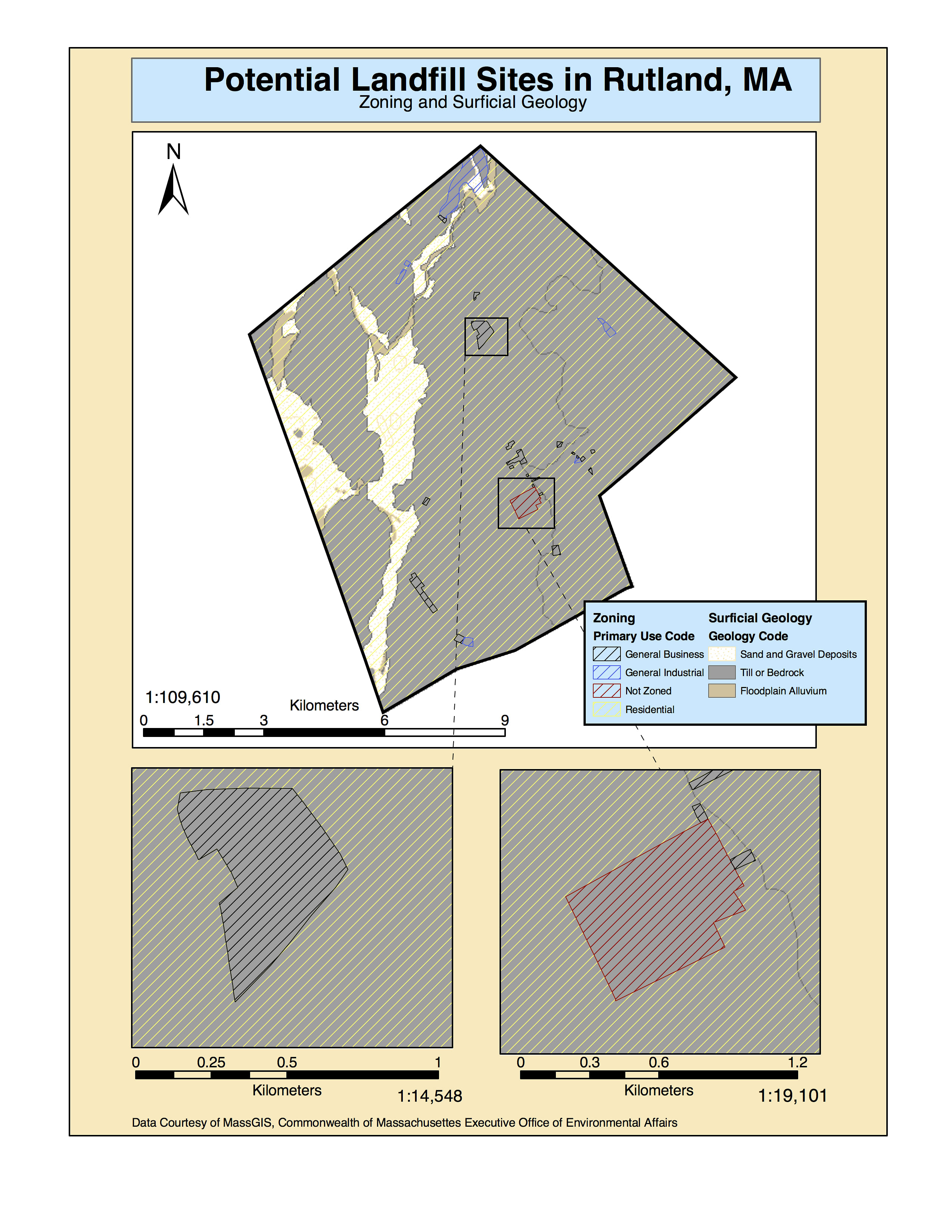
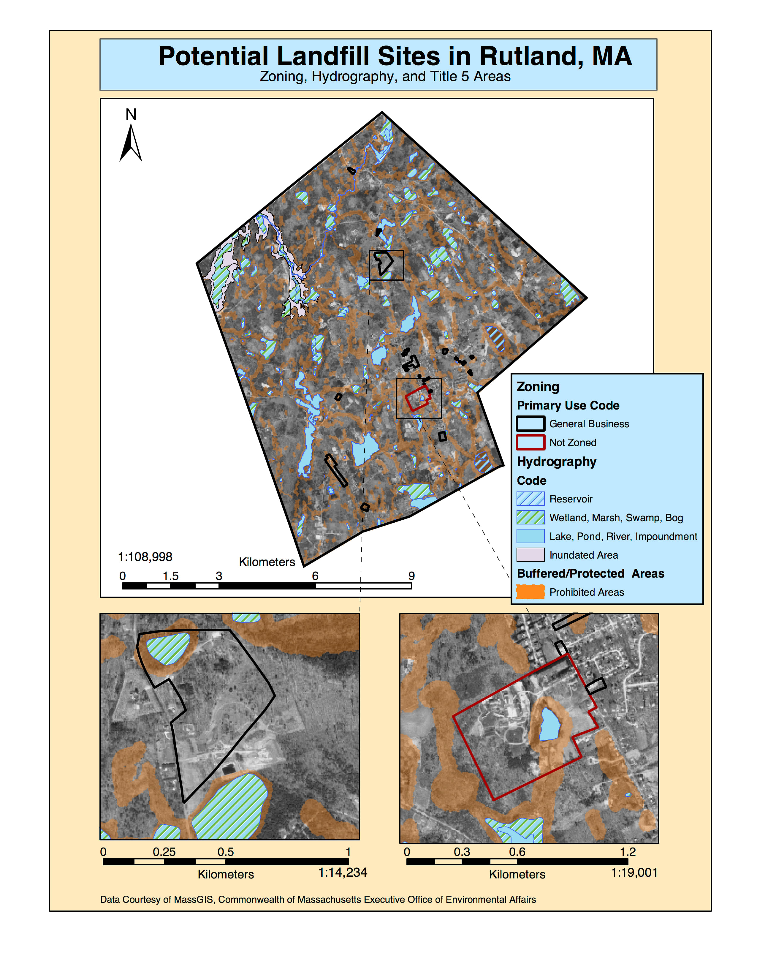
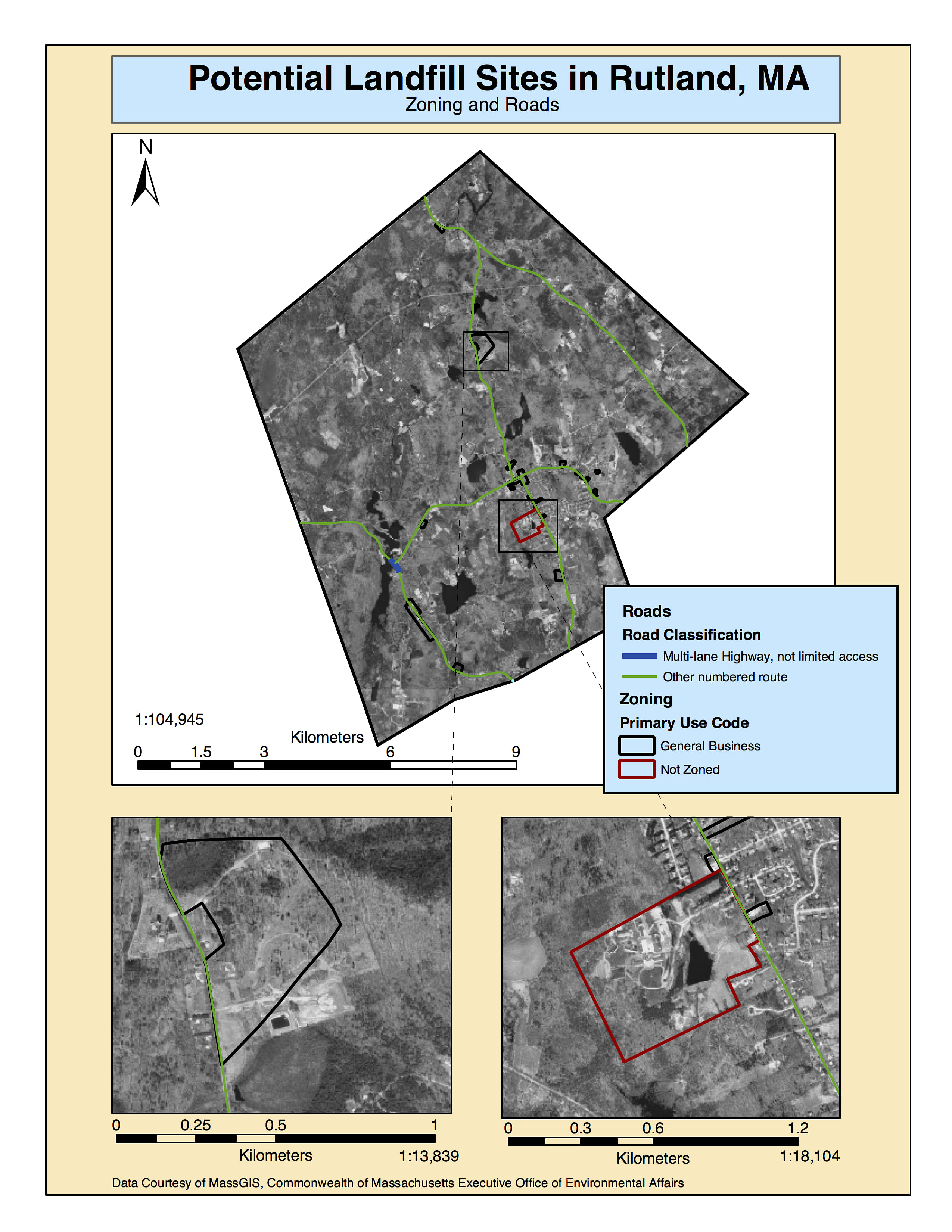
Through preliminary research, the ideal location for a landfill would meet local zoning and land use criteria; is easily accessible in all weather conditions; is located on silt or clay soils to reduce permeability and protect surface and groundwater quality; is located where there is access to easily handled and compacted earth cover material; will not effect environmentally sensitive areas; and located where there is a significant buffer zone between residences and important natural resources or areas. Given this information, I chose to incorporate the following data layers from the MassGIS website:
The Title 5 Setback Areas layer represents buffer zones around water features and other natural resources. The FEMA Q3 Flood Data layer was developed to support floodplain management and planning activities. The 1:25,000 USGS Hydrography layer represents water related features, such as streams, ponds, lakes, and rivers. The Soil Types layer represents soil maps and slope of the landscape. The Areas of Critical Environmental Concern layer contains places in Massachusetts that receive special recognition because of the quality, uniqueness and significance of their natural and cultural resources. The Major Roads layer includes Limited Access Highways (such as Interstates with on- and off-ramps as the only means of access), Multi-lane Highways without limited access, Other Numbered Highways (such as state and Federal routes that are not included in the previous two categories), and Major Road-Collectors (non-numbered routes that connect numbered routes). The NHESP BioMap Supporting Natural Landscape layer contains information about the core habitats of rare species as well as large, naturally vegetated blocks of land that have not been developed. The Elevation Contours layer is simply a topographic map.
Status: School Project


")


