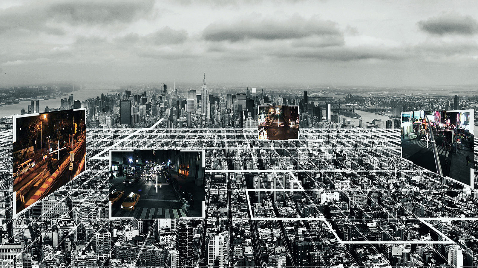
Anyone can be tracked by means of satellites, tracing cellphones and other technology. Falling off the surveillance grid, especially within metropolis is practically impossible. Undisclosed Cloud project is a critique of the current state of privacy deprivation within New York City streets and public spaces. It maps existing traffic surveillance cameras’ 3d visibility range searching for blind spots. Once blind spots are identified, they are transformed into a virtual world that offers a different perspective on what is privacy, surveillance and interaction within unobserved spaces.
Data from the web of New York City traffic surveillance cameras is available on-line and at any given time anyone can access the data from these cameras and obtain streaming video of a particular part of the city. Undisclosed Cloud project questions the condition of psychological discomfort that such state potentially creates since it is unknown who is watching and how this information is used. Surveillance is supposed to provide protection, however it would be more liberating to have a choice of whether or not one wants to be constantly watched and to know who is behind the camera.
The realm of examined surveillance range is divided into an existing range of traffic cameras observing strictly street level ranging from ground level to approximately 20 feet above it and a hypothetical range that covers 360 degrees of potential camera range as a theory that in a foreseeable future surveillance cameras will have such capability.
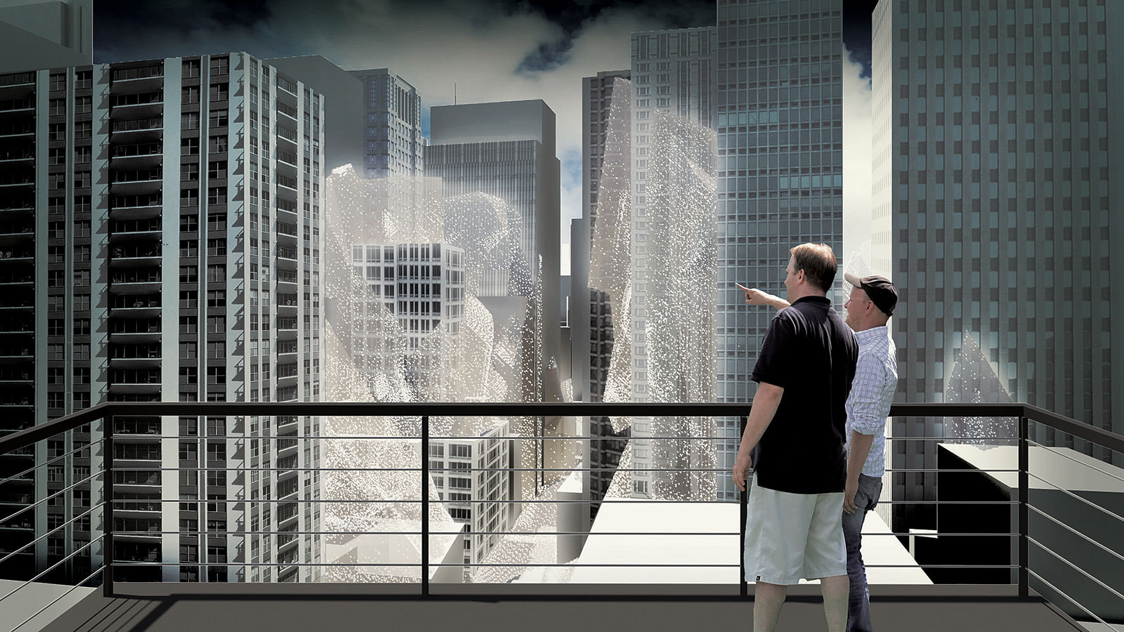
360 degrees surveillance range is mapped as a three-dimensional isovist, which is a spatial volume visible from a particular point. The range in this case is limited to a quarter of a mile which is a sufficient distance for surveillance camera to read a license plate of a vehicle and hence would be sufficient for facial recognition and identification of a person.
The remaining space is left unsurveillanced. However visibility ranges of cameras interpenetrate each other and therefore the remaining unobserved space would be limited to various three-dimensional fragments.
Examined realm of 100 public cameras between 48th and 59th streets and 5th and 8th avenues creates a dense 3d web where most of blind spots occur at buildings’ rooftops, courtyards or places with lower vehicular and pedestrian traffic.
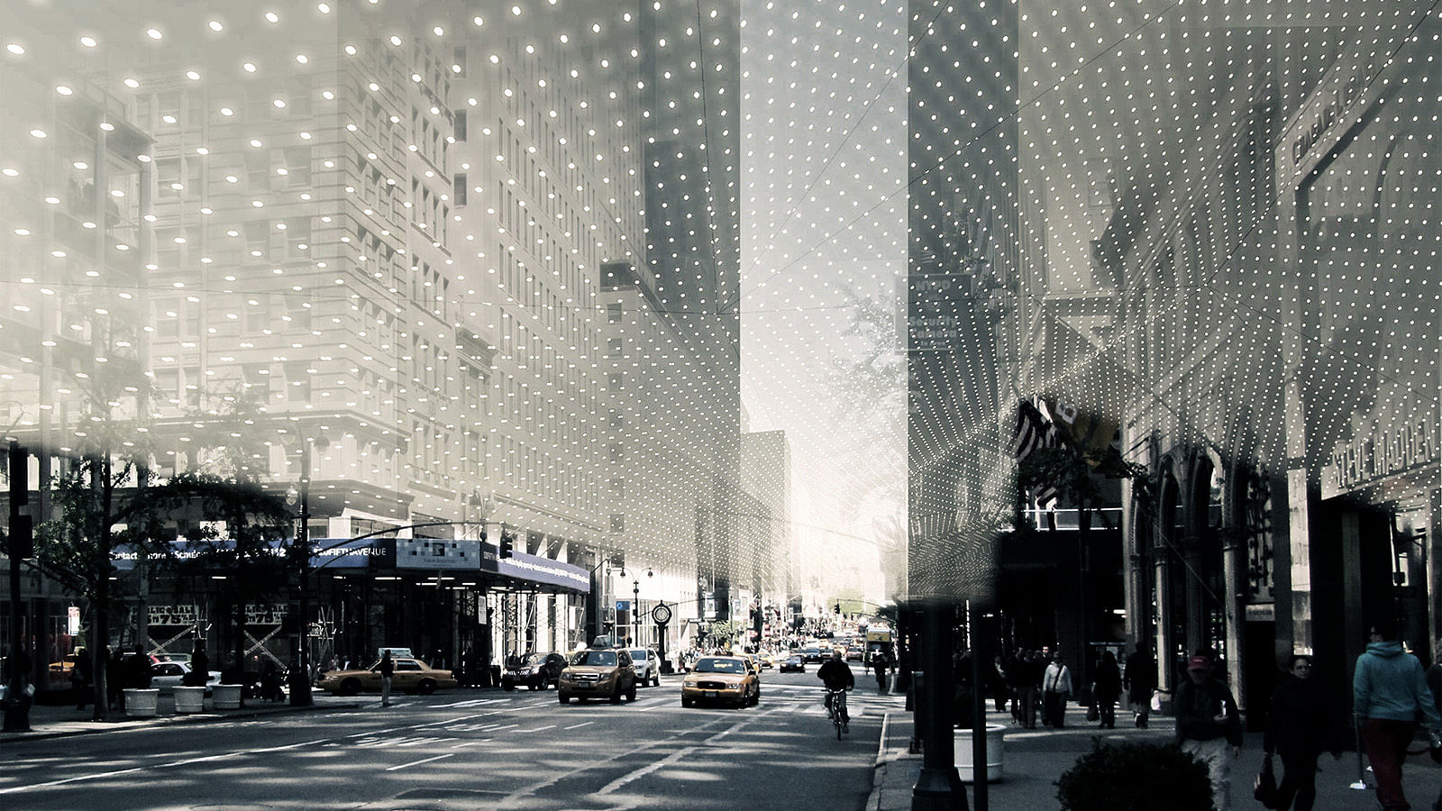
Remaining spaces that are unreachable to traffic cameras represent a corridor free from formal observing.
Within the city street these blinds spots represent fragmented spaces filling in gaps between buildings, rooftops, practically flat spaces adjacent to building facades.
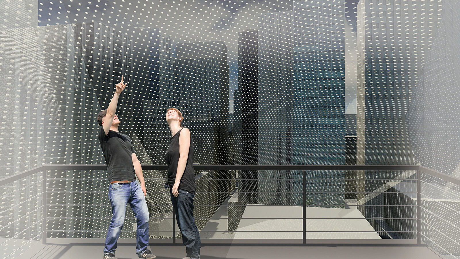
Undisclosed Cloud project aims to bring awareness of the existence of formal surveillance and the existence of blind spots in order to research and question how the public would react to such knowledge and how these spaces would be used once users know that there is no formal surveillance. To do so, 3d geometries of blind spots are manifested through “flying voxels” which are helium-filled levitating particles with LED lights coordinated by GPS navigation system that allows mapping of blind spots.
Within the city realm geometries of such spaces form floating glowing clouds that inform people that this space is not under surveillance. The question that Undisclosed Cloud project is posing - how would people behave once they know they are not being watched and how this knowledge could potentially redefine use of the city. Would people feel more free or would blind spots be misused for undesired behavior?
Status: School Project