

Placemaking In Vertical Communities
If we better understand the association of towers to their surrounding urban context, macro and micro scale, we can improve the continuity of urban communities and public spaces in both horizontal and vertical planes.
Placemaking is the act to create an urban landscape that fosters pride and ownership of the physical (Lynch) and psychological (Whyte) environment. Using it as a hands-on tool could help improve a neighborhood and how a community creates a city and linkages. Most recent examples of this investigation, such as the work of Project for Public Spaces and the mental mapping of Lynch, focus on horizontal spaces.
Could we bring these concepts to vertical public spaces and create a new relation between the urban fabric (horizontal) and a tower (vertical community)?
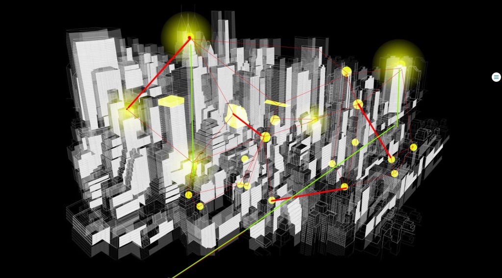
Continuing with the analysis of Prof. Al-Kodmany, Univ. of Illinois, by considering the four factors of P;acemaking within a tall building—imaginability, human scale, socioeconomic activities, and cultural associations—and adding the concept of digital city (virtual connection in public spaces), to make tower design more integrated into an urban fabric.
What if we rethink the mental map as a tool to explore the vertical cartography of public spaces? How could we use that data, a visualization of public space networks, to analyze the continuity of a tower and all of its layers in its urban context? How can the mental map contribute to Placemaking of the city’s vertical public spaces Bringing the classical concept of Kevin Lynch (Physical) into a Psychological urban matrix (Whyte, Cognitive) we can find a interesting tridimensional space where apply cognitive connections, a new dimensional field to apply classical theories of urbanity.
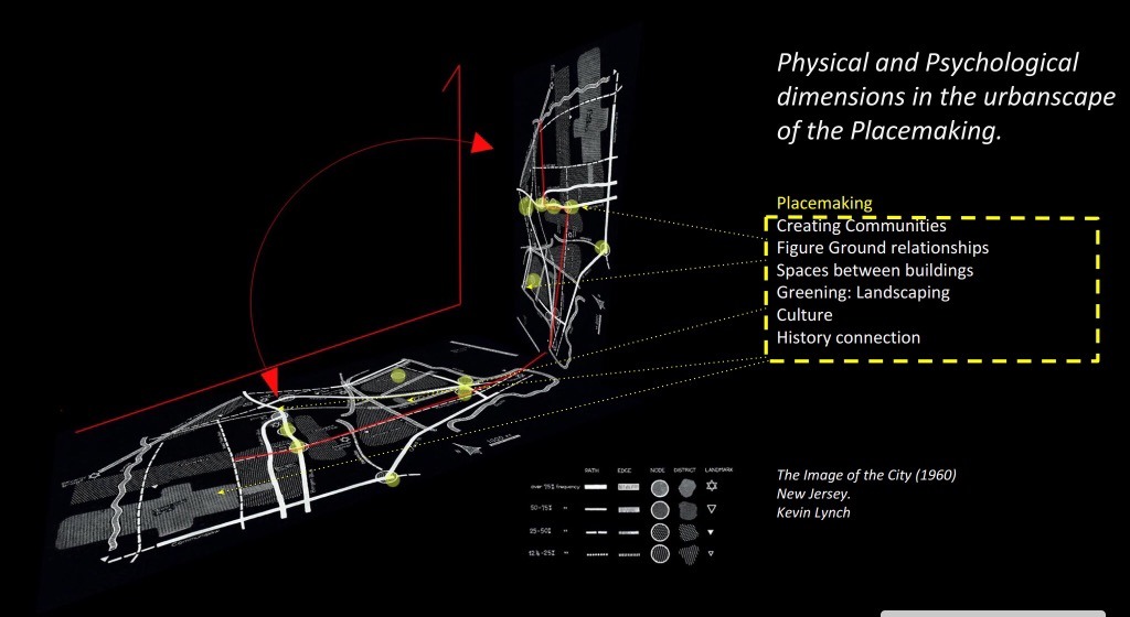
Understanding the 5 points of The Image of the city, we could abstract a diagram overlapping in old block superstructures such as New York or Hong Kong.

But, the next question is, What makes a Great Place? I would call the definition made by Project for Public Spaces Organization where every singular public space could be analyze in quantities and qualities measures, giving different ratios of successfulness and based upon how many activities has, the grade of sociability that the space has, how it is connected to the urban fabric and the last but least important how much comfort the users can feel when they use it.

At first reaction was to create an Virtual Chart where every single user can measure and valuate this space, this data would be connected with Big sources such as Pluto NYC, INCKD, .

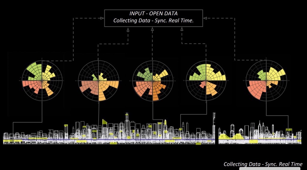
This DATA would act as a living organism and would call to all the organizations and communities, expose the complexity in simple visualizations to make


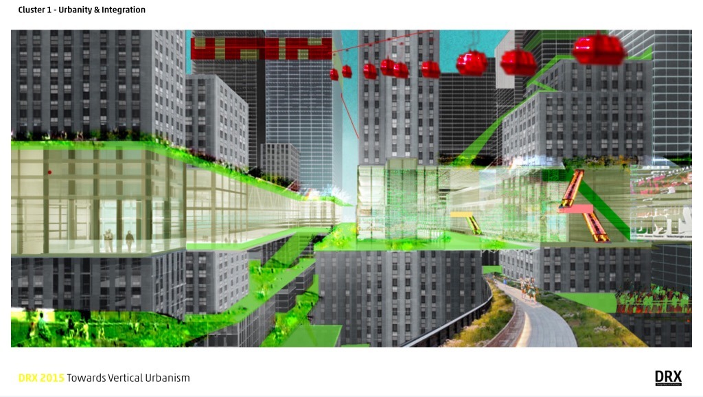
That could bring the evolution of Urban Planners Visions, Specially Zoning and Building Codes. How we could find new rules of explore the thridimensional city, or maybe the another way around, how the big data and the new virtual map could conduit new zoning and ordinances to create a city successful in their nodes (placemaking), districts (super blocks), paths (infrastructures) and landmarks towers.
This represent an short articule extract from some relative studies made for the Vertical urbanism Summer Research at DXR 2015, hosted by Henn Architects, Berlin 2015.
Ruben Cabanillas Ramos
View full entry
If we examine the significance and terminologies associated with Housing Typologies\Units, we found that in urban scales (micro unit\block\neighborhood\community) and after understanding and analyzing the social, economic, sustainable and demographic significances , the minimum requisite space... View full entry
Go through your favorites architectural daily sources, pass the vacuum, open the Vacuum Bag and voila! we will have enough provocative material to start political, cultural, philosophical and sustainable discussion regarding postmodernism trends in architecture terminology. A several blog entries that will try to filter some current overrated architectural terminologies such as Public Space,or the most common: Green Strategies.